Trek Toronto — Rouge National Urban Park, Canada

Rouge National Urban Park: Vista and Mast Trails

Canada's first national urban park on foot: up to the Vista Trail's viewing platform over two river valleys, then the old Mast Trail through Carolinian forest to Glen Rouge and back.

Rouge National Urban Park: Vista and Mast Trails
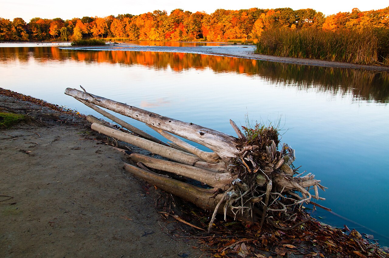
Photo: Eddar27 · CC BY-SA 4.0
Duration
1 day
Distance
7.2 km
Walking time (est.)
2 h
Ascent
150 m
Difficulty
Moderate
Best season
May–October (best from late September through October)

Walking

    Your location stays on this phone. It is never sent, stored or put in a link.

    Packing list

    Getting there and back

    Start
    Twyn Rivers Day Use Area
    Finish
    Twyn Rivers Day Use Area (out-and-back)

    One-way: plan your trip back

    Rouge National Urban Park is the reason Toronto can say it has a national park inside the city. Established in 2015 and run by Parks Canada, it covers 79 square kilometres of river valley, forest, marsh and farmland along the Rouge River on the city’s eastern edge, and it is free to enter every day of the year. It protects more than 1,700 species, a Seneca village site from the seventeenth century at Bead Hill, and the last big stretch of wild valley inside Toronto.

    This route strings together the park’s two classic trails from one trailhead, Twyn Rivers, where the Rouge and the Little Rouge meet. First the Vista Trail climbs a narrow ridge between the two rivers to a two-level viewing platform over both valleys, the best autumn view in the Toronto area. Then the Mast Trail follows a logging route cut about two hundred years ago through rare Carolinian forest, south along the Rouge to Glen Rouge Campground, and back.

    It is about eight kilometres with a couple of stiff climbs; allow three to four hours.

    Getting there. Start at the Twyn Rivers Day Use Area, near 55 Twyn Rivers Drive. By transit, take the subway to Kennedy station and TTC bus 86A toward the Toronto Zoo, then walk 10 to 15 minutes. Parking is limited and closes at 9 p.m.; Zoo Road Day Use Area is closed for construction and part of Twyn Rivers Drive is closed to cars, so check Parks Canada’s current directions.

    Permits & fees. No entry fee and no permit for day hiking. Camping at Glen Rouge needs a Parks Canada reservation.

    Good to know:

    Tips & Insights for this route Planning this route? Read our practical tips before you go — 8 tips. Read the tips

    Elevation profile

    Highest point
    113 m Day 1
    Lowest point
    75 m Day 1
    Total descent
    61 m

    Point at the profile, or focus it and use the arrow keys, to see that spot on the map.

    Terrain heights along a straight line between each day’s stops, not along the footpath, so a pass or a switchback the path takes can be missing. Descent and walking times use the same line.

    Elevation data: Terrain Tiles (Mapzen, AWS Open Data)

    Day by day

    DayDistanceAscentDescent (est.)Walking time (est.)
    Day 1 Hardest dayTwyn Rivers, the Vista Trail and the Mast Trail
    Distance7.2 kmAscent150 mDescent (est.)61 mWalking time (est.)2 h

    Flights on Kayak Car rental on Localrent Travel eSIM on Airalo

    Day 1

    Twyn Rivers, the Vista Trail and the Mast Trail

    Twyn Rivers Day Use Area → Twyn Rivers Day Use Area (out-and-back) 7.2 km 150 m 2 h

    A short, steep climb to the Vista Trail platform and back, then the Mast Trail south through the forest to Glen Rouge Campground and back to Twyn Rivers.

    Water and food

    Water
    None found near the stops. Carry enough for the day.
    Food
    sunshine variety Convenience shop 860 m from stop 1

    Places mapped by volunteers on OpenStreetMap; opening times and taps change, so check before relying on one. © OpenStreetMap contributors

    Segments

    1. Up to the ridge 0.6 km 40 m Map

      Twyn Rivers Day Use Area → Vista Trail loop

      Forest path with stairs

      From the Twyn Rivers lot, the Vista Trail climbs straight up the valley wall on a path and stairway through the forest. It is short but steep; take it slowly and the valley opens up below you as you go. About 15 minutes.

    2. The Vista Trail platform
      The Vista Trail platform 1 km 10 m Map

      Vista Trail loop → Viewing platform and around the loop

      Ridge-top forest path

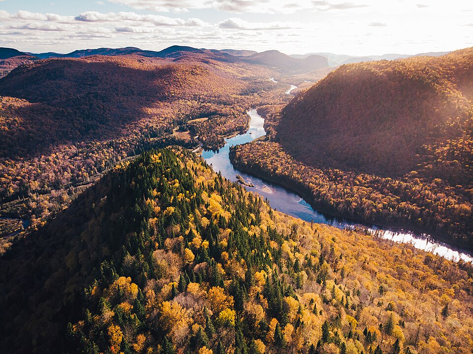
      The trail follows a narrowing strip of high ground between the Rouge River and the Little Rouge to a two-level viewing platform hanging over the valley. In October the forest below is a solid sheet of red, orange and gold, with the river winding through it. Walk the rest of the loop through the ridge-top forest. About 30 minutes.

      About this place

      The Rouge River is a river in Markham, Pickering, Richmond Hill and Toronto in the Greater Toronto Area of Ontario, Canada. The river flows from the Oak Ridges Moraine to Lake Ontario at the eastern border of Toronto, and is the location of Rouge Park, the only national park in Canada within a municipality. At its southern end, the Rouge River is the boundary between Toronto and southwestern Pickering in the Regional Municipality of Durham.

      Read more on Wikipedia Photo: Thanujan24 · CC BY-SA 4.0
    3. Back to Twyn Rivers 0.6 km 0 m Map

      Vista Trail loop → Twyn Rivers Day Use Area

      Forest path with stairs, descending

      Return down the same stairs to the valley floor and the confluence of the two rivers at Twyn Rivers. About 15 minutes.

    4. The Mast Trail 2.5 km 50 m Map

      Twyn Rivers Day Use Area → Glen Rouge Campground

      Forest trail with steep grades and steps

      The Mast Trail heads south on a logging route about two hundred years old, climbing onto the valley's tableland and dropping back through some of the park's finest forest, with Carolinian species rare this far north. It is the most demanding stretch of the day, rated moderate to difficult for its grades, and the most beautiful. It ends near Glen Rouge Campground on Kingston Road. About 1 hour.

    5. Mast Trail return 2.5 km 50 m Map

      Glen Rouge Campground → Twyn Rivers Day Use Area

      Forest trail with steep grades and steps

      Walk the Mast Trail back north to Twyn Rivers. The light and the views run the other way, and in autumn the return leg is as good as the outbound one. About 1 hour.
    Partner link: if you book through it we may earn a commission, at no extra cost to you. It does not change what we recommend. How this works

    Tips & Insights

    Packing list

    Filled in for this route from the kit a walk like this needs and the gear its tips mention. Tick things off as you pack.

    Clothing and footwear
    Gear
    Health and sun
    Water and food

    Best time to go

    • Mid-October, for the valley in colour

      The Vista Trail platform exists for autumn: from late September through October the whole Rouge and Little Rouge valley below it turns red and gold, and Parks Canada posts fall colour updates. Late spring is the second season, green and full of birdsong. In winter the trails are not cleared or salted, and the stairs and slopes ice over.

    Getting there

    • Twyn Rivers, by bus or car

      This route starts at the Twyn Rivers Day Use Area, near 55 Twyn Rivers Drive. By transit, Parks Canada suggests the subway to Kennedy station, then TTC bus 86A toward the Toronto Zoo and a 10 to 15 minute walk. The Zoo Road Day Use Area, the other classic trailhead, is closed for construction of a new visitor centre, and part of Twyn Rivers Drive is closed to cars, so check Parks Canada’s directions page for the current access before you drive.

    Permits & fees

    • Free, every day

      Rouge National Urban Park has no entry fee, all year. Only camping at Glen Rouge Campground is paid and needs a reservation through Parks Canada. The Twyn Rivers lot is small and locked at 9 p.m.

    Water & food

    • Bring everything

      Parks Canada is explicit: there is no food or water on the trails or at the trailheads, and only portable toilets at Twyn Rivers. Pack water and lunch. The nearest real food is along Kingston Road or Sheppard Avenue, a short drive away.

    Safety

    • Steep bits and ticks

      The Mast Trail is rated moderate to difficult for its steep grades and steps, and the Vista Trail has stairs; both get slick in wet weather. Blacklegged ticks live in the park’s long grass and forest edges, so stay on the trail, wear long trousers and check yourself afterward.

    With kids

    • Just the Vista Trail

      For young children, do only the Vista Trail: about two kilometres there and back from Twyn Rivers, a staircase climb, and a big viewing platform as the reward. Add the Toronto Zoo next door for a full family day.

    Where to stay

    • Glen Rouge, or back in the city

      Glen Rouge Campground, on Kingston Road at the south end of the Mast Trail, is the only campground inside Toronto’s city limits and books up on summer weekends. Otherwise stay anywhere downtown and come out by subway and bus, or by car.

    Local insights

    • Two rivers, one ridge

      The Vista Trail runs along a narrowing ridge between the Rouge River and the Little Rouge, which is why the platform looks down into two valleys at once. On the way back, notice how the forest changes on the Mast Trail: this is one of the few places near Toronto with Carolinian species, the southern hardwood forest that reaches its northern limit in this part of Ontario.

    Comments