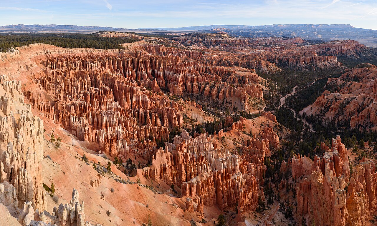
The full combination circuit: a steep switchbacked descent, an easy wander among the hoodoos, and a steady climb back to the rim.
Segments
- Sunset Point and Thor's Hammer
Sunset Point parking → Navajo Loop trailhead
Paved rim overlook
Walk out to the railing for the view over the Bryce Amphitheater. Thor's Hammer — a hoodoo with a broad block balanced on a slender neck, the park's most photographed formation — stands below the rim here and is visible from the overlook and the first switchbacks. About 15 minutes.
- The Wall Street switchbacks
Navajo Loop trailhead → Foot of Wall Street
Steep packed-dirt switchbacks in a slot
The signature descent: a tight stack of switchbacks folds down into a shaded slot barely wide enough for two people, where a pair of Douglas firs have grown tall reaching for the light. Steep and loose in places, and closed through the winter months. About 30 minutes down.
- The hoodoo floor
Foot of Wall Street → Queen's Garden junction
Easy sandy trail between spires
Out of the slot the trail levels into open ponderosa woodland on the amphitheater floor, winding between hoodoos that now tower overhead rather than falling away below. This is the quietest, strangest stretch of the loop. About 30 minutes.
- Queen's Garden
Queen's Garden junction → Sunrise Point
Steady climb, short rock-cut tunnels
Climb back toward the rim through Queen's Garden, passing under short tunnels cut through fins of rock to the spire said to resemble Queen Victoria, which gives the trail its name. The gentlest way out of the amphitheater — but it is still a climb at altitude. About 45 minutes.
- The Rim Trail back to Sunset Point
Sunrise Point → Sunset Point
Paved, mostly level rim path
Follow the paved Rim Trail south along the edge of the Paunsaugunt Plateau back to your car, with the whole loop you just walked laid out below. In summer the shuttle covers the same ground if you would rather not. About 20 minutes.
Comments
Sign in to join the conversation.
No comments yet — be the first.