
Blog
Southwest Canyon Day Hikes, and the Crossing That Takes Three Days
In short
The Narrows, Delicate Arch, and the Navajo and Queen's Garden loop are moderate day hikes, each in its own season. Grand Canyon rim-to-rim is not one of them: it is a hard three-day, 38 km crossing, best in late spring or early autumn while the North Rim is open. Do not put it on the same day as the Narrows.
Four canyon walks, and the crossing that needs its own days
Zion, Arches, Bryce Canyon and the Grand Canyon sit in the same corner of a road atlas. A car can touch all four. The walking cannot. Three of the routes people mean by a Southwest canyon trip are a half-day or one long day, graded moderate. The fourth is Grand Canyon rim-to-rim: hard, three days, 38 km, 1,450 m of ascent, and only while the North Rim and the corridor are open, roughly mid-May to mid-October. Late spring and early autumn are the weeks that trip is actually pleasant. Stacking it onto a day that already holds the Narrows is how a sensible loop becomes a plan nobody walks.
Keep the day hikes as day hikes. If you want the crossing, give it a permit, a bed and a block of days before you buy the rest of the trip. The route pages sit on trails. What follows is the season and the grade, which is the part people flatten.
The Narrows is a river day, from the bottom
The Narrows is a moderate out-and-back of 14 km and about 100 m of ascent. You start at the Temple of Sinawava, wade up the Virgin River, and turn around at Big Spring. The months on the route are May to September: late spring into early autumn, and only once snowmelt has eased enough for the park to leave the canyon open. A stormy summer day is still a reason to stay out. Flash floods are the real hazard. Rain miles upstream can send a wall of water through the slot while the sky over you is clear. Check the day’s flood forecast. The park also closes the walk when the river is high, typically above about 150 cubic feet per second, which is most often a spring snowmelt problem.
The bottom-up day needs no permit. You ride the canyon shuttle to the last stop, follow the paved Riverside Walk to the water, and wade. Big Spring is mandatory as a turnaround, because the canyon beyond it is permit-only. This is not the top-down overnight. Count on something like six to eight hours, continuous wading, and stretches that come up to the waist over cobbles you cannot see. Shoes you can trust and a pole matter more than the 100 m of climbing, which is why the grade stays moderate while the day stays full. The detail of that day is Zion Narrows from the bottom. It does not share a morning with a drive to the next park.
Delicate Arch is short because the sun is the work
Delicate Arch is 4.8 km and 146 m, graded moderate, out and back from Wolfe Ranch. The months on the route are March, April, May, September and October. Summer afternoons are dangerously hot, and June, July and August are not on that list. The middle of the hike is a long incline on open slickrock. There is no shade at the trailhead, none on the slab, and none at the arch. The rock heats past the air temperature. Rescues on this trail are routine in the hot months, including on days that look merely warm from the car.
Spring and autumn are the season. Start at dawn, or go late, and carry more water than a walk under 5 km suggests. The finish is a narrow ledge with a drop on one side. It is not technical. It is exposed, and anyone uneasy with heights will feel it. Sunset is the famous hour, which means a headlamp for the way down: the slab is where people get hurt after dark. In peak season the park requires a timed-entry reservation to drive in. Check the current dates. Arriving without one in that window means the gate, not a queue you can talk your way through. The Wolfe Ranch lot fills early on ordinary days. Two to three hours is a fair estimate when you move well. It is a half-day with a hard rule about heat, not a stop you begin at noon because the month is listed.
Bryce drops you off a high rim, then asks for the climb back
The Navajo Loop and Queen’s Garden is 4.6 km and 200 m, graded moderate. You leave the rim at Sunset Point, descend the Wall Street switchbacks, cross the hoodoo floor, and climb out through Queen’s Garden to Sunrise Point, then close the loop on the Rim Trail. The months on the route are April to October. The park itself stays open in winter. Wall Street does not. Snow and ice close that slot, and it often stays shut into spring because the narrow walls hold ice and shed rock. When it is closed, the Two Bridges branch of the Navajo Loop is the usual way down. Check the day’s trail status before you leave the visitor center. An April date on the calendar is not a promise that the slot is open.
The rim here sits at roughly 2,400 to 2,700 m. The hike begins with a descent, so the climb arrives when you are already tired, and the thin air makes a modest grade feel steep. Carry more water than 4.6 km suggests, and pace the return. Summer afternoons build thunderstorms on the plateau. Start early and be off the exposed rim when they build. Almost everyone walks it counter-clockwise, down the steep Navajo side and up the gentler Queen’s Garden side, which is kinder on the knees. In summer a shuttle links Sunrise Point and Sunset Point if you would rather ride the rim than walk it. Allow two to three hours. Paired with a long drive, this is the walking for that day.
Rim-to-rim is a different kind of trip
The crossing is North Kaibab to Phantom Ranch to Bright Angel: down from the forested North Rim, a night by the Colorado, then the long climb to the South Rim. Three days, 38 km, 1,450 m, hard. The months on the route run May to October, and the North Rim season inside that is roughly mid-May to mid-October. Outside it the North Kaibab trailhead is snowbound and unserviced. Within the season, late spring and early autumn are the point. Midsummer in the inner canyon is brutal heat and scarce shade. The Park Service warns against a single-day crossing in that heat. The three-day shape exists so the climb out still has a person attached to it.
The logistics are the other half. The rims are about 16 km apart on foot and about four and a half hours apart by road, so the trip hangs on a Trans-Canyon Shuttle seat or a car at each end, booked before the rest of the plan locks. Overnight trips need a backcountry permit. Phantom Ranch beds are a lottery. The 2025 Dragon Bravo Fire destroyed the Grand Canyon Lodge and much of the North Rim forest. That side has been reopening in stages, with reduced services and no in-park lodging. Read the current operations page before a plan assumes a lodge, a meal or a full set of services at the top. Corridor taps run off an ageing pipeline and switch on and off. Check the water status the morning you start. The day-by-day version is Grand Canyon rim-to-rim.
None of that fits between a Bryce morning and a drive to Zion. May, June and September can hold the Narrows and Bryce, and they sit inside the crossing’s season, but June is already outside Delicate Arch’s months, and a June or July crossing is the hot version the page tells you to avoid. Delicate Arch wants March, April, May, September or October, and a cool hour of the day. Bryce wants April to October with Wall Street confirmed. The Narrows wants May to September with the river open and the flood forecast clean.
Split the week on purpose
Give each moderate walk its own day, in a month that page actually lists, at an hour the sun allows. Three of those days, in parks that are hours apart by road, is already a proper stretch of walking. Rim-to-rim, if you still want it, is a separate trip: mid-May to mid-October, best at the cooler ends, shuttle and permit arranged first, water checked on the day. Use the map to see how far apart the trailheads really are, then drop the route your dates cannot support.
A closed Wall Street, a Narrows still in snowmelt, a Delicate Arch afternoon in the heat, or a North Rim without the services you assumed, is a different trip. It is not a smaller version of the week you wrote down.
Questions
- Can these Southwest canyon walks share one day?
- No. The Narrows is a full river day, Delicate Arch and the Bryce loop are half-days in different parks, and rim-to-rim is a three-day crossing. The trailheads are hours apart by road.
- When is the Zion Narrows bottom-up hike in season?
- May to September, once snowmelt has eased. Stay out on stormy summer days because of flash-flood risk, and check whether the park has closed the canyon for high water.
- When should I hike Delicate Arch?
- March, April, May, September or October, at dawn or late in the day. Summer afternoons are dangerously hot, and June, July and August are not months on this route.
- When is Grand Canyon rim-to-rim possible?
- The North Rim and the corridor are open roughly mid-May to mid-October. Late spring and early autumn are the weeks to go. Midsummer inner-canyon heat is the reason not to treat it as a day hike.
- Is Wall Street at Bryce open all season?
- No. The Navajo and Queen's Garden route is listed from April to October, but snow and ice close Wall Street, often into spring. Check the day's trail status and use Two Bridges when the slot is shut.
Sources
Routes in this post
-
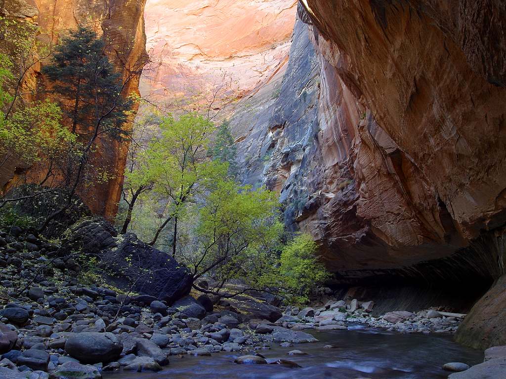 Photo: Jon Sullivan · Public domainTrek USA
The Narrows — Bottom-Up Day Hike
A one-day out-and-back wade up the Virgin River from the Temple of Sinawava, through the towering Wall Street slot canyon to Big Spring and back.
- Duration
- 1 day
- Distance
- 14 km
- Difficulty
- Moderate
-
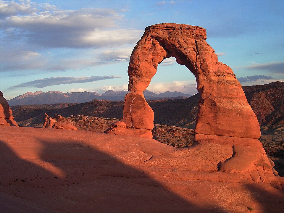 Photo: Palacemusic · CC BY-SA 3.0Trek USA
Delicate Arch — The Classic Half-Day Climb
A short but strenuous out-and-back from Wolfe Ranch, past a Ute petroglyph panel and up an open slickrock slab, to the most photographed arch in the American Southwest.
- Duration
- 1 day
- Distance
- 4.8 km
- Difficulty
- Moderate
-
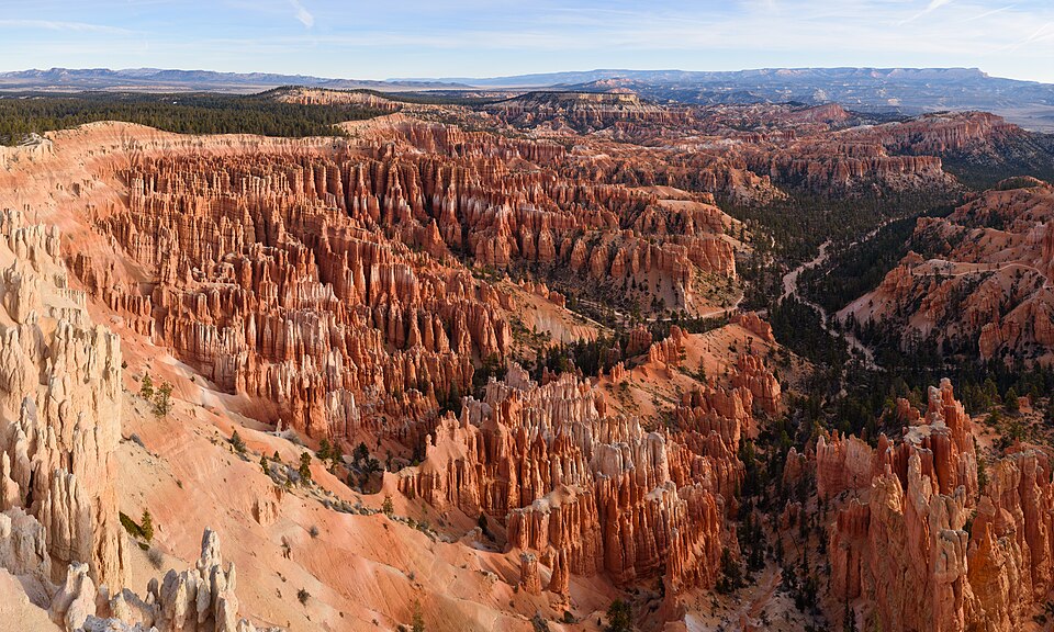 Photo: King of Hearts · CC BY-SA 4.0Trek USA
Navajo Loop & Queen's Garden — The Bryce Amphitheater Circuit
The classic half-day combination: drop off the rim at Sunset Point through the Wall Street switchbacks, cross the hoodoo floor of the Bryce Amphitheater, and climb back out through Queen's Garden to Sunrise Point.
- Duration
- 1 day
- Distance
- 4.6 km
- Difficulty
- Moderate
-
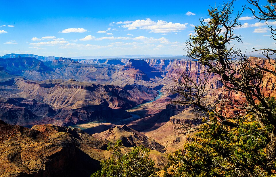 Photo: Lennart Sikkema · CC BY 3.0Trek USA
Grand Canyon Rim-to-Rim — North Kaibab to Bright Angel
The classic crossing of the Grand Canyon: down the North Kaibab Trail from the cool, forested North Rim to the Colorado River at Phantom Ranch, then up the Bright Angel Trail to the South Rim.
- Duration
- 3 days
- Distance
- 38 km
- Difficulty
- Hard