← All routes
Trek Arizona — Grand Canyon National Park, USA

Grand Canyon Rim-to-Rim — North Kaibab to Bright Angel

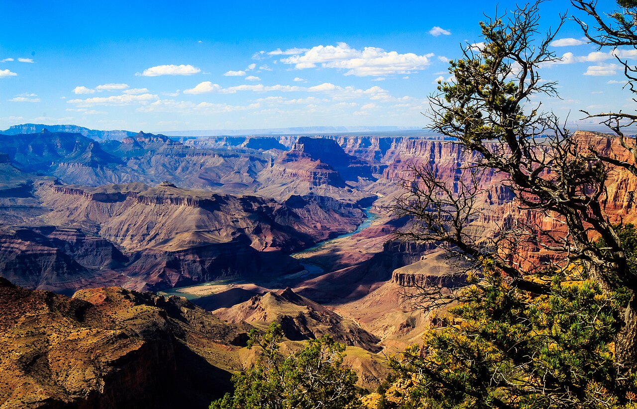
The classic crossing of the Grand Canyon: down the North Kaibab Trail from the cool, forested North Rim to the Colorado River at Phantom Ranch, then up the Bright Angel Trail to the South Rim.

Grand Canyon Rim-to-Rim — North Kaibab to Bright Angel
Photo: Lennart Sikkema · CC BY 3.0
Duration
3 days
Distance
38 km
Ascent
1450 m
Difficulty
Hard
Best season
Corridor trails and North Rim open roughly mid-May to mid-October; late spring and early autumn are best to avoid extreme inner-canyon summer heat

Rim-to-Rim is the great walk of the Grand Canyon — a full crossing of the chasm from one rim to the other, descending nearly a vertical mile through a billion years of exposed rock and climbing back out the far side. The standard north-to-south route drops down the North Kaibab Trail, camps or overnights near the Colorado River at Bright Angel Campground and Phantom Ranch, and finishes with the long grind up the Bright Angel Trail to the South Rim.

This is a serious undertaking, not a day walk. The inner canyon is brutally hot in summer, there is no shade for long stretches, and the climb out gains well over a thousand metres. Water, timing and fitness are everything.

Getting there. The two rims are only about 16 km apart as the raven flies but hundreds of kilometres by road, so most hikers arrange a shuttle between the North Rim and South Rim (the Trans-Canyon Shuttle) or leave a car at each end. Start on the North Rim to face the biggest descent first and finish at the more accessible South Rim.

Permits & season. Overnight trips require a backcountry permit, and beds at Phantom Ranch are allotted by lottery far in advance. The North Rim and its facilities are seasonal, open roughly mid-May to mid-October; outside that window the North Kaibab trailhead is snowbound and unserviced.

Good to know:

Day 1

North Rim to Cottonwood Campground

North Kaibab Trailhead (North Rim, 2,510 m) → Cottonwood Campground 11 km ↑ 100 m

Drop off the high, cool North Rim through fir and aspen forest into the canyon, losing over 1,200 m past Supai Tunnel and Roaring Springs to the desert bench at Cottonwood Campground. Steep and hard on the knees, but shaded early.

Segments

  1. Rim to Supai Tunnel
    Rim to Supai Tunnel 2.7 km ↑ 20 m

    North Kaibab Trailhead → Supai Tunnel

    Steep forested switchbacks

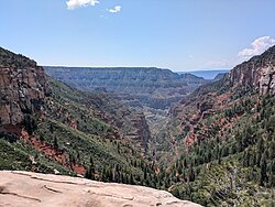
    Switchback steeply down through shady forest from the rim to Supai Tunnel, blasted through the redwall cliff, with water and a first sweeping view into the canyon. About 1.5 hours.

    About this place

    The North Kaibab Trail is a hiking trail in the North Rim side of the Grand Canyon, in Grand Canyon National Park, located in the U.S. state of Arizona.

    Read more on Wikipedia ↗

    Photo: Buidhe · CC BY-SA 4.0

  2. Supai Tunnel to Roaring Springs
    Supai Tunnel to Roaring Springs 5.3 km ↑ 30 m

    Supai Tunnel → Roaring Springs

    Cliff-cut trail and footbridge

    Cross the footbridge below the tunnel and descend a trail cut into the cliffs to Roaring Springs, where water bursts from the canyon wall — the source that supplies both rims. About 2 hours.

    About this place

    The North Kaibab Trail is a hiking trail in the North Rim side of the Grand Canyon, in Grand Canyon National Park, located in the U.S. state of Arizona.

    Read more on Wikipedia ↗

    Photo: Buidhe · CC BY-SA 4.0

  3. Roaring Springs to Cottonwood
    Roaring Springs to Cottonwood 3 km ↑ 20 m

    Roaring Springs → Cottonwood Campground

    Creekside desert trail

    Follow Bright Angel Creek down a gentler grade into hotter, drier country to Cottonwood Campground, the usual first night's camp roughly halfway down. About 1.5 hours.

    About this place

    The North Kaibab Trail is a hiking trail in the North Rim side of the Grand Canyon, in Grand Canyon National Park, located in the U.S. state of Arizona.

    Read more on Wikipedia ↗

    Photo: Buidhe · CC BY-SA 4.0

Day 2

Cottonwood to Phantom Ranch

Cottonwood Campground → Phantom Ranch 11 km ↑ 50 m

An easier day following Bright Angel Creek ever downward, with a side trip to Ribbon Falls before the trail threads The Box, a narrow, sun-trapped inner gorge, to reach Bright Angel Campground and Phantom Ranch beside the Colorado River.

Segments

  1. Cottonwood to Ribbon Falls
    Cottonwood to Ribbon Falls 2.6 km ↑ 20 m

    Cottonwood Campground → Ribbon Falls

    Creekside desert trail

    An easy walk down the creek to the short spur for Ribbon Falls, a mossy cascade in a green grotto and a perfect cool-off stop. About 1 hour.

    About this place

    The North Kaibab Trail is a hiking trail in the North Rim side of the Grand Canyon, in Grand Canyon National Park, located in the U.S. state of Arizona.

    Read more on Wikipedia ↗

    Photo: Buidhe · CC BY-SA 4.0

  2. Ribbon Falls through The Box to the river
    Ribbon Falls through The Box to the river 8.4 km ↑ 30 m

    Ribbon Falls → Phantom Ranch

    Narrow inner-gorge canyon floor

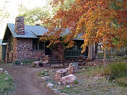
    Follow the creek into The Box, where sheer black Vishnu schist walls close in and radiate heat, then emerge at Bright Angel Campground and Phantom Ranch beside the Colorado River. About 3 hours.

    About this place

    Phantom Ranch is a lodge inside Grand Canyon National Park in Arizona. It sits at the bottom of Grand Canyon, on the east side of Bright Angel Creek, a little over half a mile north of the Creek's confluence with the Colorado River. Opened in 1922, Phantom Ranch is a member of Historic Hotels of America, the official program of the National Trust for Historic Preservation.

    Read more on Wikipedia ↗

    Photo: Mhazhiker at English Wikipedia · CC BY-SA 3.0

Day 3

Phantom Ranch to the South Rim

Phantom Ranch → Bright Angel Trailhead (South Rim, 2,090 m) 16 km ↑ 1340 m

Cross the river on the Silver Bridge and grind up the Bright Angel Trail out of the canyon, climbing steadily past Havasupai Gardens and up the final switchbacks to the South Rim. The longest and hardest day; start before dawn in warm months.

Segments

  1. River to River Resthouse
    River to River Resthouse 3 km ↑ 60 m

    Phantom Ranch → River Resthouse

    River Trail and suspension bridge

    Follow the River Trail across the Colorado on the Silver Bridge and along the water to the River Resthouse, where the Bright Angel Trail begins its climb. About 1.5 hours.

    About this place

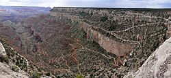
    The Bright Angel Trail is a hiking trail located in Grand Canyon National Park in the U.S. state of Arizona.

    Read more on Wikipedia ↗

    Photo: Jarek Tuszyński · CC BY-SA 4.0

  2. River to Havasupai Gardens
    River to Havasupai Gardens 6.5 km ↑ 420 m

    River Resthouse → Havasupai Gardens

    Switchbacking desert trail

    Climb the Devil's Corkscrew switchbacks and follow Garden Creek up to Havasupai Gardens (formerly Indian Garden), a shaded oasis with water, restrooms and campsites at the midpoint of the ascent. About 3 hours.

    About this place

    The Bright Angel Trail is a hiking trail located in Grand Canyon National Park in the U.S. state of Arizona.

    Read more on Wikipedia ↗

    Photo: Jarek Tuszyński · CC BY-SA 4.0

  3. Havasupai Gardens to the South Rim
    Havasupai Gardens to the South Rim 6.5 km ↑ 860 m

    Havasupai Gardens → Bright Angel Trailhead (South Rim)

    Long steep switchbacks

    The relentless final climb, switchbacking up past Three-Mile and Mile-and-a-Half Resthouses to top out at the Bright Angel Trailhead in Grand Canyon Village on the South Rim. About 3.5 hours.

    About this place

    The Bright Angel Trail is a hiking trail located in Grand Canyon National Park in the U.S. state of Arizona.

    Read more on Wikipedia ↗

    Photo: Jarek Tuszyński · CC BY-SA 4.0