Trek Toronto — Scarborough, Canada

Scarborough Bluffs: Under the White Cliffs to Guild Park

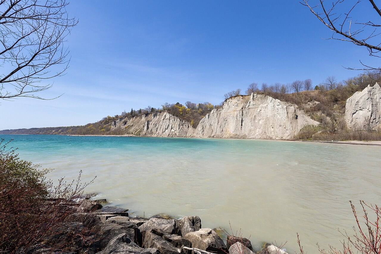
Toronto's lakeside cliffs from below: Bluffer's beach at dawn, down the Doris McCarthy Trail through Gates Gully, then a wild shoreline walk under the Bluffs to the architectural ruins of Guild Park.

Scarborough Bluffs: Under the White Cliffs to Guild Park
Photo: Dillan Payne · CC BY-SA 4.0
Duration
1 day
Distance
9.9 km
Walking time (est.)
2 h 45 min
Ascent
80 m
Difficulty
Moderate
Best season
May–October (September and October are quietest)

Walking

    Your location stays on this phone. It is never sent, stored or put in a link.

    Packing list

    Getting there and back

    Start
    Bluffer's Park, foot of Brimley Road
    Finish
    Guild Inn, Guild Park

    One-way: plan your trip back

    The Scarborough Bluffs are the most unexpected landscape in Toronto: a line of pale cliffs, about 15 kilometres long, rising straight out of Lake Ontario on the city’s eastern edge, up to roughly 90 metres high. They are the eroding shoreline of Glacial Lake Iroquois, the bigger lake that filled this basin after the last ice age, and the sand they shed drifted west over thousands of years to build the Toronto Islands. Elizabeth Simcoe, wife of Upper Canada’s first lieutenant governor, named them in 1793 because they reminded her of the chalk cliffs near Scarborough in England.

    Houses sit along the top, so the only way to really see the cliffs is from below, and there are few ways down. This route uses the two best ones. It starts early at Bluffer’s Park, the one place with a proper beach and marina, directly under the tallest, most sculpted faces. Then it moves east to the Doris McCarthy Trail, a steep ravine path named for the painter who lived on the clifftop, drops through Gates Gully to the water, and follows the rough shoreline path east under the Bluffs to Guild Park, where a 1930s artists’ colony left behind a garden full of columns and facades rescued from demolished downtown buildings.

    The walking part, from Gates Gully to the Guild, is about eight kilometres; Bluffer’s adds a short beach stroll at the start. Between the two you need a car, a taxi or a bus: there is no dry shoreline link.

    Getting there. Drive or take the seasonal TTC bus from Kennedy station to Bluffer’s Park at the foot of Brimley Road; on summer weekends arrive early, because the road down is closed once the lots fill. From there it is about ten minutes by car to the Doris McCarthy trailhead on Ravine Drive, south of Kingston Road. Guild Park, at 201 Guildwood Parkway, is on a TTC bus route back to Kennedy station.

    Permits & fees. No permits. Parking at Bluffer’s Park is paid in season; the trails and Guild Park are free.

    Good to know:

    Tips & Insights for this route Planning this route? Read our practical tips before you go — 8 tips. Read the tips

    Elevation profile

    Highest point
    137 m Day 1
    Lowest point
    101 m Day 1
    Total descent
    41 m

    Point at the profile, or focus it and use the arrow keys, to see that spot on the map.

    Terrain heights along a straight line between each day’s stops, not along the footpath, so a pass or a switchback the path takes can be missing. Descent and walking times use the same line.

    Elevation data: Terrain Tiles (Mapzen, AWS Open Data)

    Day by day

    DayDistanceAscentDescent (est.)Walking time (est.)
    Day 1 Hardest dayBluffer's Park, Gates Gully and the Guildwood shore
    Distance9.9 kmAscent80 mDescent (est.)41 mWalking time (est.)2 h 45 min

    Flights on Kayak Car rental on Localrent Travel eSIM on Airalo

    Day 1

    Bluffer's Park, Gates Gully and the Guildwood shore

    Bluffer's Park, foot of Brimley Road → Guild Inn, Guild Park 9.9 km 80 m 2 h 45 min

    A beach stroll under the Cathedral Bluffs, then a descent through Gates Gully and a long shoreline walk east beneath the cliffs, climbing at the end into Guild Park’s sculpture garden of rescued buildings.

    Water and food

    Water
    None found near the stops. Carry enough for the day.

    Places mapped by volunteers on OpenStreetMap; opening times and taps change, so check before relying on one. © OpenStreetMap contributors

    Segments

    1. Bluffer's Park and the Cathedral Bluffs 1.5 km 0 m Map

      Bluffer's Park parking → West end of Bluffer's beach and back

      Flat beach promenade and sand

      Start at the only real beach under the Bluffs. Walk the promenade and the sand west toward the tallest faces, the Cathedral Bluffs, where rain and wind have carved the clay into ribs and spires that look like a Gothic facade. Stay well back from the base. Early morning is the time: the light is on the cliffs and the lots are still open. About 45 minutes, then drive or taxi to Ravine Drive.

    2. Down the Doris McCarthy Trail
      Down the Doris McCarthy Trail 0.9 km 0 m Map

      Ravine Drive trailhead → Lakeshore at the foot of Gates Gully

      Steep paved and gravel ravine path

      The trail drops about 90 metres in under a kilometre through Gates Gully, a wooded ravine cut by a small creek, on a smooth but steep path; cyclists are told to dismount. It is named for Doris McCarthy, the landscape painter who lived and worked on the clifftop above for most of her long life. At the bottom a large steel sculpture, shaped like both a canoe and the ribcage of a fish, marks the meeting with the lake. About 20 minutes.

      About this place

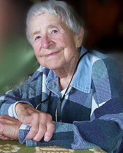
      Doris McCarthy, LL. D. was a Canadian artist known for her semi-abstracted landscapes. In a 2004 interview with Harold Klunder, the artist remarked:I was influenced very strongly by the tradition of going out into nature and painting what was there. I bought it. And I still buy it.

      Read more on Wikipedia Photo: Vickyjones at English Wikipedia · CC BY-SA 3.0
    3. The western viewpoint 1 km 0 m Map

      Foot of Gates Gully → End of the western path and back

      Gravel shoreline path

      Turn right first, for about half a kilometre along the water, to where the path ends in a view back west along the cliffs toward Bluffer's Park. This is the classic picture of the Bluffs: white walls rising out of blue water, with no houses in sight. There is no way through to Bluffer's without wading, so turn back. About 20 minutes.

    4. The Guildwood shoreline 4.5 km 0 m Map

      Foot of Gates Gully → Shore below Guild Park

      Gravel path, boardwalk, armour stone and pebble beach

      Now the long stretch: east along the water's edge under the Bluffs, on a mix of gravel path, boardwalk and rock. The cliffs stay above you on the left the whole way, the lake on the right, and on a weekday you may meet almost no one. Near the Sylvan Park headland, look for the remains of the steamship Alexandria, which can sometimes be seen just breaking the surface. About 1 hour 15 minutes.

    5. Up to Guild Park
      Up to Guild Park 1 km 70 m Map

      Shore below Guild Park → Guild Park tableland

      Climbing park path

      Leave the shore on the access path that climbs to the top of the Bluffs at Guild Park. This is the only real uphill of the day, and the view back over the lake from the top is the reward. About 20 minutes.

      About this place

      Guildwood, also known as Guildwood Village, is a residential neighbourhood in Toronto, Ontario, Canada. It is located in the eastern area of the city, in the district of Scarborough. It is bounded by the Scarborough Bluffs, south of Kingston Road, from Grey Abbey Trail in the east.

      Read more on Wikipedia Photo: Jeff Hitchcock from Seattle, WA, USA · CC BY 2.0
    6. The Guild ruins
      The Guild ruins 1 km 10 m Map

      Guild Park tableland → Guild Inn

      Park paths and lawns

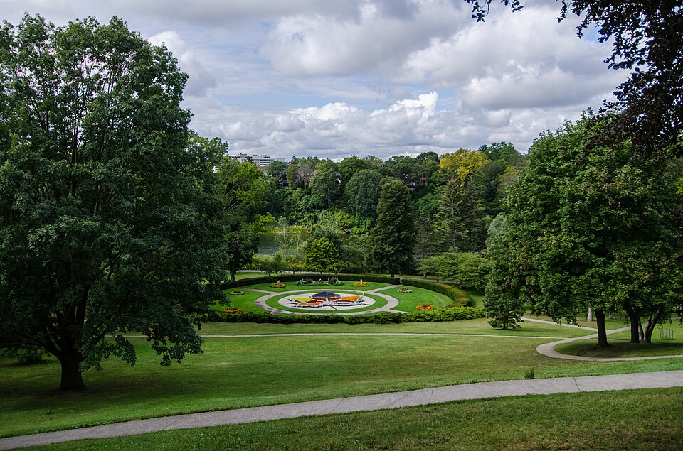
      Rosa and Spencer Clark bought this estate in 1932 and turned it into the Guild of All Arts, an artists' colony and inn. From the 1950s they collected pieces of more than 60 demolished Toronto buildings and set them in the gardens: arches, carved stonework, and the marble columns of the Bank of Toronto, now framing an outdoor Greek Theatre. Walk the ruins, then finish at the restored Guild Inn. About 30 minutes.

      About this place

      Guild Park and Gardens is a public park in the Scarborough district of Toronto, Ontario, Canada. The park was formerly the site of an artist colony and is notable for its collection of relics saved from the demolition of buildings primarily in downtown Toronto arranged akin to ancient ruins. Located on the Scarborough Bluffs, Guild Park and Gardens has an outdoor Greek stage and a 19th-century log cabin among the oldest in Toronto. The principal building in the park is the Guild Inn, a former inn and estate mansion.

      Read more on Wikipedia Photo: Jeff Hitchcock from Seattle, WA, USA · CC BY 2.0
    Partner link: if you book through it we may earn a commission, at no extra cost to you. It does not change what we recommend. How this works

    Tips & Insights

    Packing list

    Filled in for this route from the kit a walk like this needs and the gear its tips mention. Tick things off as you pack.

    Clothing and footwear
    Gear
    Health and sun
    Water and food

    Best time to go

    • Late spring to early autumn, early in the day

      May through October gives you a dry shoreline path and warm water at Bluffer’s beach; September and October add autumn colour in Gates Gully and far fewer people. Morning light falls on the white cliff faces and makes them glow. After heavy rain or in spring high water, parts of the shoreline path can be wet or washed out.

    Getting there

    • Bluffer's by car or seasonal bus, the rest by TTC

      Bluffer’s Park sits at the bottom of Brimley Road; the TTC runs a seasonal weekend and holiday bus there from Kennedy station, and there are paid lots. On summer weekends the lots fill early and police close the road down once they do, sometimes by 9 a.m. The Doris McCarthy trailhead is on Ravine Drive just south of Kingston Road, and Guild Park is on Guildwood Parkway; both are on TTC bus routes from Kennedy station. Check the TTC trip planner for current routes.

    Safety

    • Stay off the cliffs, top and bottom

      The Bluffs are made of loose glacial sand and clay and they are still eroding, sometimes in sudden collapses. Do not climb them, do not stand at the top edge, and do not linger at the foot of a bare face. Fenced areas are closed for a reason and the city can fine you for entering them. People have died here.

    Gear & packing

    • Shoes for rock, not for pavement

      The shoreline between Gates Gully and Guild Park is a mix of gravel path, boardwalk and stretches over armour stone and pebble beach. Wear shoes with grip, carry water (there is none on the shoreline), and in winter bring traction cleats: the Gates Gully path is steep and ices over.

    With kids

    • Split it in two

      The full walk is long for small legs. With children, do Bluffer’s beach in the morning, then the Doris McCarthy Trail down to the lake and back (about two kilometres, with a steep climb out), and skip the long shoreline stretch. Guild Park’s ruins make a good separate stop by car.

    Water & food

    • Pack lunch for the shoreline

      Bluffer’s Park has seasonal food at the marina and washrooms, and Guild Park has facilities at the Guild Inn, but the shoreline in between has nothing. Pack a lunch and eat it on the rocks under the cliffs; Kingston Road has plain neighbourhood places if you need something after.

    Where to stay

    • Sleep downtown, not in Scarborough

      There is little reason to stay out here: the Bluffs are an easy day out from anywhere downtown. Stay near Union Station or in the east end along the Queen Street East streetcar, which gets you closer to the start and back into the city’s restaurants at night.

    Local insights

    • Read the cliffs from below

      The best views of the Bluffs are not from the top, where fences and trees hide them, but from the water’s edge looking up. That is why this route spends its time at the bottom. From the foot of Gates Gully, look west and you see the tall, fluted faces toward Bluffer’s Park, the section that gave the Cathedral Bluffs their name.

    Comments