Trek Toronto — High Park, Canada

High Park to the Humber: Cherry Blossoms and the Lakeshore

An easy downhill walk from the Bloor Street gate through High Park's gardens, cherry trees and Grenadier Pond, past Colborne Lodge, to the lake and over the Humber Bay Arch Bridge.

High Park to the Humber: Cherry Blossoms and the Lakeshore
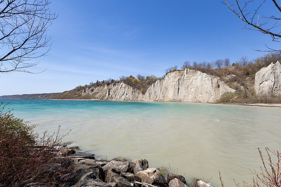
Photo: Jeff Hitchcock from Seattle, WA, USA · CC BY 2.0
Duration
1 day
Distance
7.8 km
Walking time (est.)
2 h
Ascent
25 m
Difficulty
Easy
Best season
Late April–October (cherry blossoms usually late April or early May)

Walking

    Your location stays on this phone. It is never sent, stored or put in a link.

    Packing list

    Getting there and back

    Start
    High Park station
    Finish
    Humber Bay Park East

    One-way: plan your trip back

    Season events near this route

    High Park is Toronto’s great city park: 161 hectares of oak savannah, ravines, gardens and a long pond on the west side of the city, given to Toronto by the architect John George Howard in 1873 on the condition that it stay free for everyone. For about a week each spring it becomes the most photographed place in the city, when the Japanese cherry trees on the slope above Grenadier Pond, gifts from Japan beginning in 1959, come into bloom.

    This easy walk takes the park from top to bottom and then keeps going to the lake. It starts at the Bloor Street gate, drops through Hillside Gardens to the cherry trees and Grenadier Pond, and passes Colborne Lodge, the Howards’ 1837 cottage, now a museum. Then it slips under the Gardiner Expressway to the lakeshore and follows the Martin Goodman Trail west to the Humber Bay Arch Bridge, a white arch over the mouth of the Humber River whose decoration recalls the Toronto Carrying-Place, the ancient portage route that began here. It ends in Humber Bay Park East, on a lakefill peninsula with one of the best views back at the skyline.

    It is about eight kilometres, almost all downhill or flat, and works in any season; spring blossom week is simply the most famous version.

    Getting there. Take Line 2 to High Park station and cross Bloor Street to the park gate. At the end, walk up to Lake Shore Boulevard West for the 501 streetcar back toward downtown.

    Permits & tickets. None. The park, the zoo and the trail are free; Colborne Lodge has its own admission and seasonal hours, so check the City of Toronto site.

    Good to know:

    Tips & Insights for this route Planning this route? Read our practical tips before you go — 8 tips. Read the tips

    Elevation profile

    Highest point
    100 m Day 1
    Lowest point
    75 m Day 1
    Total descent
    35 m

    Point at the profile, or focus it and use the arrow keys, to see that spot on the map.

    Terrain heights along a straight line between each day’s stops, not along the footpath, so a pass or a switchback the path takes can be missing. Descent and walking times use the same line.

    Elevation data: Terrain Tiles (Mapzen, AWS Open Data)

    Day by day

    DayDistanceAscentDescent (est.)Walking time (est.)
    Day 1 Hardest dayHigh Park station to Humber Bay Park East
    Distance7.8 kmAscent25 mDescent (est.)35 mWalking time (est.)2 h

    Flights on Kayak Car rental on Localrent Travel eSIM on Airalo

    Day 1

    High Park station to Humber Bay Park East

    High Park station → Humber Bay Park East 7.8 km 25 m 2 h

    Hillside Gardens, the cherry slope above Grenadier Pond, Colborne Lodge and the Howard Tomb, then under the Gardiner to the Martin Goodman Trail, over the Humber Bay Arch Bridge and out to the skyline view in Humber Bay Park East.

    Water and food

    Places mapped by volunteers on OpenStreetMap; opening times and taps change, so check before relying on one. © OpenStreetMap contributors

    Segments

    1. Bloor gate to Hillside Gardens 1.2 km 5 m Map

      High Park station → Hillside Gardens

      Paved park roads and paths

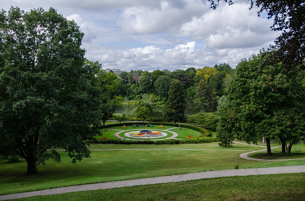
      Cross Bloor Street into the park and head south through the oak woods to Hillside Gardens, terraced ornamental gardens on the slope above Grenadier Pond, with a flower bed planted in the shape of a maple leaf. On the way you pass through one of Ontario's rare surviving black oak savannahs, where some trees are well over a century old. About 20 minutes.

    2. The cherry trees and Grenadier Pond 1.5 km 0 m Map

      Hillside Gardens → South end of Grenadier Pond

      Grassy slope and pondside path

      Drop to the water. Most of the Sakura trees stand on the hillside beside Grenadier Pond, near the Grenadier Café; in bloom week this slope is a pink ceiling over a crowd of photographers, the rest of the year a quiet lawn under the trees. Follow the path along the pond's east shore, where herons and turtles are common in summer. About 30 minutes.

    3. Colborne Lodge and the Howard Tomb
      Colborne Lodge and the Howard Tomb 0.8 km 20 m Map

      South end of Grenadier Pond → Colborne Lodge

      Park path with a short climb

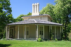
      Climb to the Howard Tomb, where John and Jemima Howard are buried behind a fence that once stood around St. Paul's Cathedral in London, then cross Colborne Lodge Drive to their Regency-style cottage, built in 1836 and 1837 and a museum since 1928. From here the Howards looked out over the lake that the Gardiner now hides. About 20 minutes, longer if you go inside.

      About this place

      Colborne Lodge is an historic house museum located in an 1837 home in Toronto's High Park. John George Howard, an architect, engineer and prominent Toronto citizen, built this house, which became the property of the city following his death in 1890.

      Read more on Wikipedia Photo: Robert Taylor from Stirling, Canada · CC BY 2.0
    4. Under the Gardiner to the lake
      Under the Gardiner to the lake 0.8 km 0 m Map

      Colborne Lodge → Martin Goodman Trail

      Park road and sidewalk, road crossing

      Follow Colborne Lodge Drive south out of the park, under the railway and the concrete Gardiner Expressway, and cross Lake Shore Boulevard at the lights to the waterfront. It is the least lovely ten minutes of the day, and then the whole lake opens up. About 15 minutes.

      About this place

      The Martin Goodman Trail is a 56 km (35 mi) multi-use path along the waterfront in Toronto, Ontario, Canada. It traverses the entire lake shore from one end of the city to the other, from Humber Bay Arch Bridge in the west to the Rouge River in the east. The Martin Goodman Trail is part of the 730 km Waterfront Trail around Lake Ontario.

      Read more on Wikipedia Photo: Maury Markowitz at English Wikipedia · Public domain
    5. West to the Humber Bay Arch Bridge
      West to the Humber Bay Arch Bridge 1.5 km 0 m Map

      Martin Goodman Trail → Humber Bay Arch Bridge

      Paved waterfront trail

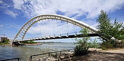
      Turn west along the Martin Goodman Trail, the path that runs the length of Toronto's lakeshore, to the mouth of the Humber River. The Humber Bay Arch Bridge, opened in 1994, spans the river in a single white 100-metre arch, and its details, including carved turtles, recall the Toronto Carrying-Place, the Indigenous trade route that ran north from this river mouth. Stop in the middle for the view up the Humber. About 25 minutes.

      About this place

      The Humber Bay Arch Bridge is a pedestrian and bicycle through arch bridge south of Lake Shore Boulevard West in Toronto, Ontario, Canada. Completed in the mid-1990s, the bridge is part of the Martin Goodman Trail and is 139 metres (456 ft) in length, with a clear span of 100 metres (330 ft) over the mouth of the Humber River to protect the environmental integrity of the waterway.

      Read more on Wikipedia Photo: Wladyslaw · CC BY-SA 3.0
    6. Humber Bay Park East
      Humber Bay Park East 2 km 0 m Map

      Humber Bay Arch Bridge → Humber Bay Park East point

      Paved and gravel park paths

      Across the bridge, follow the shore into Humber Bay Park East, built on lakefill and opened in 1984. The paths loop out to the tip of the peninsula, where the downtown skyline lines up across Humber Bay, with the CN Tower in the middle; at sunset the towers glow. The park also holds Toronto's memorial to the victims of the 1985 Air India bombing. About 40 minutes.

      About this place

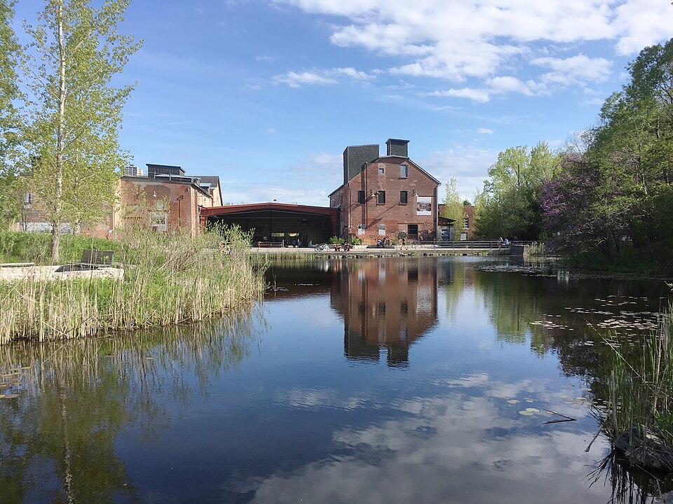
      Humber Bay Park is a waterfront park located in Etobicoke, part of Toronto, Ontario, Canada. The park consists of two landspits situated at the mouth of Mimico Creek. The park is south of Lake Shore Boulevard West, near Park Lawn Road. Humber Bay Park East is 19 hectares, while Humber Bay Park West is 120 hectares.

      Read more on Wikipedia Photo: Dillan Payne · CC BY-SA 4.0
    Partner link: if you book through it we may earn a commission, at no extra cost to you. It does not change what we recommend. How this works

    Tips & Insights

    Packing list

    Filled in for this route from the kit a walk like this needs and the gear its tips mention. Tick things off as you pack.

    Clothing and footwear
    Gear
    Health and sun
    Water and food

    Best time to go

    • Cherry blossom week, or any autumn afternoon

      The Sakura bloom usually peaks in late April or early May and lasts only four to ten days, depending on weather; the city and the High Park Nature Centre post bloom updates each spring. That week is spectacular and very crowded. For the same walk with space to breathe, come on a weekday in May, June or September, or in October when the oak savannah turns.

    Getting there

    • Take the subway, especially in bloom season

      High Park station on Line 2 is across Bloor Street from the park’s north gate; Keele station also works. The park is closed to cars on weekends and holidays and for the whole peak bloom, so do not plan to drive. At the end, the 501 Queen streetcar runs along Lake Shore Boulevard West near Humber Bay Park back toward downtown; check the TTC for current routing.

    Beating the lines

    • Blossoms at breakfast

      In peak bloom the slope above Grenadier Pond fills by mid-morning, especially on weekends. Arrive at sunrise or on a weekday before work hours and you will have the trees nearly to yourself, with soft light on the water. Late evening is the second-best window.

    With kids

    • The zoo and the castle playground

      High Park has a free small zoo with animals like bison and capybaras, and the Jamie Bell Adventure Playground, a big wooden castle-style playground. Both are in the middle of the park, a short detour east from Grenadier Pond. With small children, end at Colborne Lodge and skip the lakeshore half.

    Local insights

    • This is a dry park

      When John George Howard gave the estate to the city in 1873, one of his conditions was that no alcohol be served here, and High Park remains Toronto’s dry park. Pack a picnic of the non-alcoholic kind; the Grenadier Café inside the park and Bloor West Village just north cover the rest.

    Food

    • Bloor West or Roncesvalles

      Before the walk, Bloor West Village, just west of the park along Bloor Street, has bakeries and cafés; Roncesvalles Avenue, on the park’s east side, is one of the city’s nicest neighbourhood food streets. Inside the park, the Grenadier Café sits near the cherry trees. The lakeshore half has little beyond seasonal snack stands.

    Where to stay

    • West-end neighbourhoods

      Staying downtown is fine, since Line 2 gets you here in about twenty minutes. If you want to wake up near the park for a sunrise bloom visit, look at rentals and small guesthouses in Roncesvalles, Bloor West Village or the Junction.

    Gear & packing

    • Layers for the lake

      It is often several degrees cooler and much windier on the lakeshore than in the park, especially in spring. Bring a layer for the second half. The route is paved or packed path throughout and fine for strollers.

    Comments