
Blog
Galilee Day Walks Around the Jesus Trail
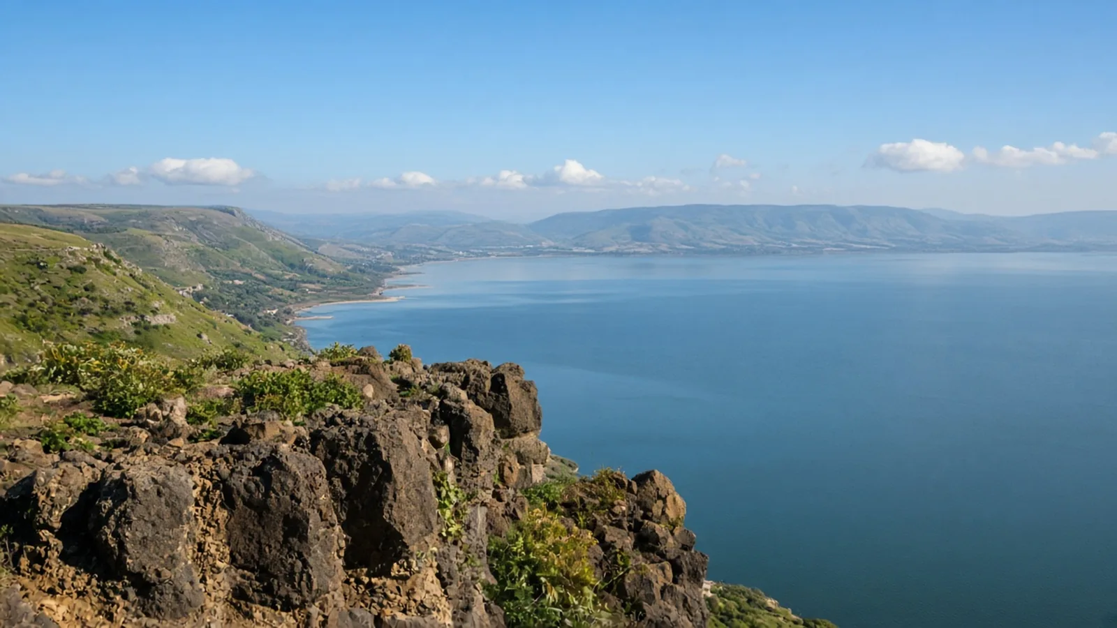
In short
Use the Jesus Trail as the multi-day spine: 4 days, 65 km and 1,600 m, graded moderate, in March to May and October to November. Around it, Banias is a 4 km easy walk all year, Nahal Amud and Mount Arbel want October to April, and Tel Dan's shaded wading stays cool in summer. Nahal Yehudiya is the opposite calendar: 5 km, graded hard, May to October, because you swim. Winter storms close it.
The spine is four days. The day walks do not share one season.
The Galilee looks like one green north on a map. On Waymark it is several calendars. The Jesus Trail is the multi-day line, in spring and autumn. Banias is open all year. Nahal Amud and Mount Arbel want the cooler months, and Amud can flood. Tel Dan is short, shaded, and explicitly still pleasant in summer. Nahal Yehudiya is a swim with a ladder, open from May to October, and dangerous in winter storms.
Build a week from the walks whose seasons overlap. Leave the others for the month they name. The desert circuit further south uses October to April for a different reason, heat, and it is written up in Israel desert walks in the cool season. Do not copy that calendar onto Yehudiya, and do not copy Yehudiya’s summer onto the desert.
The Jesus Trail is the multi-day spine
The Jesus Trail runs from the Church of the Annunciation in Nazareth to Capernaum on the Sea of Galilee. Waymark lists 4 days, 65 km and 1,600 m of ascent, graded moderate. The season is March to May and October to November. Summer is hot and the farmland is exposed. Winter can be rainy and muddy.
This is a cultural path: olive groves, wheat fields, villages, kibbutzim, and one dramatic descent, the cliff of Mount Arbel down to the lake. The blazes are white, orange, white. The route is free. Beds are in guesthouses and village rooms, and those gaps set the stages. Carry water, and start early. Taps between villages are not the plan.
Most people walk west to east, from the hills down to the lake. Nazareth is a bus ride from Tel Aviv, Haifa, or Tiberias. Capernaum connects back to Tiberias. Four days at 65 km is the right spine for a first Galilee week in March, April, May, October, or November. How it compares with other first long walks is in your first long walk.
If the week is only the trail, stop there. If you have spare days, add a day walk whose season contains those dates.
Banias works in any month
The Banias is 4 km and 60 m, graded easy. The season is year-round. The waterfall is fullest from December to May.
The path is mostly flat and shaded: the Hermon spring, a Greek shrine cut in the cliff, Roman ruins, and the fall. Shade is why the page calls it a rare summer-friendly walk in this part of the country, while still sending you in winter and spring for the strongest water. There is an entrance fee. Two gates, spring and waterfall, sit a short drive apart. The point-to-point line is downhill overall. Wet shoes near the falls are normal.
Banias is the day you can add to almost any Galilee week, including a July week that should not be on the Jesus Trail. It is also on the short-walk list.
Nahal Amud wants October to April, and a dry forecast
Nahal Amud is 11 km and 150 m, graded moderate. The season is October to April, when the springs run full and the canyon is green. The page says to avoid summer heat, and to check for flash-flood warnings after winter storms.
The stream falls from the flanks of Mount Meron toward the Sea of Galilee. The upper springs flow all year. The lower stream dries in summer and autumn. The walk crosses the bed and the rock, so expect wet feet and some scrambling. The pillar of rock that gives the stream its name stands above the channel near Kibbutz Hukok.
The upper trailhead is off Route 866 in the Meron area. The line is a descent, so a second car or a shuttle belongs at the lower end, unless you walk the upper loop and return to the same car. After winter storms the canyon can flood fast. A cool-season date is not a permission to enter on a flood warning. October to April is the green window. A storm week inside that window is a closed canyon.
Mount Arbel is a cliff, in the same cool months
Mount Arbel is 6 km and 350 m, graded moderate. The season is October to April. The page says to avoid the summer heat.
The summit barely clears 181 m above sea level, and the Sea of Galilee below sits some 200 m under sea level, so the cliff falls away roughly 380 m. The route walks in from the south, then goes over the edge on iron handholds and cables. It is not technical, and it is steep and exposed. The caves under the lip are the old cliff dwellings. Switchbacks then drop toward Wadi Hamam. Most people loop back to the car park at Moshav Arbel. If you exit at the village, arrange the pickup.
There is no shade and no water on the cliff. The page calls the Kinneret basin brutal in summer and names this as a winter and shoulder-season walk. Skip it with small children, and skip it after rain, when the limestone is slick. Anyone uneasy with heights should pick Banias or Tel Dan instead. Arbel National Park charges an entrance fee and closes in the late afternoon, so the start has to leave time for the rangers.
Tel Dan is the short summer exception
Tel Dan is 2 km, graded easy. There is no ascent figure, because the circuit is short and mostly flat. The season line is specific: spring, March to May, for wildflowers and full flow, and the shaded wading trail stays refreshing right through the hot summer.
The Dan is the largest of the three sources of the Jordan, cold and clear, under a canopy that feels out of place in a dry region. The same loop passes the Middle Bronze arched gate, the Israelite gate where the House of David inscription was found, and the high place. There is an entrance fee. The wading trail needs shoes you can soak. The water is genuinely cold all year. The archaeological tel is the exposed, hot part in summer, so the hat still comes.
Pair it with Banias, which is also shaded and also open in summer. That pair is the hot-weather day. It does not replace the four-day trail.
Nahal Yehudiya is May to October, because you swim
Nahal Yehudiya is 5 km and 200 m, graded hard. The season is May to October, when the water is warm enough to swim and the winter flow has dropped. The canyon is closed or dangerous during and after winter storms.
The page refuses the idea that this is an ordinary walk. At the upper waterfall an iron ladder of about nine metres is bolted to the wall. It ends in a deep pool. There is no dry route past it. You swim with your pack, or what you carry goes in a dry bag. The reserve allows the route for people who can swim, and it sets a minimum age of about 10. Last entry is roughly two and a half hours before closing, about 14:30 in summer time and about 13:30 in winter time, and an hour earlier on Fridays. Rangers turn people away. The hike has to finish before dark.
Hikers have died in these pools, from drowning and from jumping into water they had not checked. You may swim. You must not jump. Rockfall has closed sections in recent years, so check the current line with the Israel Nature and Parks Authority before you go. The trailhead is off Route 87 south of Katzrin. The route is linear, so a second car or a shuttle is part of the day.
Yehudiya’s season is May to October. Amud and Arbel are October to April. The desert walks are October to April because summer heat is dangerous there. Yehudiya’s winter is the dangerous season: storms, high water, and a canyon that is closed. October sits at the end of Yehudiya’s window and the start of the cool-season walks. It is not a blended week. May is Yehudiya’s opening and already outside Ein Avdat’s season.
Three weeks, not one
A March-to-May or October-to-November week can hold the Jesus Trail, Banias, and, inside October to April, Amud and Arbel. Tel Dan fits that spring as well, for the flowers. A summer week can hold Banias, the Tel Dan wade, and Yehudiya if everyone in the party can swim and you arrive early enough for the entry cutoff. A summer week cannot hold the Jesus Trail, Amud, or Arbel without contradicting the pages, and it cannot hold the desert circuit at all.
Four days from Nazareth to Capernaum means March to May or October to November. A Golan swim means May to October, and it leaves the desert season on its own page.
Questions
- When should you walk the Jesus Trail?
- March to May and October to November. It is 4 days, 65 km and 1,600 m, graded moderate, from Nazareth to Capernaum. Summer is hot and exposed. Winter can be rainy and muddy.
- Which Galilee day walks share the cool months?
- Nahal Amud is 11 km and 150 m, graded moderate, from October to April, and it can flash-flood after winter storms. Mount Arbel is 6 km and 350 m, graded moderate, in the same months. Banias (4 km, 60 m, easy) is year-round, with the waterfall fullest from December to May.
- Can you walk Tel Dan in summer?
- Yes. The main season for flowers and full flow is March to May, and the page says the shaded wading trail stays refreshing through the hot summer. The walk is 2 km, graded easy. The water is cold year-round.
- Is Nahal Yehudiya a cool-season walk?
- No. It is graded hard, 5 km, and the season is May to October, when the water is warm enough to swim. The canyon is closed or dangerous during and after winter storms. You climb a ladder of about nine metres and swim with your pack. That is the opposite season from the desert walks.
Sources
Routes in this post
-
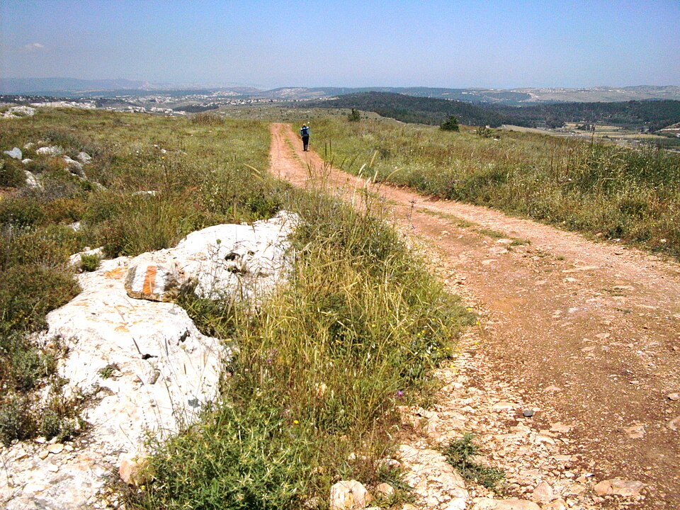 Photo: Zeromancer44 · CC BY-SA 3.0Trek Israel
The Jesus Trail: Nazareth to Capernaum
Four days on foot across the Lower Galilee, from Nazareth over the hills to the Sea of Galilee, tracing a path Jesus may have walked and stringing together ancient towns, panoramic ridges and lakeside holy sites.
- Duration
- 4 days
- Distance
- 65 km
- Difficulty
- Moderate
-
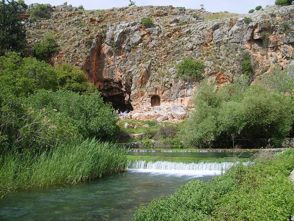 Photo: gugganij · CC BY-SA 3.0Trek Israel
The Banias: Spring of Pan to the Waterfall
An easy day through the Hermon Stream reserve — from the cave and spring of Pan along a suspended riverside trail past Roman palace ruins to Israel's largest waterfall.
- Duration
- 1 day
- Distance
- 4 km
- Difficulty
- Easy
-
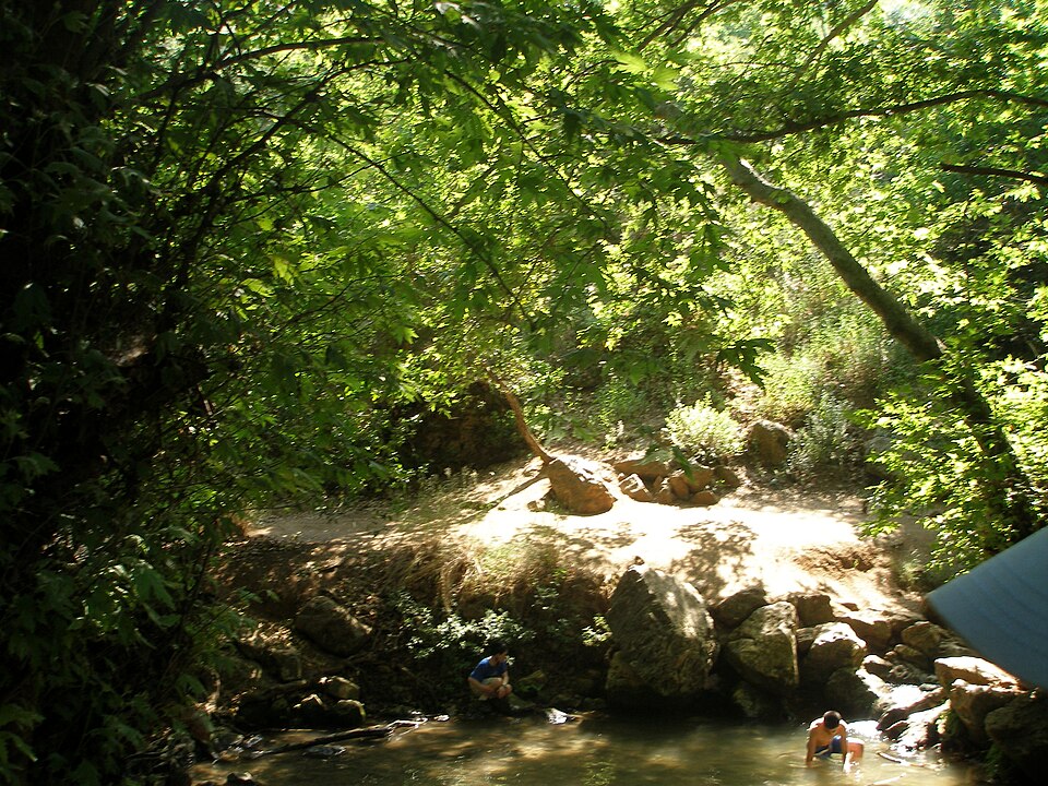 Photo: Pacman · Public domainTrek Israel
Nahal Amud — Springs, Canyon and the Pillar Rock
A descent through the shaded canyon of the Amud Stream in the Upper Galilee, past year-round springs and pools to the tall pillar of rock that gave the stream its name, on down toward the Sea of Galilee.
- Duration
- 1 day
- Distance
- 11 km
- Difficulty
- Moderate
-
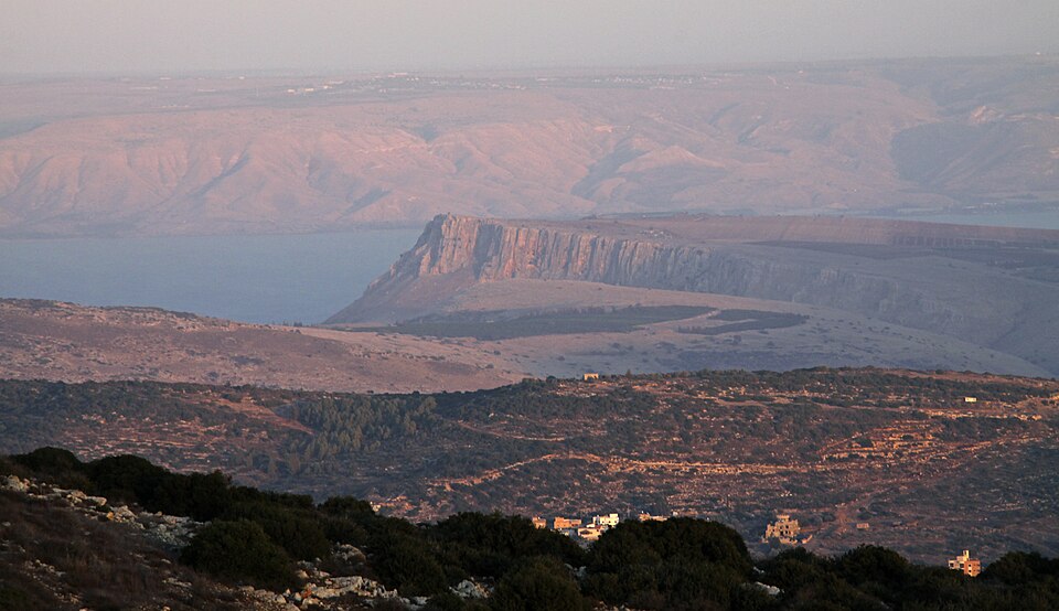 Photo: Yuvalr · CC BY-SA 3.0Trek Israel
Mount Arbel: The Cliff Above the Sea of Galilee
A short, spectacular day above the Kinneret — the best lookout in the Galilee, a steep cliff descent on iron handholds, the rebel caves of Qal'at Ibn Ma'an, and out through Wadi Hamam.
- Duration
- 1 day
- Distance
- 6 km
- Difficulty
- Moderate
-
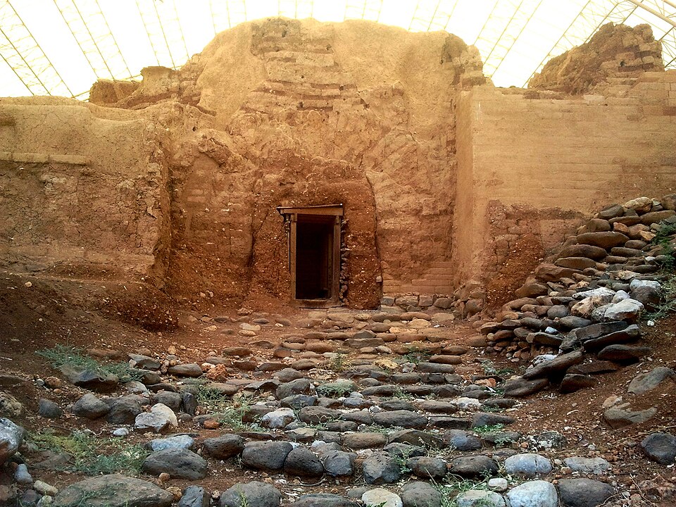 Photo: Hanay · CC BY-SA 3.0Trek Israel
Tel Dan Nature Reserve: The Jordan's Source and the House of David
A short, shaded walk through the lushest corner of the Galilee — wading the cold Dan Stream, then climbing the tel past the world's oldest arched gate to where the 'House of David' inscription was found.
- Duration
- 1 day
- Distance
- 2 km
- Difficulty
- Easy
-
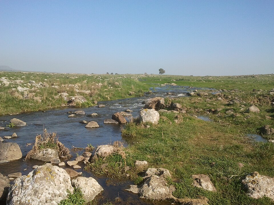 Photo: Hanay · CC BY-SA 3.0Trek Israel
Nahal Yehudiya — The Canyon, the Ladder and the Swim
A hard water route down a basalt canyon in the central Golan: an iron ladder bolted to the cliff drops you into a pool you can only cross by swimming, then the trail runs on past the falls and the hexagonal columns.
- Duration
- 1 day
- Distance
- 5 km
- Difficulty
- Hard