
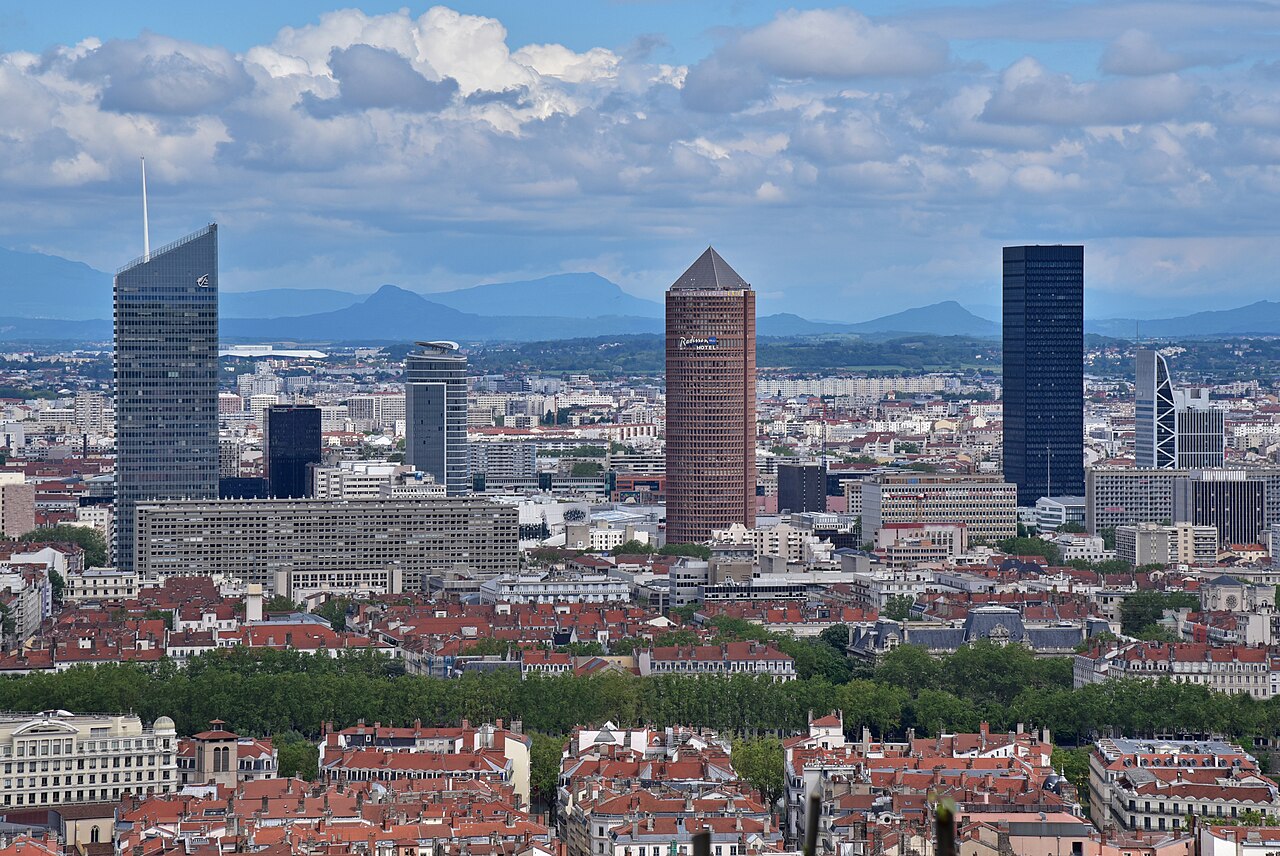
A continuous line from the Renaissance old town, up to Roman Fourvière, across the Presqu’île and onto the silk weavers’ hill.
Drinking water
- Water
- Water tap 30 m from stop 1
- Drinking water 90 m from stop 2
- Drinking water 100 m from stop 3
- Drinking water 250 m from stop 4
- Drinking water 40 m from stop 5
Places mapped by volunteers on OpenStreetMap; opening times and taps change, so check before relying on one. © OpenStreetMap contributors
Segments
-
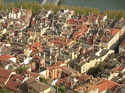 Vieux Lyon and its traboules
Vieux Lyon metro station → Rue du Bœuf
Cobbled lanes and covered passages
Begin in the largest Renaissance quarter of Lyon, a grid of narrow cobbled streets built roughly between the 15th and 17th centuries and split into three parishes — Saint-Paul, Saint-Jean and Saint-Georges. The signature of the district is the traboule: a covered passage running through a building and its courtyard to reach the next street. The first ones are thought to date back as far as the fourth century, and silk merchants later used them to carry cloth across town in the dry. The long traboule between 54 rue Saint-Jean and 27 rue du Bœuf is one of the best known. Allow about 75 minutes.
About this place
Vieux Lyon is the largest Renaissance district of Lyon. In 1964, Vieux-Lyon, the city's oldest district, became the first site in France to be protected under the Malraux law to protect France's cultural sites. Covering an area of 24 hectares between the Fourvière hill and the river Saône, it is one of Europe's most extensive Renaissance neighborhoods. There are three distinct sections: Saint Jean, Saint Paul and Saint Georges. In 1998, Vieux Lyon was inscribed on the UNESCO World Heritage List along with other districts in Lyon because of its historical importance and architecture.
Read more on Wikipedia Photo: Karldupart · CC BY-SA 3.0 -
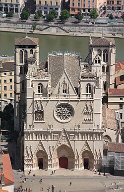 Cathédrale Saint-Jean
Rue du Bœuf → Place Saint-Jean
Cobbled lanes
The Cathedral of Saint John the Baptist, seat of the Archbishop of Lyon, was built over roughly three centuries from about 1180 to 1480, so you can read the shift from Romanesque to Gothic as you walk toward the west front. Inside, the 14th-century astronomical clock is the thing to wait for — it chimes on the hour through the early afternoon. Entry is free. About 30 minutes.
About this place
Lyon Cathedral or the Cathedral of Saint John the Baptist of Lyon is a Roman Catholic church located on Place Saint-Jean in central Lyon, France. The cathedral is dedicated to Saint John the Baptist, and is the seat of the Archbishop of Lyon. Begun in 1180 on the ruins of a 6th-century church, it was completed in 1476. Despite its long construction time, it has a relatively consistent architectural style. In 1998, the building, along with other historic sites in the center of Lyon, was inscribed on the UNESCO World Heritage List.
Read more on Wikipedia Photo: Otourly · CC BY-SA 3.0 -
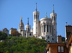 Funicular up to Fourvière basilica
Place Saint-Jean → Fourvière
Funicular railway, then paved esplanade
Take the funicular from the station beside Vieux Lyon metro and let it haul you up the hill in a couple of minutes. At the top stands the Basilica of Notre-Dame de Fourvière, built with private funds between 1872 and 1896 in a deliberately dominant position over the city — a riot of mosaic and gilding inside. The esplanade gives you the whole of Lyon and, on a clear day, the Alps. Entry is free; roof and tower tours are a small extra charge. Around 60 minutes.
About this place
The Basilica of Notre-Dame de Fourvière is a minor basilica in Lyon, France. It was built with private funds between 1872 and 1896 in a dominant position overlooking the city. The site it occupies was once the Roman forum of Trajan, the forum vetus, thus its name.
Read more on Wikipedia Photo: Elwood j blues · CC BY-SA 3.0 -
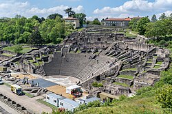 The Roman theatres of Fourvière
Fourvière basilica → Ancient Theatre of Fourvière
Sloping paths and ancient stone tiers
A short walk down the hillside brings you to the ancient theatre, the most substantial surviving piece of Lugdunum, the Roman city founded here in 43 BC. It sits within the UNESCO World Heritage site covering historic Lyon, alongside the smaller odeon next door. Sit on the tiers; in summer they still stage concerts here. The Lugdunum museum is built into the slope beside it if you want the finds as well as the stones. About 60 minutes.
About this place
The Ancient Theatre of Fourvière is a Roman theatre in Lyon, France. It was built on the hill of Fourvière, which is situated in the center of the Roman city. The theatre is part of a UNESCO World Heritage Site that protects the historic center of Lyon.
Read more on Wikipedia Photo: Jean-Christophe BENOIST · CC BY 4.0 -
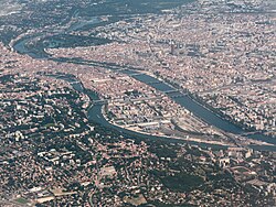 Across the Presqu'île
Fourvière → Place des Terreaux
City streets and bridges
Come down off the hill, cross the Saône and walk the peninsula between the two rivers — the commercial and civic heart of Lyon. Place Bellecour is one of the largest open squares in Europe; from there it is roughly a 20-minute walk north through the shopping streets to Place des Terreaux, with the Hôtel de Ville and the Musée des Beaux-Arts facing each other across it. About 60 minutes at a stroll.
About this place
The Presqu'île is the central part of the City of Lyon, France. Extending from the foot of the Croix-Rousse hill in the north to the confluence of the Rhône and the Saône rivers in the south, it has a preponderance of cafés, restaurants, luxury shops, department stores, banks, government buildings and cultural institutions.
Read more on Wikipedia Photo: David.Monniaux · CC BY-SA 3.0 -
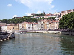 Up to Croix-Rousse
Place des Terreaux → Croix-Rousse plateau
Steep stepped streets
Climb the pentes onto the hill of about 254 metres that Lyon calls the working hill. In the 19th century this was the territory of the canuts, the silk weavers, and their trade shaped the architecture: tall rooms with high ceilings built to house Jacquard looms, and traboules threading between them. The canuts' revolt of 1831 gave the neighbourhood a rebel reputation it has never quite put down. Finish on the plateau with a drink and the city spread out below. About 75 minutes.
About this place
La Croix-Rousse is a hill 254 metres (833 ft) high in the city of Lyon, France, as well as the name of a neighborhood located on this hill. The neighborhood is divided into les pentes and le plateau. This zone is served by Lyon Metro Line C. With 18th century architecture, including unique dwellings for labourers, La Croix-Rousse was inscribed on the UNESCO World Heritage List in 1998 to protect Lyon's long history as an important European city.
Read more on Wikipedia Photo: Pline · CC BY-SA 3.0
Comments
Sign in to join the conversation.
No comments yet — be the first.