
Blog
Vancouver Day Hikes, from the Seawall to Garibaldi Lake
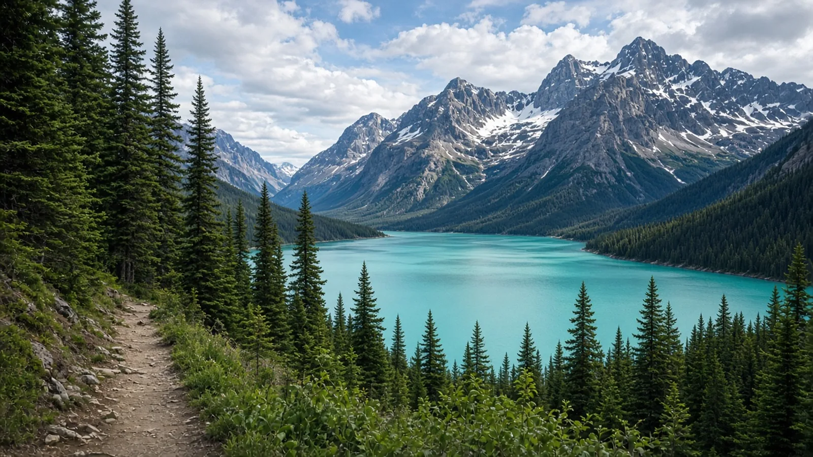
In short
Sort Vancouver days by season. The Stanley Park seawall (10 km, easy), Lynn Canyon (3 km, easy, free suspension bridge), and Quarry Rock (3.8 km, 100 m, moderate) are year-round. The Grouse Grind (2.5 km, 800 m, hard) is usually closed about November to April, and you ride the gondola down. Joffre Lakes (10 km, 370 m, moderate) and Garibaldi Lake (18 km, 900 m, hard) run from July to early October. Joffre needs a free day-use pass, and it has cultural closures. The pass has no price to invent.
Sort the day by the month you are actually there
Vancouver’s day hikes look, from a hotel, like one menu. On the route pages they split into three calendars. Three walks are year-round and close to the city. One is a stair climb that closes for the winter and sends you down by gondola. Two are Sea-to-Sky lake days that wait until July and ask for a free pass. Picking Garibaldi in November, or the Grind in January, is how a good city wastes a day on a closed gate.
The figures below are the ones on each page. Where a pass is free, it is free because the page says so. This article does not add a price.
The short famous walks that include the seawall and Lynn Canyon, beside routes in other countries, are in short walks of ten kilometres or less. What the Grind’s grade means next to other hard routes is in what hard means.
Year-round, inside the city
The seawall
The Stanley Park seawall is 10 km, graded easy, with almost no climbing. It is open year-round. May to September is when the beaches are staffed and the evenings run long, which the page calls the best of it. The path still works in January.
Walk counterclockwise from Coal Harbour: skyline and floatplanes, the North Shore mountains, the Lions Gate Bridge overhead, then English Bay. That is also the direction the bikes ride. Walkers stay on the water side. Three to four hours with stops is the usual pace. The park and the path are free. Parking inside the park is paid, and sunny weekends fill the beach lots. Bus 19 ends at the loop just inside the park.
Lynn Canyon
Lynn Canyon is 3 km, graded easy, year-round. The catalogue ascent is 100 m. The loop crosses a suspension bridge about 50 m above the creek, drops toward the 30 Foot Pool, and continues on a piece of the Baden-Powell Trail to Twin Falls. Spring is the full waterfalls. Summer is the swimming hole. Rain is a good day for it.
Entry, the bridge, and the Ecology Centre are free. Parking is paid from about March to October during the day. The page points you at the District of North Vancouver for the current rate, and this article will not guess it. The lot fills on summer weekends. Transit is the SeaBus to Lonsdale Quay, then bus 228, plus a walk of about 10 to 15 minutes.
Stay on the trails and behind the fences. People have died jumping or falling, and the pools have strong hidden currents. Storms and maintenance close the bridge and the trails, so check the district notices. Dogs are allowed on leash in most of the park. The decision is simple: a free bridge, a short forest loop, any month.
Quarry Rock
Quarry Rock is 3.8 km and 100 m, graded moderate, year-round. The page suggests weekday mornings from May to September if you want the view without the crowds.
Deep Cove is about 13 km from downtown, on the Tsleil-Waututh shore of Indian Arm. The walk follows the eastern end of the Baden-Powell Trail through second-growth forest, on stairs, roots, and boardwalk, to a granite outcrop above the fjord. The numbers look easy. The page says the constant ups and downs make it harder than those numbers suggest, which is why the grade is moderate rather than easy.
The hike is free and needs no permit. Parking in the village is limited and paid for much of the year, and the lots fill early on summer weekends. The path closed for long stretches between 2020 and 2023. It has reopened with parking limits, so check the district notices.
The stair climb that closes
The Grouse Grind is 2.5 km and 800 m, graded hard. The season is late spring to autumn, when the trail is open. It is usually closed from about November to April.
There is almost no flat ground and almost no view until the chalet. About 2,830 steps sit in the steepest parts. Most people take around two hours. The trail is one-way. Hiking down is prohibited, because the descent is hard on knees and dangerous when the steps are wet, and because downhill walkers block the path. You ride the Skyride or gondola back to the base. The hike is free. The download ticket is not. Buy it at the top or online, and check the current price on the mountain’s own site.
The trailhead is beside the Skyride base at the top of Capilano Road. From about November to April, assume the gate is shut and take the seawall, Lynn Canyon, or Quarry Rock instead.
The Sea-to-Sky lakes, from July
Joffre Lakes
Joffre Lakes is 10 km and 370 m, graded moderate. The season is July to early October, outside the scheduled cultural closures. The trail is snowbound from November to late May, and the page says to expect snow on the upper trail well into June. June is not a clever early start.
Three lakes, fed by the glaciers on Mount Matier and Joffre Peak, sit one above the next. The trail climbs about 5 km from the highway through forest, past a waterfall, and over moraine, then returns the same way. Above Middle Lake it gets rougher. The drive is roughly three hours each way from Vancouver, past Whistler and Pemberton, with no public transit. Parking is only in the designated lots, and they fill early on summer weekends. Dogs are not allowed.
The pass is free. During the pass season every person needs a free day-use trail pass. On the page, the 2026 season ran from 11 May to 25 October. Passes are released on the BC Parks site at 7 a.m. Pacific, two days before the visit, and they go quickly. Campers with a reservation at Upper Joffre Lake do not need a separate day pass. Dates change each year. Check before you go. There is no price to add, because the page’s price is zero.
The park, now officially Pipi7íyekw/Joffre Lakes Park, is co-managed by BC Parks with the Líl̓wat Nation and N’Quatqua. It closes to recreational visitors for set periods so the Nations can use the land for ceremony and harvesting. In 2026 those closures were 20 to 27 June and 8 to 30 September. Plan around the dates published for your year. A date inside a closure is a shut trailhead. July through early October is the walking season, and only on the days the closure calendar leaves open.
Garibaldi Lake
Garibaldi Lake is 18 km and 900 m, graded hard, from the Rubble Creek trailhead. The season is July to early October, once the snow is off the upper trail. The lake sits at nearly 1,500 m. The climb is about 9 km each way, and almost all of the 900 m comes in the first 6 km of forest, before the grade eases toward the water.
This is the long city-accessible day: the page says the trailhead is about 1.5 to 2 hours from downtown, and that the round trip takes most people six hours or more. There is no transit to the trailhead. Dogs are not permitted. Snow lingers on the upper trail into early summer, and the lake is typically frozen from late December to late April. October can bring the first snow with short days. Late July to September is the reliable clear trail.
The pass, on busy days, is also free, and it is a different pass from Joffre’s. BC Parks requires a free day-use vehicle pass for Rubble Creek on busy days in summer and early autumn. In 2026 that season ran from 12 June to 12 October, on Fridays through Mondays and holidays. One pass covers the car. They are released at 7 a.m. Pacific two days ahead. Campers with a reservation do not need a separate day pass. The page’s tip for a missed release is Tuesday to Thursday, when passes have not been required, and it tells you to confirm that rule for your year. Again there is no fare to quote.
Do not linger in the signed hazard zone at the trailhead. The Barrier, the lava dam that holds the lake, collapsed down this valley in the nineteenth century, and the province has long treated the ground below it as unsafe to loiter in. Park, put the boots on, and walk. Carry water and a filter. There is no treated water on the trail.
Joffre is the moderate lake, 10 km and 370 m. Garibaldi is the hard one, 18 km and 900 m. Both want July to early October, and both want a free pass of a different kind. From November through May they are snow, and the year-round walks are the seawall, Lynn Canyon, and Quarry Rock.
Questions
- Which Vancouver walks are open all year?
- The Stanley Park seawall is 10 km, graded easy. Lynn Canyon is 3 km, graded easy, and the suspension bridge is free. Quarry Rock is 3.8 km and 100 m, graded moderate. All three list year-round. The seawall is at its best from May to September.
- When is the Grouse Grind closed?
- Usually from about November to April. When it is open it is 2.5 km and 800 m, graded hard, and one-way. Hiking down is not allowed. You buy a download ticket and ride the gondola or Skyride down. The hike is free. Check the current download price rather than trusting a remembered fare.
- Does Joffre Lakes charge for a pass?
- The day-use trail pass is free. In the 2026 season on the page it was required from 11 May to 25 October, released at 7 a.m. Pacific two days ahead, one per person. Cultural closures in 2026 ran 20 to 27 June and 8 to 30 September. The walk is 10 km and 370 m, graded moderate, from July to early October, and snowbound from November to late May.
- How hard is Garibaldi Lake compared with Joffre?
- Garibaldi Lake is 18 km and 900 m, graded hard, from the Rubble Creek trailhead, July to early October. Joffre is 10 km and 370 m, graded moderate. Garibaldi's busy-day vehicle pass is also free. In 2026 that pass season was 12 June to 12 October, Fridays through Mondays and holidays. Confirm the current rule before you go.
Sources
Routes in this post
-
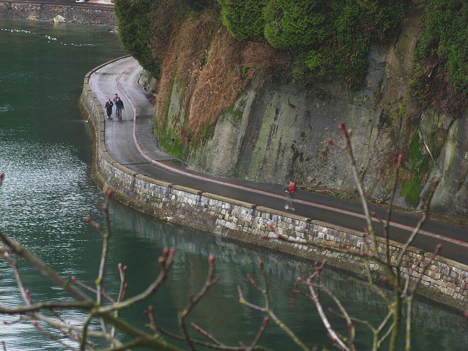 Photo: No machine-readable author provided. Bobanny assumed (based on copyright claims). · Public domainTrek Canada
The Stanley Park Seawall: Coal Harbour to English Bay on Foot
A flat, ten-kilometre loop around the edge of Vancouver's great forest park, from the marinas of Coal Harbour past totem poles, a lighthouse, the Lions Gate Bridge and a lone sea stack, to the sunset beaches of English Bay.
- Duration
- 1 day
- Distance
- 10 km
- Difficulty
- Easy
-
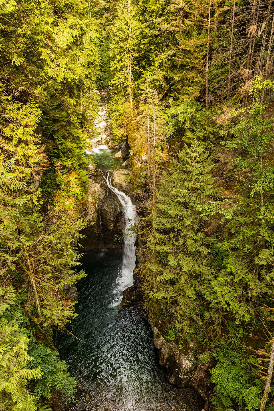 Photo: Diego Delso · CC BY-SA 4.0Trek Canada
Lynn Canyon: Suspension Bridge, 30 Foot Pool and Twin Falls
A short rainforest loop on the North Shore that locals prefer to Capilano: a free suspension bridge 50 metres above Lynn Creek, a green swimming hole, and a second bridge over Twin Falls, all in about three kilometres.
- Duration
- 1 day
- Distance
- 3 km
- Difficulty
- Easy
-
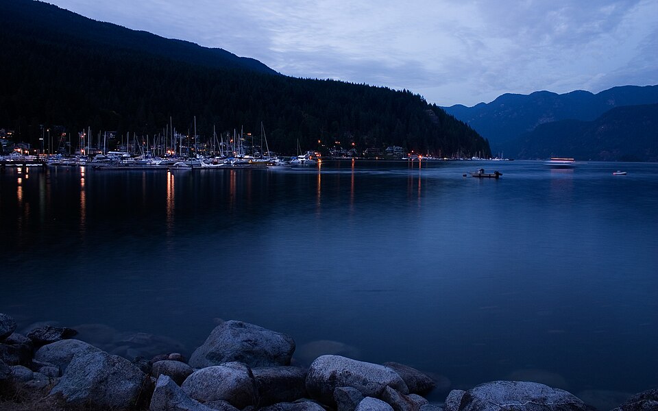 Photo: No machine-readable author provided. LilDice assumed (based on copyright claims). · CC BY-SA 2.5Trek Canada
Quarry Rock from Deep Cove
A short, rooty forest climb on the Baden-Powell Trail from the seaside village of Deep Cove to a bare granite outcrop with a sweeping view over Indian Arm, the fjord at the eastern edge of the North Shore.
- Duration
- 1 day
- Distance
- 3.8 km
- Difficulty
- Moderate
-
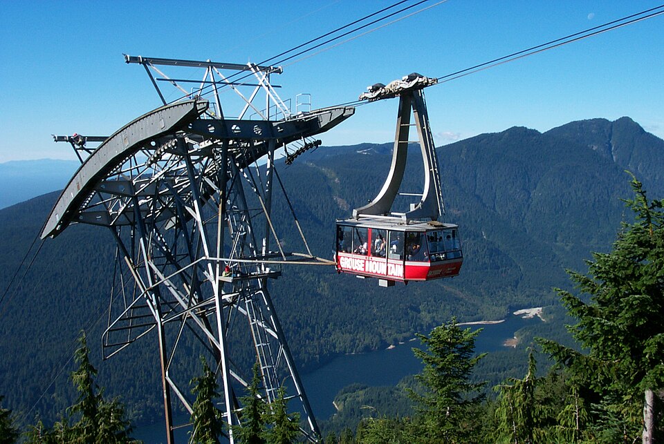 Photo: Pburka at English Wikipedia · Public domainTrek Canada
The Grouse Grind
Vancouver's famous fitness test: 2.5 kilometres and about 800 metres of relentless climbing, much of it on stairs, straight up the face of Grouse Mountain through rainforest to a chalet with a view over the whole city. You ride the gondola down.
- Duration
- 1 day
- Distance
- 2.5 km
- Difficulty
- Hard
-
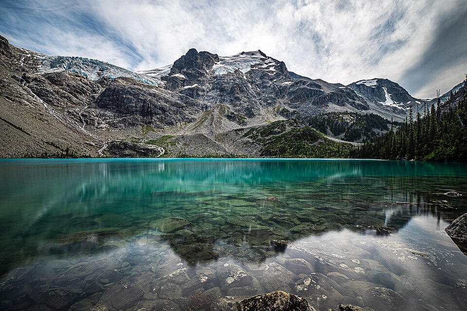 Photo: Giuseppe Milo · CC BY 2.0Trek Canada
Joffre Lakes: Three Glacier Lakes Under the Matier Icefield
A five-kilometre climb past three turquoise lakes, each brighter than the last, to Upper Joffre Lake at the foot of a hanging glacier. One of the most photographed hikes in BC, with a pass system and cultural closures you need to plan around.
- Duration
- 1 day
- Distance
- 10 km
- Difficulty
- Moderate
-
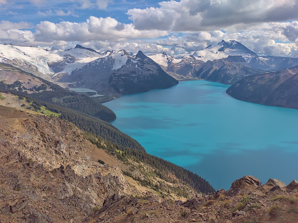 Photo: The Cosmonaut · CC BY-SA 2.5 caTrek Canada
Garibaldi Lake from Rubble Creek
The big day hike of the Sea-to-Sky: nine kilometres and about 900 metres up through old forest from Rubble Creek to a vast turquoise lake held back by a volcanic lava dam, with glaciers pouring into its far shore.
- Duration
- 1 day
- Distance
- 18 km
- Difficulty
- Hard