Trek Vancouver — North Shore, Canada

The Grouse Grind

Vancouver's famous fitness test: 2.5 kilometres and about 800 metres of relentless climbing, much of it on stairs, straight up the face of Grouse Mountain through rainforest to a chalet with a view over the whole city. You ride the gondola down.

The Grouse Grind
Photo: Pburka at English Wikipedia · Public domain
Duration
1 day
Distance
2.5 km
Walking time (est.)
3 h
Ascent
800 m
Difficulty
Hard
Best season
Late spring to autumn, when the trail is open; usually closed from about November to April

Walking

    Your location stays on this phone. It is never sent, stored or put in a link.

    Packing list

    Getting there and back

    Start
    Grouse Grind trailhead, Capilano Road
    Finish
    Grouse Mountain Skyride base station

    One-way: plan your trip back

    Nicknamed Mother Nature’s Stairmaster, the Grouse Grind climbs straight up the southern face of Grouse Mountain with almost no flat ground from bottom to top. It was built in the early 1980s by two local hikers, Don McPherson and Phil Severy, and has become a Vancouver ritual: on summer mornings you will find first-timers gasping at the quarter mark and regulars who run it before work in well under an hour. The official figures are 2.5 kilometres and about 800 metres of elevation gain, with some 2,830 steps built into the steepest sections; other measurements put it slightly longer and higher.

    There are no views on the way up, just dense second-growth forest of cedar, hemlock and fir, rock and root steps, and quarter markers to count down. The reward is at the top, where the trail emerges beside the Grouse Mountain chalet with the city, the Lions Gate Bridge, Stanley Park and the Strait of Georgia spread out below. Most people take two hours or so; the official guidance is about two to two and a half hours for an average hiker.

    The trail is one-way. Hiking down is not allowed because the descent is hard on knees and dangerous on the steep, wet steps, and descending hikers clog the narrow trail. Everyone rides down on the mountain’s Skyride or gondola, which requires a download ticket.

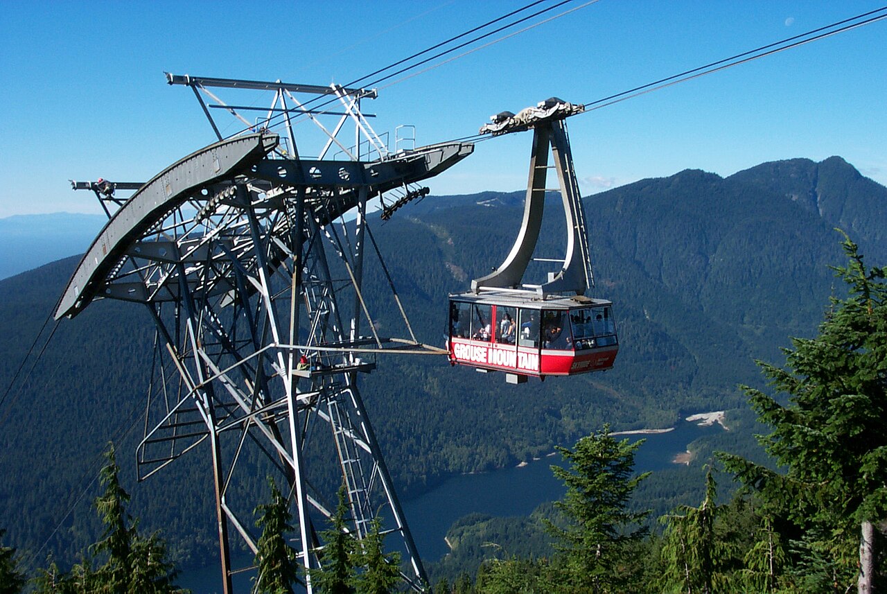
    Getting there. The trailhead is at the base of Grouse Mountain at the top of Capilano Road in North Vancouver, beside the Skyride base station. Take the SeaBus to Lonsdale Quay and bus 236 to Grouse Mountain, or drive and use the pay parking. From downtown in summer, the Grouse Mountain shuttle from Canada Place is another option; check its current schedule.

    Permits & tickets. The hike is free, but you must buy a download ticket for the Skyride or gondola to get back down; buy it at the top or in advance online. Prices change; check Grouse Mountain’s official site. The trail is part of a Metro Vancouver regional park, which sets the opening dates and hours.

    Good to know:

    Tips & Insights for this route Planning this route? Read our practical tips before you go — 9 tips. Read the tips

    Day by day

    DayDistanceAscentDescentWalking time (est.)
    Day 1 Hardest dayBase to summit, then the ride down
    Distance2.5 kmAscent800 mDescentNot recordedWalking time (est.)3 h

    Flights on Kayak Car rental on Localrent Travel eSIM on Airalo

    Day 1

    Base to summit, then the ride down

    Grouse Grind trailhead, Capilano Road → Grouse Mountain Skyride base station 2.5 km 800 m 3 h

    The whole Grind, marked by quarter signs, ending at the Grouse Mountain chalet. The distance and climb per quarter below are rough even splits, not official figures.

    Water and food

    Water
    None found near the stops. Carry enough for the day.

    Places mapped by volunteers on OpenStreetMap; opening times and taps change, so check before relying on one. © OpenStreetMap contributors

    Segments

    1. The first quarter 0.6 km 200 m Map

      Grouse Grind trailhead → Quarter marker

      Steep forest trail with rock and root steps

      From the gate beside the Skyride base station the trail climbs immediately and does not relent. Everyone starts too fast: keep a pace you can hold for two hours, because the first quarter is where most people discover what they have signed up for. About 25 to 35 minutes for a typical hiker.

    2. The second quarter 0.6 km 200 m Map

      Quarter marker → Halfway marker

      Steep trail and timber stairs

      Deeper into the rainforest, the trail climbs through cedar and hemlock on built wooden and rock steps. The halfway sign is a favourite rest stop; step aside to let faster hikers pass, since the trail is narrow. About 25 to 35 minutes.

    3. The third quarter 0.6 km 200 m Map

      Halfway marker → Three-quarter marker

      Steepest stairs and rock

      Many hikers find this the hardest stretch, with long runs of steep steps and boulders. Break it into small goals, drink regularly, and remember there is no easy way down from here: continue up. About 25 to 35 minutes.

    4. The final quarter 0.7 km 200 m Map

      Three-quarter marker → Grouse Mountain chalet

      Steep trail easing near the top

      The forest thins and light begins to break through. The last few minutes ease slightly before you step out onto the plateau beside the chalet, where the view over Vancouver, the Lions Gate Bridge and the ocean opens out at once. About 20 to 30 minutes.

    5. The summit and the ride down 0 km 0 m Map

      Grouse Mountain chalet → Grouse Mountain Skyride base station

      Summit paths and aerial tramway

      Recover with a drink on the chalet terrace and, if you have energy left, walk to the summit attractions: in the warmer months the resort runs a grizzly bear refuge, a lumberjack show and a birds-of-prey display, some included only with a paid summit ticket. Then show your download ticket and ride the Skyride or gondola back to the base. About 30 to 60 minutes.
    Partner link: if you book through it we may earn a commission, at no extra cost to you. It does not change what we recommend. How this works

    Tips & Insights

    Packing list

    Filled in for this route from the kit a walk like this needs and the gear its tips mention. Tick things off as you pack.

    Clothing and footwear
    Gear
    Health and sun
    Water and food

    Best time to go

    • Weekday mornings, cool days

      The trail is shaded but humid, and summer afternoons are stifling. Start early on a weekday to avoid the conga lines on the narrow steps. Always check Metro Vancouver’s status page first: it closes for the season, for weather and for trail work.

    Getting there

    • Transit beats the parking lot

      The pay parking at the base fills on sunny weekends. The SeaBus plus bus 236 from Lonsdale Quay drops you at the trailhead, and you ride down to the same spot.

    Permits & fees

    • Budget for the ride down

      The trail is free, but the download ticket is not optional, since descending on foot is prohibited. Buy it at the guest services desk at the top or online in advance, and check the current price on the official site.

    Gear & packing

    • Light, with grip and a dry layer

      Wear trail runners or light hiking shoes with good grip; the rocks and roots are slippery when wet. Carry a dry shirt or a light jacket for the top: you arrive soaked in sweat, and the summit is several degrees cooler than the city.

    Water & food

    • Carry at least a litre

      There is no water on the trail. Bring at least a litre, more on hot days, and something salty. The chalet at the top has places to eat and buy drinks, so you don’t need to carry lunch.

    Safety

    • Know when to turn around

      Search and rescue teams are called to the Grind many times each year, mostly for exhaustion, injuries and heat. Go at your own pace, stop when you need to, and if you are not fit, consider starting with a gentler hike. Before the quarter mark you can still turn around; after that, it is usually better to continue up.

    Local insights

    • Time yourself

      Regulars use Grouse Mountain’s Grind timer system, which records your time between the base and the top with a card or pass; check the official site for current options. It turns the climb into a personal challenge, and times are posted so you can compare.

    With kids

    • Older, fit kids only

      The Grind is not suitable for small children. Fit teenagers and active older kids manage it, but for families with younger children the Skyride up to the summit’s bear habitat, lumberjack show and walking trails is the better day.

    Where to stay

    • North Vancouver

      Hotels near Lonsdale Quay in North Vancouver are one bus ride from the trailhead and close to Capilano and Lynn Canyon. Downtown is fine too: allow about 45 minutes to an hour by SeaBus and bus.

    Comments