
The eastern end of the Baden-Powell Trail through rainforest to the Quarry Rock outcrop, then back to Deep Cove’s waterfront.
Segments
-
 Trailhead stairs
Panorama Drive trailhead → Creek bridge
Stairs and forest trail
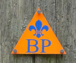
The trail begins with a climb up wooden stairs from Panorama Drive into the forest, marked with the orange Baden-Powell Trail markers. It soon levels out and crosses a creek on a footbridge. About 15 minutes.
About this place
The Baden-Powell Trail is a rugged but well-maintained 48 km hiking trail, that traverses from Horseshoe Bay in West Vancouver to Deep Cove in North Vancouver, British Columbia, Canada. It was named after Robert Baden-Powell, Lord Baden-Powell, founder of the world Scouting Movement.
Read more on Wikipedia Photo: Uogpjf · CC BY-SA 3.0 - Through the rainforest
Creek bridge → Quarry Rock junction
Rooty forest trail and boardwalk
The trail rolls up and down through cedar, fir and ferns, over roots and rocks and short sections of boardwalk, with glimpses of Indian Arm through the trees. Watch your footing; this is where most slips happen. About 20 minutes.
-
 Quarry Rock
Quarry Rock junction → Quarry Rock outcrop
Open granite rock
Take the short spur to the right at the junction onto the outcrop. The granite slab looks out over Indian Arm, the fjord that runs north from Burrard Inlet between steep forested mountains, with Belcarra on the far shore and Deep Cove's marina below. Take your time here. About 20 minutes.
About this place
Indian Arm is a steep-sided glacial fjord in southwestern British Columbia. Formed during the last Ice Age, it extends due north from Burrard Inlet, between the communities of Belcarra and the District of North Vancouver, then on into mountainous wilderness. The name səl̓ilw̓ət is the Halkomelem word for the inlet itself, and from which the Tsleil-Waututh, Halkomelem 'people of the inlet' derive their name. Later Burrard Inlet and the opening of Indian Arm was mapped by Captain George Vancouver and fully explored days later by Dionisio Alcalá Galiano in June 1792.
Read more on Wikipedia Photo: Alex Wen · CC BY-SA 4.0 - Back through the forest
Quarry Rock outcrop → Panorama Drive trailhead
Rooty forest trail and stairs
Return the way you came, which means climbing some of the same ups and downs in reverse, then descend the stairs to Panorama Drive. Go carefully on the steps if they are wet. About 30 minutes.
About this place
The Baden-Powell Trail is a rugged but well-maintained 48 km hiking trail, that traverses from Horseshoe Bay in West Vancouver to Deep Cove in North Vancouver, British Columbia, Canada. It was named after Robert Baden-Powell, Lord Baden-Powell, founder of the world Scouting Movement.
Read more on Wikipedia Photo: Uogpjf · CC BY-SA 3.0 -
 Deep Cove waterfront
Panorama Drive trailhead → Deep Cove Park
Village streets and park
Walk down into the village and out to Deep Cove Park and Panorama Park on the waterfront, with a small beach, a dock and the kayak rental shops. It is a fine spot to rest with a coffee before the bus back. About 15 minutes.
About this place
The District of North Vancouver, commonly North Vancouver or North Van, is a district municipality in British Columbia, Canada, situated north of the city of Vancouver across the Burrard Inlet. It surrounds the respective City of North Vancouver on three sides, and the remaining fellow North Shore municipality of West Vancouver on the other, and is part of the Metro Vancouver Regional District.
Read more on Wikipedia Photo: David Zhang from Canada · CC BY-SA 2.0


Comments
Sign in to join the conversation.
No comments yet — be the first.