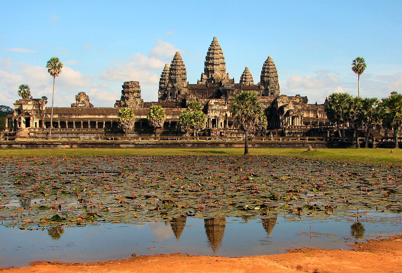
A logical clockwise loop from Angkor Wat through the walled city of Angkor Thom to Ta Prohm and Banteay Kdei, travelling between temples and exploring each on foot.
Segments
-
 Angkor Wat at sunrise
West causeway → Angkor Wat central towers
Stone causeway and galleries
Arrive in the dark and watch the five lotus-bud towers of Angkor Wat blacken against the sunrise, mirrored in the reflecting pool. Built in the early 12th century by Suryavarman II as a Hindu temple to Vishnu, it is the largest religious monument on earth. Allow around 90 minutes with the galleries of carved reliefs.
About this place
Angkor Wat is a Theravada Buddhist temple complex, originally built as a Vaishnava Hindu temple, in Siem Reap, Cambodia. It is the largest religious complex in the world. Located on a site measuring 162.6 hectares within the medieval capital of Angkor, it was constructed between 1113 and 1150 CE during the reign of the Khmer king Suryavarman II as a Hindu temple dedicated to Vishnu. From the late 13th century onward, the complex was gradually transformed into a Buddhist temple as Khmer kings adopted Buddhism. Angkor Wat has remained a Buddhist monastery and an active center of Buddhist worship into the present day. It is noted for its monumental scale, extensive bas-reliefs, and an architectural unity characteristic of Khmer architecture. Unlike most Angkorian temples, it is oriented toward the west. It is a symbol of Cambodia and appears on the Cambodian national flag.
Read more on Wikipedia Photo: Bjørn Christian Tørrissen · CC BY-SA 4.0 -
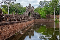 The South Gate of Angkor Thom
Angkor Wat → Angkor Thom South Gate
Road and stone causeway
Cross to the great walled city of Angkor Thom, entering through its monumental South Gate, its causeway lined with rows of gods and demons gripping a serpent. The last capital of the Khmer Empire, built by Jayavarman VII. About 30 minutes.
About this place
Angkor Thom, alternatively Nokor Thom, located in present-day Cambodia, was the last and most enduring capital city of the Khmer Empire. It was established in the late twelfth century by King Jayavarman VII. It covers an area of 9 km², within which are located several monuments from earlier eras as well as those established by Jayavarman and his successors. At the centre of the city is Jayavarman's state temple, the Bayon, with the other major sites clustered around the Victory Square immediately to the north. The site is one of the major tourist attractions of Southeast Asia.
Read more on Wikipedia Photo: This Photo was taken by Supanut Arunoprayote. Feel free to use any of my images, but please mention me as the author and may send me a message. (สามารถใช้ภาพได้อิสระ แต่กรุณาใส่เครดิตผู้ถ่ายและอาจส่งข้อความบอกกล่าวด้วย) Please do not upload an updated image here without consultation with the Author. The author would like to make corrections only at his own source. This ensures that the changes are preserved.Please if you think that any changes should be required, please inform the author.Otherwise you can upload a new image with a new name. Please use one of the templates derivative or extract. · CC BY 4.0 -
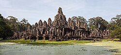 The Bayon and its faces
South Gate → The Bayon
Temple stairs and terraces
At the exact centre of Angkor Thom stands the Bayon, its towers carved with more than two hundred huge, serene stone faces that seem to watch you from every angle. Study the vivid bas-reliefs of daily Khmer life around the base. Around 60 minutes.
About this place
The Bayon is a richly decorated Theravada Buddhist temple of the Khmer Empire located at Angkor in Cambodia. Built in the late 12th or early 13th century as the state temple of King Jayavarman VII, it stands at the centre of Jayavarman's capital city, Angkor Thom. The Bayon reflects the strong Buddhist orientation of Jayavarman VII's reign. Originally conceived as a Mahayana Buddhist monument centered on the cult of the Bodhisattva of compassion, the temple later adapted to the spread of Theravada Buddhism in Cambodia. Its iconography, spatial organization, and emphasis on compassion and kingship illustrate the close relationship between Buddhism and royal authority at Angkor, while its continued use as a Buddhist sanctuary demonstrates the enduring influence of Buddhism in the region.
Read more on Wikipedia Photo: Diego Delso · CC BY-SA 3.0 -
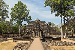 Baphuon and the royal terraces
The Bayon → Terrace of the Elephants
Raised causeway and terraces
Walk north to the pyramid-temple of the Baphuon and the palace enclosure of Phimeanakas, then along the Terrace of the Elephants and the Terrace of the Leper King, the grandstands of the old royal city. About 45 minutes.
About this place
The Baphuon is a Buddhist temple at Angkor, Cambodia. It is located in Angkor Thom, northwest of the Bayon. Also called "golden mountain" (svarnādrī), the Baphuon is built on an artificial hill. The temple was originally dedicated to Shiva and late converted to a Theravada Buddhist temple.
Read more on Wikipedia Photo: Marcin Konsek · CC BY-SA 4.0 -
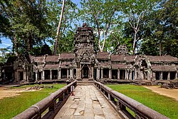 Ta Prohm, the jungle temple
Angkor Thom → Ta Prohm
Forest paths and rubble
The most atmospheric ruin at Angkor, deliberately left in the grip of the forest: giant silk-cotton and strangler-fig roots pour over collapsing galleries. A Buddhist monastery built by Jayavarman VII in honour of his mother, and the 'Tomb Raider' temple. Around 75 minutes.
About this place
Ta Prohm is the modern name of a temple near the city of Siem Reap, Cambodia, approximately one kilometre east of Angkor Thom and on the southern edge of the East Baray. It was built in the Bayon style largely in the late 12th century and early 13th century and was originally called Rajavihara. It was founded by the Khmer King Jayavarman VII as a Mahayana Buddhist monastery and center of learning dedicated to his mother. Almost 80,000 people were required to maintain or attend at the temple, including over 2,700 officials and 615 dancers.
Read more on Wikipedia Photo: This Photo was taken by Supanut Arunoprayote. Feel free to use any of my images, but please mention me as the author and may send me a message. (สามารถใช้ภาพได้อิสระ แต่กรุณาใส่เครดิตผู้ถ่ายและอาจส่งข้อความบอกกล่าวด้วย) Please do not upload an updated image here without consultation with the Author. The author would like to make corrections only at his own source. This ensures that the changes are preserved.Please if you think that any changes should be required, please inform the author.Otherwise you can upload a new image with a new name. Please use one of the templates derivative or extract. · CC BY 4.0 -
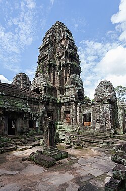 Banteay Kdei and Srah Srang
Ta Prohm → Srah Srang
Temple paths and baray shore
Finish at the sprawling, uncrowded Buddhist monastery of Banteay Kdei, then step across the road to Srah Srang, the royal bathing pond, a calm sheet of water and a fine place to close the circuit. About 60 minutes.
About this place
Banteay Kdei, also known as "Citadel of Monks' cells", is a Buddhist temple in Angkor, Cambodia. It is located southeast of Ta Prohm and east of Angkor Thom. Built in the mid-12th to early 13th centuries AD during the reign of Jayavarman VII, it is in the Bayon architectural style, similar in plan to Ta Prohm and Preah Khan, but less complex and smaller. Its structures are contained within two successive enclosure walls, and consist of two concentric galleries from which emerge towers, preceded to the east by a cloister.
Read more on Wikipedia Photo: Diego Delso · CC BY-SA 3.0
Comments
Sign in to join the conversation.
No comments yet — be the first.