
A compact circuit from the hot spring at the city’s origin out to the grandest terrace in Britain and back to the river.
Drinking water
- Water
- Drinking water 180 m from stop 1
- Drinking water 240 m from stop 1
- Drinking water 260 m from stop 1
- Drinking water 100 m from stop 2
Places mapped by volunteers on OpenStreetMap; opening times and taps change, so check before relying on one. © OpenStreetMap contributors
Segments
-
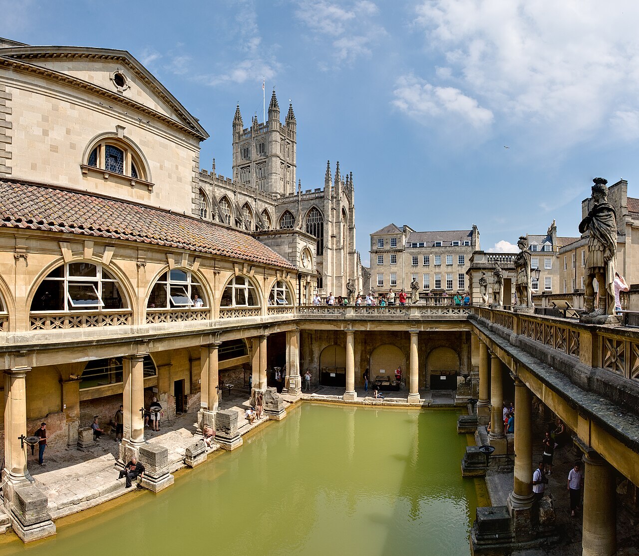
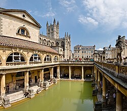 The Roman Baths
Abbey Churchyard → The Great Bath
City streets and stone flooring
Start where the city started. A temple was built over the hot spring between about 60 and 70 AD, in the first decades of Roman Britain, and the settlement of Aquae Sulis grew around it. The bathing complex ran until the end of Roman rule in the 5th century. Walk the Great Bath at its original level, look at the gilt bronze head of Sulis Minerva, and read the curse tablets thrown into the water. Allow about 2 hours.
About this place
The Roman Baths are well-preserved thermae in the city of Bath, Somerset, England. A temple was constructed on the site between 60 and 70 AD in the first few decades of Roman Britain. Its presence led to the development of the small Roman urban settlement known as Aquae Sulis around the site. The Roman baths were designed for public bathing and were used until the end of Roman rule in Britain in the 5th century AD. According to the Anglo-Saxon Chronicle, the original Roman baths were in ruins a century later. The area around the natural springs was redeveloped several times during the Early and Late Middle Ages.
Read more on Wikipedia Photo: Diliff · CC BY 2.5 -
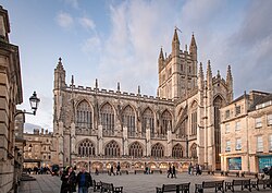 Bath Abbey
The Great Bath → Bath Abbey
Paved churchyard
Next door, and a thousand years later. Founded in the 7th century, reorganised in the 10th and rebuilt in the 12th and 16th, the abbey is one of the finest examples of Perpendicular Gothic in the West Country — all vertical lines, fan vaulting and glass. Look for the stone angels climbing ladders up the west front. About 40 minutes.
About this place
The Abbey Church of Saint Peter and Saint Paul, commonly known as Bath Abbey, is a parish church of the Church of England and former Benedictine monastery in Bath, Somerset, England. Founded in the 7th century, it was reorganised in the 10th century and rebuilt in the 12th and 16th centuries; major restoration work was carried out by Sir George Gilbert Scott in the 1860s. It is one of the most significant examples of Perpendicular Gothic architecture in the West Country. The medieval abbey church served as a sometime cathedral of a bishop. After long contention between churchmen in Bath and Wells the seat of the Diocese of Bath and Wells was later consolidated at Wells Cathedral. The Benedictine community was dissolved in 1539 during the Dissolution of the Monasteries.
Read more on Wikipedia Photo: GarfieldJAustin · CC BY 4.0 -
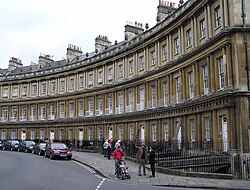 Up to the Circus
Bath Abbey → The Circus
City streets, gentle uphill
Walk north through Milsom Street and up Gay Street into the Georgian city proper. The Circus is a ring of large townhouses forming a circle with three entrances, designed by John Wood the Elder and built between 1754 and 1768 — a pre-eminent example of Georgian architecture, and best experienced by standing in the middle of it and turning around. About 30 minutes.
About this place
The Circus is a historic ring of large townhouses in the city of Bath, Somerset, England, forming a circle with three entrances. Designed by architect John Wood, the Elder, it was built between 1754 and 1768, and is regarded as a pre-eminent example of Georgian architecture. "Circus" (Latin) means a ring, oval or circle in English. The construction has been designated as a Grade I listed building.
Read more on Wikipedia Photo: Wikimedia Commons · Public domain -
 The Royal Crescent
The Circus → Royal Crescent
City streets and lawn
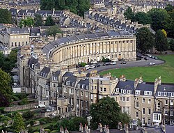
Brock Street delivers you, deliberately, without warning: thirty terraced houses laid out in one sweeping curve above a great open lawn, designed by John Wood the Younger and built between 1767 and 1774. It is among the greatest examples of Georgian architecture anywhere. No. 1 Royal Crescent is furnished as it would have been in the 1770s. About 60 minutes.
About this place
The Royal Crescent is a row of 30 terraced houses laid out in a sweeping crescent in the city of Bath, England. Designed by the architect John Wood, the Younger, and built between 1767 and 1774, it is among the greatest examples of Georgian architecture to be found in the United Kingdom and is a Grade I listed building. Although some changes have been made to the various interiors over the years, the Georgian stone facade remains much as it was when first built.
Read more on Wikipedia Photo: Wikimedia Commons · Public domain -
 Down to Pulteney Bridge
Royal Crescent → Pulteney Bridge
City streets, gentle downhill
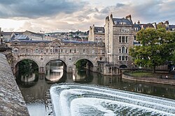
Drop back through town to the River Avon. Designed by Robert Adam in a Palladian style and completed by 1774, Pulteney Bridge is one of only four bridges in the world with shops across its full span on both sides — you can cross it without realising you are on a bridge at all. View it from the Parade Gardens side, above the curved weir. About 45 minutes.
About this place
Pulteney Bridge is a bridge over the River Avon in Bath, England. It was completed by 1774, and connected the city with land in Bathwick which Sir William Pulteney and his family wished to develop. Designed by Robert Adam in a Palladian style, it is one of only four bridges in the world to have shops across its full span on both sides. It has been designated as a Grade I listed building. The bridge is named after Frances Pulteney, wife of the Scottish lawyer and politician Sir William Pulteney, 5th Baronet. Frances was a first cousin once removed of William Pulteney, 1st Earl of Bath. She inherited the Earl's substantial fortune in Somerset after his death in 1764. The rural Bathwick estate, which Frances and William inherited in 1767, was across the river from the city and could be reached only by ferry. William made plans to create a new town, which would become a suburb to the historic city of Bath, but first he needed a better river crossing.
Read more on Wikipedia Photo: Diego Delso · CC BY-SA 4.0 -
 The Assembly Rooms
Pulteney Bridge → Bath Assembly Rooms
City streets, gentle uphill
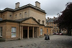
Finish where Georgian Bath actually happened. Designed by John Wood the Younger in 1769 and now a Grade I listed visitor attraction, the Assembly Rooms were the social engine of the spa town — the ball room, tea room and card room where the season's dancing, gossip and matchmaking took place. Jane Austen's Bath is this building. About 40 minutes.
About this place
The Bath Assembly Rooms, designed by John Wood, the Younger in 1769, are a set of assembly rooms located in the heart of the World Heritage City of Bath in England which are now open to the public as a visitor attraction. They are designated as a Grade I listed building.
Read more on Wikipedia Photo: Mark Anderson · CC BY-SA 2.0
Comments
Sign in to join the conversation.
No comments yet — be the first.