← All routes
City walk Scotland — Edinburgh, United Kingdom

Edinburgh: The Royal Mile and Arthur's Seat

One day from the castle on its volcanic rock, straight down the Royal Mile to Holyrood, then up an extinct volcano for the whole city at your feet.

Edinburgh: The Royal Mile and Arthur's Seat
Photo: Andrew Colin · CC BY 2.0
Duration
1 days
Distance
6 km
Ascent
230 m
Difficulty
Easy
Best season
May–September

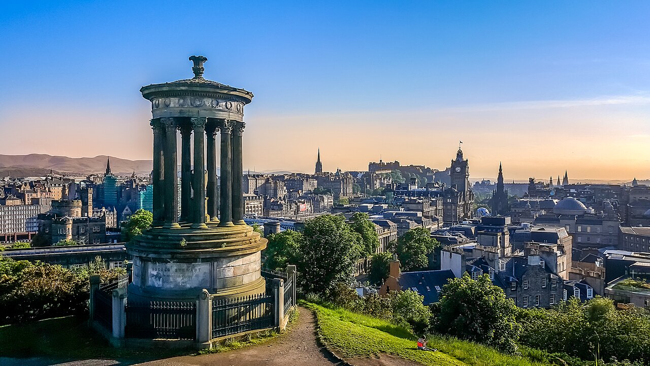
Few capitals hand you a mountain at the end of the high street. Edinburgh does. This walk runs the length of the Old Town’s spine — the Royal Mile, a series of streets forming the main thoroughfare of the medieval city — from Edinburgh Castle at the top to the Palace of Holyroodhouse at the bottom, and then simply keeps going, up the grassy flank of Arthur’s Seat to a summit of about 251 m with the Firth of Forth laid out beyond.

The castle end is all crag and garrison; the middle is closes and wynds, the narrow alleys running off the Mile into a buried city; the bottom is royal, then suddenly wild. It is about six kilometres in total, but the last one is the one your legs will remember.

Getting there. Edinburgh Waverley station sits directly below the Royal Mile; from Edinburgh Airport the tram takes about 35 minutes to St Andrew Square, a short walk away. The walk begins at the Castle Esplanade.

Permits & tickets. Edinburgh Castle and the Palace of Holyroodhouse both charge admission and both are best booked in advance for a timed slot. The Royal Mile, St Giles’ Cathedral (a donation is invited) and Holyrood Park are free.

Good to know:

Day 1

Castle to summit

Castle Esplanade → Arthur's Seat summit 6 km ↑ 230 m
Navigate this day

A single downhill line through a thousand years of the Old Town, followed by one honest uphill.

Segments

  1. Edinburgh Castle
    Edinburgh Castle 0.4 km ↑ 20 m 📍 Map

    Castle Esplanade → Crown Square

    Cobbled ramps and stone stairs

    Start on Castle Rock, occupied since at least the Iron Age and crowned by a royal castle since the reign of Malcolm III in the 11th century. Inside are the Honours of Scotland — the Scottish crown jewels, dating from the 15th and 16th centuries — the tiny Norman St Margaret's Chapel, and views straight down the street you are about to walk. Allow about 90 minutes.

    About this place

    Edinburgh Castle is a historic castle in Edinburgh, Scotland. It stands on Castle Rock, which has been occupied by humans since at least the Iron Age. There has been a royal castle on the rock since the reign of Malcolm III in the 11th century, and the castle continued to be a royal residence until 1633. From the 15th century, the castle's residential role declined, and by the 17th century it was principally used as a military garrison. Its importance as a part of Scotland's national heritage was recognised increasingly from the early 19th century onwards, and various restoration programmes have been carried out over the past century and a half.

    Read more on Wikipedia ↗

    Photo: Enric · CC BY-SA 4.0

  2. Down the Royal Mile and its closes
    Down the Royal Mile and its closes 0.9 km 📍 Map

    Castlehill → High Street

    Cobbled street

    The Mile is not one street but several, running downhill in a straight medieval line. The real discovery is sideways: duck into the closes and wynds — steep, shoulder-width alleys off both sides — where the tenement city stacked itself up to eleven storeys. Mary King's Close, sealed under the City Chambers, can be visited underground. About 45 minutes, more if you wander.

    About this place

    The Royal Mile is a series of streets forming the main thoroughfare of the Old Town of Edinburgh, Scotland. The term originated in the early 20th century and has since entered popular usage.

    Read more on Wikipedia ↗

    Photo: Kim Traynor · CC BY-SA 3.0

  3. St Giles' Cathedral
    St Giles' Cathedral 0.2 km 📍 Map

    High Street → Parliament Square

    Cobbled street

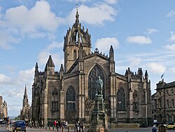
    The High Kirk of Edinburgh, begun in the 14th century and extended into the early 16th, sits halfway down the Mile under its distinctive crowned steeple. This was John Knox's church and the pulpit of the Scottish Reformation. Don't miss the Thistle Chapel, a small riot of carved stone. About 30 minutes.

    About this place

    St Giles' Cathedral, also known as the High Kirk of Edinburgh, is one of three cathedrals in Edinburgh, Scotland. The existing building was begun in the 14th century and extended until the early 16th century; significant alterations were undertaken in the 19th and 20th centuries, including the addition of the Thistle Chapel. St Giles' is closely associated with many events and figures in Scottish history, including John Knox, who served as the church's minister after the Scottish Reformation. The cathedral is administered by the Church of Scotland.

    Read more on Wikipedia ↗

    Photo: Carlos Delgado · CC BY-SA 3.0

  4. Canongate to Holyrood Palace
    Canongate to Holyrood Palace 1.1 km 📍 Map

    Parliament Square → Palace of Holyroodhouse

    Cobbled street and pavement

    The Mile's lower half, the Canongate, is quieter and older-feeling, and delivers you to the Palace of Holyroodhouse — the official residence of the monarch in Scotland, standing at the opposite end of the Mile from the castle. Mary, Queen of Scots' chambers are here, and the roofless ruin of Holyrood Abbey sits alongside. The modern Scottish Parliament faces it across the road. About 90 minutes.

    About this place

    The Palace of Holyroodhouse, also known as Holyrood Palace, is the official residence of the monarch of the United Kingdom in Scotland. Located at the bottom of the Royal Mile in Edinburgh, at the opposite end to Edinburgh Castle, Holyrood has served as the principal royal residence in Scotland since the 16th century, and is a setting for state occasions and official entertaining.

    Read more on Wikipedia ↗

    Photo: 瑞丽江的河水 · CC BY-SA 4.0

  5. Into Holyrood Park
    Into Holyrood Park 1.8 km ↑ 90 m 📍 Map

    Palace of Holyroodhouse → Dunsapie Loch

    Park paths and road

    The city stops at a gate. Holyrood Park is a piece of highland dropped into the capital — hills, lochs, glens and basalt cliffs, with the great curved wall of Salisbury Crags overhead. Follow the park round to Dunsapie Loch, the launching point for the gentlest way up. About 45 minutes.

    About this place

    Holyrood Park is a public park in central Edinburgh, Scotland about 1 mile to the east of Edinburgh Castle. It has an array of hills, lochs, glens, ridges, basalt cliffs, and patches of gorse, providing a wild piece of highland landscape within its 650-acre (260 ha) area. The park is associated with the Palace of Holyroodhouse and was formerly a royal hunting estate. The park was created in 1541 when James V had the ground "circulit about Arthurs Sett, Salisborie and Duddingston craggis" enclosed by a stone wall.

    Read more on Wikipedia ↗

    Photo: David Monniaux · CC BY-SA 3.0

  6. Up Arthur's Seat
    Up Arthur's Seat 1.6 km ↑ 120 m 📍 Map

    Dunsapie Loch → Arthur's Seat summit

    Grassy slope and rocky path

    The main peak of an ancient extinct volcano, rising to about 251 m above the city — Robert Louis Stevenson called it a hill for magnitude, a mountain in virtue of its bold design. From the east, above Dunsapie Loch, it is a steady grassy pull with a rocky final scramble to a summit that gives back the whole route: the Mile, the castle, the Forth and, on a clear day, Fife. About 45 minutes up.
    About this place

    Arthur's Seat is an ancient extinct volcano. It is the main peak of a group of hills in Edinburgh, Scotland, which form most of Holyrood Park. Robert Louis Stevenson described it as "a hill for magnitude, a mountain in virtue of its bold design". It is situated just to the east of the city centre, about 1 mile (1.6 km) to the east of Edinburgh Castle. The hill rises above the city to a height of 250.5 m (822 ft), provides panoramic views of the city and beyond, is relatively easy to climb, and is popular for hillwalking. Though it can be climbed from almost any direction, the easiest ascent is from the east, where a grassy slope rises above Dunsapie Loch. At a spur of the hill, Salisbury Crags has historically been a rock climbing venue with routes of various degrees of difficulty. Rock climbing was restricted to the South Quarry, but access was banned altogether in 2019 by Historic Environment Scotland.

    Read more on Wikipedia ↗

    Photo: Kim Traynor · CC BY-SA 3.0

Comments