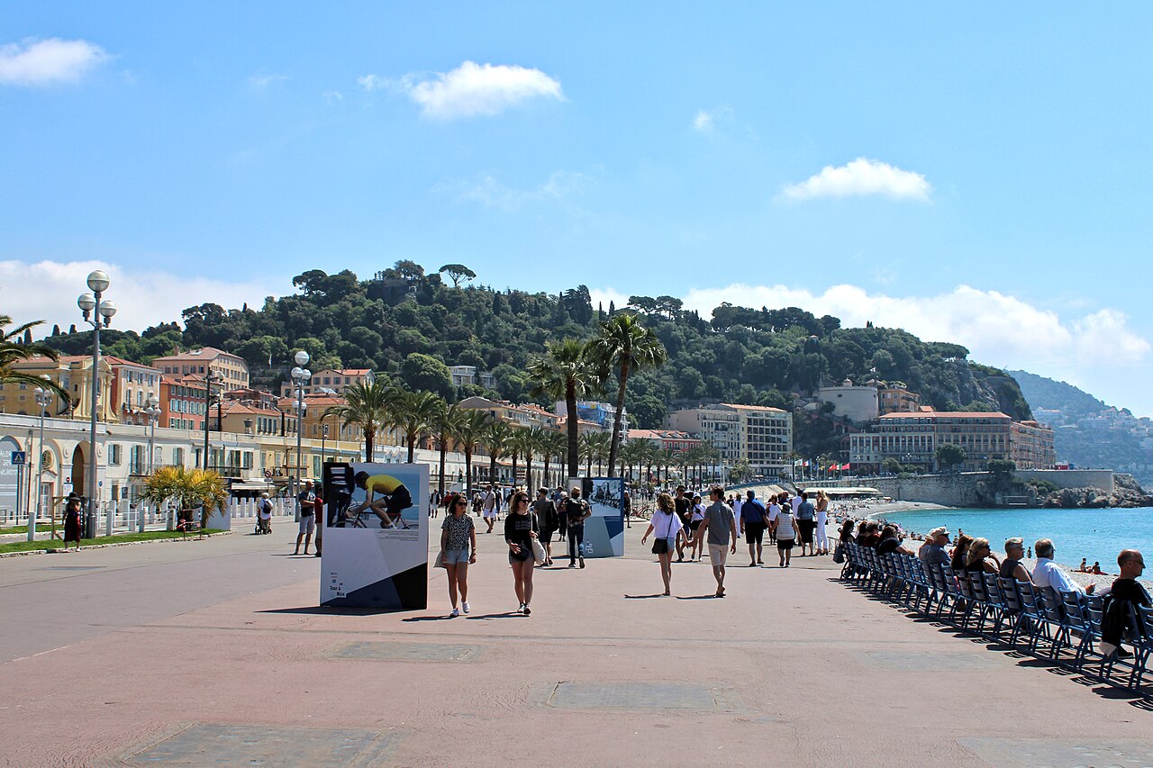
A continuous line from the seafront promenade through Vieux Nice and up to Castle Hill, then back through the centre to the Russian cathedral.
Segments
- The Promenade des Anglais
Jardin Albert I → Quai des États-Unis
Seafront promenade
Begin on the broad seafront walk that curves around the Baie des Anges for about seven kilometres. It was paid for in the 1820s by Nice's wintering English colony — hence the name — and remains the city's front porch, lined with blue chairs facing the Mediterranean. Stroll the eastern stretch toward the old town. Allow about 30 minutes.
- Into Vieux Nice
Quai des États-Unis → Rue Droite
Narrow old-town lanes
Turn inland into the tangle of narrow lanes that make up the old town. Tall ochre and red houses lean over streets barely wide enough for the light, hung with laundry and dotted with Baroque churches. This was the heart of Nice when it still belonged to Savoy. About 30 minutes to wander.
- The Cours Saleya market
Rue Droite → Cours Saleya
Pedestrian square
Emerge onto the long open square that has held Nice's flower and produce market for generations. Stalls spill over with cut flowers, olives, and local socca; the painter Matisse kept an apartment overlooking it for years. On Mondays the market gives way to antiques instead. About 30 minutes.
- Castle Hill viewpoint
Cours Saleya → Colline du Château
Stepped path and park
Climb the hill at the old town's eastern edge — about ninety metres up — to the park now called the Colline du Château. The medieval citadel that gave it its name was demolished on the orders of Louis XIV in the early 1700s; what remains is a green terrace with the finest view over the red roofs and the sweep of the bay. About 45 minutes including the climb.
- Place Masséna
Colline du Château → Place Masséna
City streets
Come down and cross to the city's grand central square, framed by red-ochre arcaded buildings and paved in a black-and-white checkerboard. At one end the Fountain of the Sun carries a marble Apollo; above the tram line, illuminated figures by Jaume Plensa glow after dark. About 30 minutes with a pause.
- The Russian Orthodox Cathedral
Place Masséna → Cathédrale Saint-Nicolas
City streets
Finish with a walk northwest to St Nicholas Cathedral, the largest Eastern Orthodox cathedral in Western Europe. Consecrated in 1912 and built with the backing of the last tsar, its six onion domes rise unexpectedly above a quiet Nice street — a reminder of the Russian aristocracy who once wintered here. About 40 minutes including the walk.
Comments
Sign in to join the conversation.
No comments yet — be the first.