Trek Vancouver — North Shore, Canada

Lynn Canyon: Suspension Bridge, 30 Foot Pool and Twin Falls

A short rainforest loop on the North Shore that locals prefer to Capilano: a free suspension bridge 50 metres above Lynn Creek, a green swimming hole, and a second bridge over Twin Falls, all in about three kilometres.

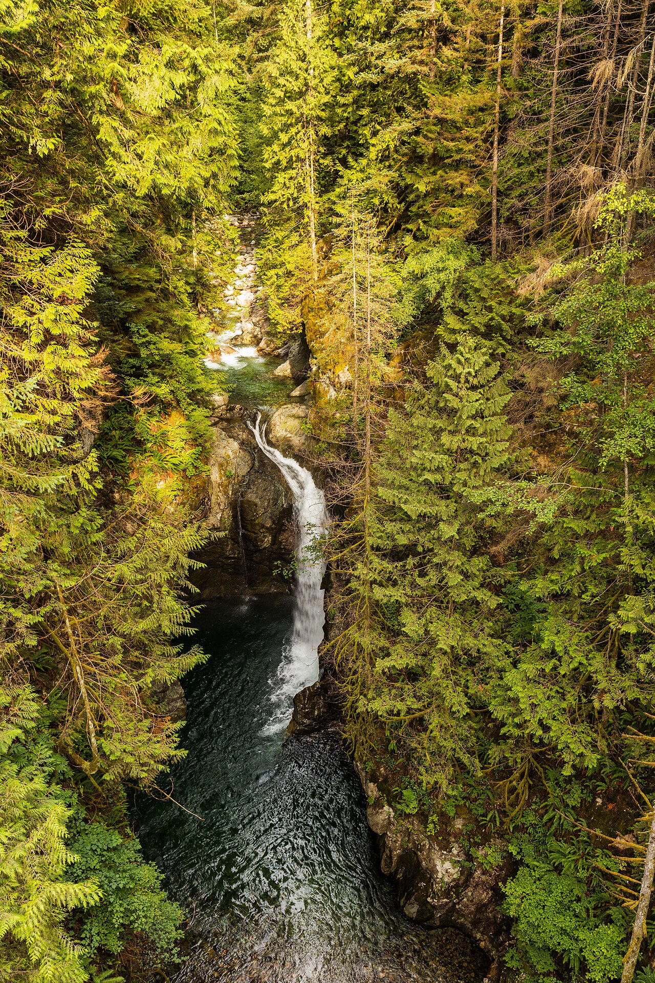
Lynn Canyon: Suspension Bridge, 30 Foot Pool and Twin Falls
Photo: Diego Delso · CC BY-SA 4.0
Duration
1 day
Distance
3 km
Walking time (est.)
1 h
Ascent
100 m
Difficulty
Easy
Best season
Year-round; spring for the fullest waterfalls, summer for the pools

Walking

    Your location stays on this phone. It is never sent, stored or put in a link.

    Packing list

    Getting there and back

    Start
    Lynn Canyon Ecology Centre
    Finish
    Lynn Canyon Ecology Centre

    Loop: you finish where you started

    Season events near this route

    Lynn Canyon Park opened in 1912, and its suspension bridge, finished the year before, has been swaying 50 metres above Lynn Creek ever since. Unlike its famous neighbour at Capilano, it is free, and the canyon beneath it is arguably more dramatic: a narrow slot of rock where the creek pours through a series of falls and green pools, surrounded by second-growth rainforest of Douglas fir, western red cedar and hemlock. The park covers about 250 hectares and is run by the District of North Vancouver.

    This loop crosses the suspension bridge, detours to the 30 Foot Pool, a popular swimming hole, then follows a section of the Baden-Powell Trail upstream to Twin Falls, where a low bridge crosses the creek just above the falls. From there you climb back up to the entrance by the Ecology Centre and café. It is short but not flat, with plenty of wooden stairs, and it works in any season: in the rain the canyon is at its most atmospheric.

    Getting there. The park entrance is at the end of Park Road off Peters Road in Lynn Valley, North Vancouver. By transit, take the SeaBus to Lonsdale Quay, then bus 228 to Lynn Valley Road at Peters Road and walk about 10 to 15 minutes. There is a pay parking lot at the entrance that fills quickly on summer weekends.

    Permits & tickets. Entry to the park, the suspension bridge and the Ecology Centre is free. Parking is paid from about March to October during the day; check the District of North Vancouver’s site for current rates and hours.

    Good to know:

    Tips & Insights for this route Planning this route? Read our practical tips before you go — 9 tips. Read the tips

    Elevation profile

    Highest point
    167 m Day 1
    Lowest point
    85 m Day 1
    Total descent
    123 m

    Point at the profile, or focus it and use the arrow keys, to see that spot on the map.

    Terrain heights along a straight line between each day’s stops, not along the footpath, so a pass or a switchback the path takes can be missing. Descent and walking times use the same line.

    Elevation data: Terrain Tiles (Mapzen, AWS Open Data)

    Day by day

    DayDistanceAscentDescent (est.)Walking time (est.)
    Day 1 Hardest dayBridges, pools and Twin Falls
    Distance3 kmAscent100 mDescent (est.)123 mWalking time (est.)1 h

    Flights on Kayak Car rental on Localrent Travel eSIM on Airalo

    Day 1

    Bridges, pools and Twin Falls

    Lynn Canyon Ecology Centre → Lynn Canyon Ecology Centre 3 km 100 m 1 h

    The suspension bridge, the 30 Foot Pool, the Baden-Powell Trail to Twin Falls, and back up to the Ecology Centre.

    Water and food

    Places mapped by volunteers on OpenStreetMap; opening times and taps change, so check before relying on one. © OpenStreetMap contributors

    Segments

    1. Ecology Centre to the bridge 0.2 km 0 m Map

      Lynn Canyon Ecology Centre → Suspension bridge

      Wide gravel path

      From the parking lot, pass the Ecology Centre and the café and follow the wide path through tall firs and cedars to the edge of the canyon. About 5 minutes.

    2. The suspension bridge
      The suspension bridge 0.1 km 0 m Map

      Suspension bridge, east end → Suspension bridge, west end

      Swaying suspension bridge

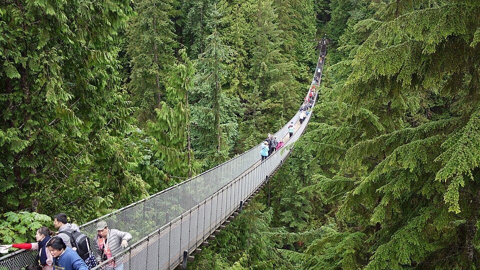
      Cross the bridge that has hung 50 metres above Lynn Creek since 1912. It bounces with every step. Look down into the canyon at the waterfalls and pools below, then continue to the far side. About 10 minutes.

      About this place

      The Lynn Canyon Suspension Bridge is a pedestrian bridge located within Lynn Canyon Park, in the District of North Vancouver, British Columbia. It is 50 metres (160 ft) high from the bottom of the canyon. The bridge was built as a private venture in 1912.

      Read more on Wikipedia Photo: Diego Delso · CC BY-SA 4.0
    3. To the 30 Foot Pool
      To the 30 Foot Pool 1 km 30 m Map

      Suspension bridge, west end → Suspension bridge, west end, via 30 Foot Pool

      Forest trail and stairs

      On the far side of the bridge turn left and follow the trail about 20 minutes to the 30 Foot Pool, a deep, clear green pool below the canyon walls, with rocks for sunbathing. Wade or swim only in calm water. Then climb the stairs, turn right, and follow the loop trail back to the bridge. About 45 minutes for the loop.

      About this place

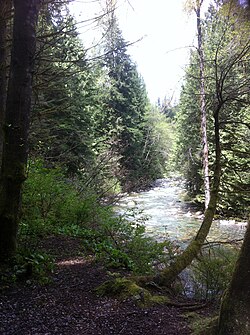
      Lynn Valley is a neighbourhood in the District of North Vancouver, British Columbia, Canada. Located at the northern edge of Metro Vancouver, it sits between Mount Fromme and Mount Seymour. The area's natural parks include Lynn Headwaters Regional Park, the Lower Seymour Conservation Reserve and Lynn Canyon Park, whose main attraction is the Lynn Canyon Suspension Bridge. Lynn Valley is named after British Royal Engineer John Linn, who settled in the area after 1869. The main intersection of Lynn Valley Road and Mountain Highway is the location of the Main Library and Town Centre. The area is now known as Lynn Valley Village.

      Read more on Wikipedia Photo: bynyalcin · CC BY 3.0
    4. Baden-Powell Trail to Twin Falls
      Baden-Powell Trail to Twin Falls 0.8 km 30 m Map

      Suspension bridge, west end → Twin Falls viewpoint

      Rooty forest trail with stairs

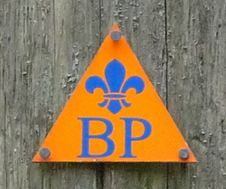
      Back at the bridge, turn right and follow the signs to Twin Falls on the Baden-Powell Trail, marked with orange markers, along the far side of the canyon through the rainforest. Stairs lead down to a viewpoint where the creek drops over two falls into a pool. About 20 minutes.

      About this place

      The Baden-Powell Trail is a rugged but well-maintained 48 km hiking trail, that traverses from Horseshoe Bay in West Vancouver to Deep Cove in North Vancouver, British Columbia, Canada. It was named after Robert Baden-Powell, Lord Baden-Powell, founder of the world Scouting Movement.

      Read more on Wikipedia Photo: Uogpjf · CC BY-SA 3.0
    5. Twin Falls bridge and back 0.9 km 40 m Map

      Twin Falls viewpoint → Lynn Canyon Ecology Centre

      Footbridge and long stair climb

      Cross the creek on the sturdy Twin Falls bridge, low over the water just above the falls, then climb the long flight of wooden stairs up the entrance side of the canyon and follow the trail back to the Ecology Centre. About 25 minutes.
    Partner link: if you book through it we may earn a commission, at no extra cost to you. It does not change what we recommend. How this works

    Tips & Insights

    Packing list

    Filled in for this route from the kit a walk like this needs and the gear its tips mention. Tick things off as you pack.

    Clothing and footwear
    Gear
    Health and sun
    Water and food

    Best time to go

    • Early or on a weekday

      The suspension bridge is narrow and gets crowded with tour groups on summer weekends. Arrive in the morning or on a weekday. After heavy rain the falls are most impressive, but the stairs are slick.

    Getting there

    • Transit is easy

      The SeaBus to Lonsdale Quay and bus 228 put you within a 15-minute walk of the entrance. Driving saves time only if you get a space; the lot fills early on sunny weekends.

    Smart savings

    • The free suspension bridge

      Lynn Canyon’s bridge is shorter than Capilano’s, but it is free and hangs over a deeper-looking slot canyon. If you want the thrill without the admission price, this is the place.

    Safety

    • Do not jump

      Cliff jumping into Lynn Canyon’s pools has caused deaths and serious injuries, and rescues happen every summer. Water levels and currents change fast. If you swim, do so only in calm water at the 30 Foot Pool from the shore, and never alone.

    Gear & packing

    • Shoes with grip

      The loop is short but full of wooden stairs, roots and wet rocks. Wear shoes with good tread and bring a rain jacket; this is a rainforest.

    Food

    • The café at the entrance

      The Lynn Canyon Café by the park entrance serves coffee, snacks and simple meals; check its current opening hours, which are shorter in winter. For more choice, Lynn Valley Village is a short drive or bus ride away.

    With kids

    • Ecology Centre first

      The Ecology Centre at the entrance, open since 1971, has hands-on displays about the rainforest and its animals. The loop is manageable for school-age kids, but the many stairs make it hard with a stroller.

    Local insights

    • Extend on the Baden-Powell Trail

      The loop follows part of the Baden-Powell Trail, which crosses the North Shore for 48 kilometres from Horseshoe Bay to Deep Cove. Keep following its orange markers beyond Twin Falls if you want a longer walk into Lynn Headwaters.

    Where to stay

    • North Vancouver

      Hotels around Lonsdale Quay in North Vancouver are the closest convenient base, a bus ride from the park and close to Grouse Mountain and Capilano. From downtown, allow about 45 minutes each way by SeaBus and bus.

    Comments