← All routes
Trek Upper Austria — Salzkammergut, Austria

Hallstatt & the Dachstein — Lake, Salt Mine and Ice Cave

Two unhurried days in the Salzkammergut: a lakeside village wedged between cliff and water, the oldest salt mine in the world above it, and an ice cave and clifftop platform in the Dachstein across the lake.

Hallstatt & the Dachstein — Lake, Salt Mine and Ice Cave
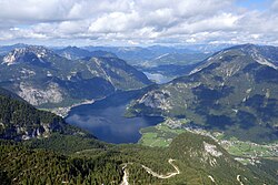
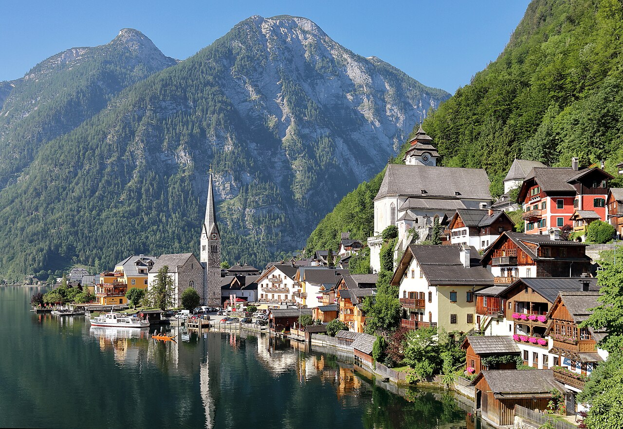
Photo: C.Stadler/Bwag · CC BY-SA 4.0
Duration
2 days
Distance
8 km
Ascent
650 m
Difficulty
Moderate
Best season
May to October, when the Dachstein cable car and the ice cave are open (roughly May to early November); the village itself is year-round and quietest in winter

Hallstatt gets photographed to death and it is still worth going. The village is pinned onto a narrow shelf between the Hallstätter See and a wall of rock, with barely room for one street — and the reason it exists at all is buried in the mountain above it. People have been digging salt out of that slope for something like 7,000 years, long enough that an entire Iron Age culture across central Europe is named after this village. The whole Hallstatt-Dachstein/Salzkammergut landscape is a UNESCO World Heritage Site, listed for a salt industry that goes back to the 2nd millennium BC.

This is not a hard route. It is a two-day pairing of the lake shore with the limestone plateau opposite: day one at water level and in the mine, day two up in the Dachstein for the ice cave and the 5 Fingers platform.

Getting there. Most people come from Salzburg, about 75 km away. By train you change at Attnang-Puchheim; Hallstatt’s station sits on the far shore, and a small ferry crosses to the village in about 10 minutes — arguably the best possible way to arrive. Obertraun, the base for the Dachstein cable car, is a short hop around the lake.

Timing. Go early or stay the night. Day-trip coaches land mid-morning and the single street becomes unwalkable; by evening the village is quiet again and it is a different place entirely.

Good to know:

Day 1

The village, the Skywalk and the salt mine

Hallstatt village → Hallstatt village 4 km ↑ 430 m
Navigate this day

A short day at the heart of it: the shore of the Hallstätter See, the platform hanging above the rooftops, and the prehistoric salt workings that made the place.

Segments

  1. The lakeside village
    The lakeside village 2 km ↑ 30 m 📍 Map

    Ferry pier / Lahn → Marktplatz and the Hallstätter See shore

    Village lanes and lake promenade

    Walk the shore of the Hallstätter See through a village that has almost no flat ground to spare — pastel houses stacked up the slope, the market square, the small waterfront where the ferry ties up. It takes barely an hour end to end. Come back at dawn or after the coaches leave and it belongs to itself again.

    About this place

    Hallstätter See or Lake Hallstatt is a lake in Salzkammergut, Austria. It is named after Hallstatt, a small market town famous for its salt mining since prehistoric times and for being the starting point of the world's oldest still-working industrial pipeline, used to transport brine to Bad Ischl and further to Ebensee.

    Read more on Wikipedia ↗

    Photo: Tigerente · CC BY-SA 4.0

  2. Funicular to the Skywalk 1 km ↑ 350 m 📍 Map

    Salzwelten funicular valley station → Skywalk viewing platform

    Funicular, then a level path

    The Salzwelten funicular hauls you about 360 m up the slope to the Bergstation in a few minutes. From there a short walk reaches the Skywalk, a platform cantilevered out over the drop with the village directly below and the lake running away north between the mountains. Free with a funicular ticket, and the view most people came for without knowing its name.

  3. Into the world's oldest salt mine
    Into the world's oldest salt mine 1 km ↑ 50 m 📍 Map

    Skywalk / Bergstation → Salzwelten Hallstatt salt mine

    Mine tunnels and wooden slides

    A few minutes' walk from the Bergstation is the oldest salt mine in the world, worked on and off for roughly 7,000 years. The guided tour puts you in overalls, sends you down two polished wooden miners' slides — the longer one about 64 m — past an underground salt lake, and out on a small mine train. The prehistoric burial ground unearthed on this slope gave its name to the Hallstatt culture of Iron Age Europe.

    About this place

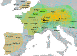
    The Hallstatt culture was the predominant Western and Central European archaeological culture of the Late Bronze Age from the 12th to 8th centuries BC and Early Iron Age Europe from the 8th to 6th centuries BC, developing out of the Urnfield culture of the 12th century BC and followed in much of its area by the La Tène culture. It is commonly associated with Proto-Celtic speaking populations.

    Read more on Wikipedia ↗

    Photo: Dbachmann · CC BY-SA 3.0

Day 2

Up into the Dachstein

Obertraun → Obertraun 3.5 km ↑ 200 m
Navigate this day

The limestone plateau across the lake: a cave of frozen waterfalls inside the mountain, then a hand-shaped platform reaching out over a 400 m drop.

Segments

  1. The Dachstein Giant Ice Cave
    The Dachstein Giant Ice Cave 1.5 km ↑ 100 m 📍 Map

    Obertraun valley station → Rieseneishöhle (Giant Ice Cave)

    Cable car, then a mountain path to the cave mouth

    Section one of the Dachstein Krippenstein cable car lifts you from Obertraun to the Schönbergalm, and a walk of about 15–20 minutes climbs to the cave entrance. Inside the Rieseneishöhle, water that seeped into the limestone has frozen into sheets, falls and ponds of ice that persist year-round; the guided tour lasts roughly 50 minutes at around −2 °C. The mountain and cave world here runs a summer season of about May to early November.

    About this place

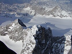
    The Dachstein Mountains are a mountain range in the Northern Limestone Alps.

    Read more on Wikipedia ↗

    Photo: Ralph Deleja-Hotko = de:Benutzer:Aerotiker · CC BY-SA 3.0 de

  2. Krippenstein and the 5 Fingers
    Krippenstein and the 5 Fingers 2 km ↑ 100 m 📍 Map

    Schönbergalm → 5 Fingers platform (about 2,108 m)

    Cable car, then an alpine path

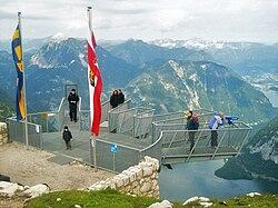
    Section two carries you up to Krippenstein, and from the top station it is under 20 minutes on foot to the 5 Fingers — a free viewing platform built as a hand, five roughly four-metre fingers projecting over a 400 m precipice, one with a glass floor and one with a telescope. The lake and Hallstatt lie far below. The platform is lit at night and can be seen from the village.

    About this place

    5 Fingers is a free viewing platform in the Dachstein Mountains of Upper Austria, on Mount Krippenstein. It was named "5 Fingers" by virtue of its hand-like shape.

    Read more on Wikipedia ↗

    Photo: German Wikipedia, original upload 15. July 2009 by DjSquirrel (selfmade 14.07.2009) · Public domain

Comments