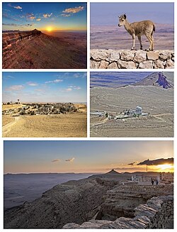
← All routes
Trek Negev — Ramon Nature Reserve, Israel

Makhtesh Ramon — Rim to Crater Floor

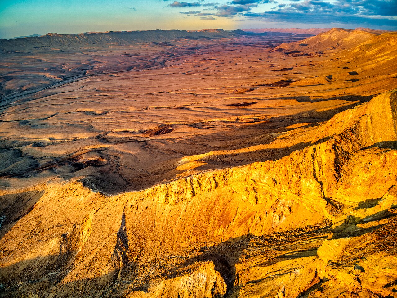
One to two days in the world's largest erosion crater: the rim promenade at Mitzpe Ramon, the prismatic stone columns of the Carpentry, the coloured sands of the Ardon valley and the desert spring at Ein Saharonim.

Makhtesh Ramon — Rim to Crater Floor
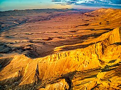
Photo: Hagai Agmon-Snir حچاي اچمون-سنير חגי אגמון-שניר · CC BY-SA 4.0
Duration
2 days
Distance
18 km
Ascent
400 m
Difficulty
Moderate
Best season
October–April; spring and autumn are ideal. Avoid midsummer — heat on the crater floor is genuinely dangerous

Makhtesh Ramon is not a meteor crater and not a volcano, which is the first thing every guide will tell you and the last thing anyone believes when they first see it. It is a makhtesh — an erosion cirque, a landform found essentially only in the Negev and Sinai — where a domed ridge was breached, the soft rock inside was flushed out by streams, and what remained is a closed valley walled by cliffs. This one is the largest in the world: about 40 km long, between 2 and 10 km wide, and some 500 m deep, with rocks on its floor reaching back around 200 million years.

You can see it in a single day from the rim. Two days lets you drop onto the floor, which is where the crater stops being a view and starts being a place.

Getting there. Mitzpe Ramon sits on the northern rim at about 860 m, roughly 85 km south of Beersheba on Route 40 — about 1.5 hours from Beersheba, about 2 hours from Eilat. Buses 64 and 65 run frequently from Beersheba, and line 392 passes through on the Beersheba–Eilat run. Inside the crater you need a car, a 4×4 for the rougher tracks, or your own legs.

Permits & tickets. No permit is needed to walk the marked trails. The Ilan Ramon Visitor Center charges about ₪29 for an adult and generally opens 08:00–16:00 (an hour later under daylight saving). The crater is a nature reserve: being inside it after dark, outside a marked campground, can earn a fine of about ₪700.

Good to know:

Day 1

The rim — visitor centre, Albert Promenade and Camel Mount

Ilan Ramon Visitor Center, Mitzpe Ramon → Camel Mount 6 km ↑ 150 m
Navigate this day

Start with the geology indoors, then walk the rim westward for the long views across the makhtesh.

Segments

  1. Visitor centre and the Albert Promenade
    Visitor centre and the Albert Promenade 2 km ↑ 30 m 📍 Map

    Ilan Ramon Visitor Center → The bird balcony

    Paved cliff-top promenade

    The visitor centre, named for Israel's first astronaut, lays out how the makhtesh formed — the Tethys sea retreating, the ridge splitting, streams carrying the soft interior away. Then step outside onto the Albert Promenade, a paved path along the cliff studded with environmental sculptures, ending at a cantilevered 'bird balcony' hanging over the drop. About 1 hour, and the best orientation you will get.

    About this place

    Mitzpe Ramon is a local council in the Negev desert of southern Israel. It is situated on the northern ridge at an elevation of 860 meters (2,800 feet) overlooking the world's largest erosion cirque, known as the Makhtesh Ramon. In 2024 it had a population of 5,843.

    Read more on Wikipedia ↗

    Photo: Tanker TheDestroyer · CC0

  2. Rim path to Camel Mount
    Rim path to Camel Mount 4 km ↑ 120 m 📍 Map

    Albert Promenade → Camel Mount (Har Gamal)

    Stony rim path and a short rocky rise

    Follow the cliff west from the visitor centre to Camel Mount, a rise on the rim whose humped silhouette is said to suggest a resting camel. The walking is easy and the drop is always on your left. About 2 hours there and back, and worth timing for late afternoon when the light rakes across the crater floor and the layers separate out by colour.

    About this place

    A makhtesh ; pl.: makhteshim, Hebrew: מַכְתְּשִׁים ) is a unique geological landform found primarily in the Negev desert of Israel and the Sinai Peninsula of Egypt. A makhtesh has steep walls of resistant rock surrounding a deep closed valley, which is typically drained by a single wadi. The valleys have limited vegetation and soil, containing a variety of different-colored rocks and diverse fauna and flora. The best known and largest makhtesh is Makhtesh Ramon.

    Read more on Wikipedia ↗

    Photo: Hagai Agmon-Snir حچاي اچمون-سنير חגי אגמון-שניר · CC BY-SA 4.0
Day 2

The crater floor — the Carpentry, Ardon and Ein Saharonim

Ma'ale Ramon (Ramon Ascent) → Ein Saharonim 12 km ↑ 250 m
Navigate this day

Descend the Ramon Ascent and work eastward across the floor, from prismatic stone to coloured sand to the only spring in the crater.

Segments

  1. HaMinsara — the Carpentry 1 km ↑ 20 m 📍 Map

    HaMinsara car park → The prismatic hill

    Short green-marked path over loose stone

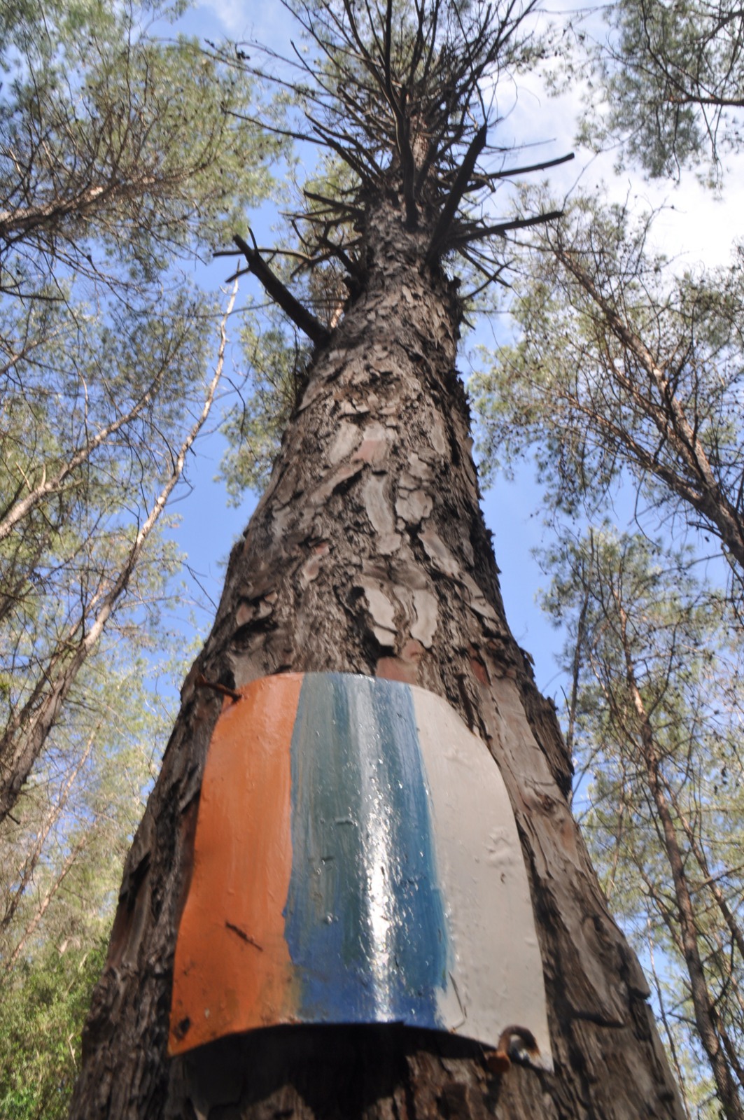
    A hill scattered with what look exactly like sawn timber offcuts — polygonal prismatic columns of quartzite, which is how the place got its name. They are thought to have formed where hot magma intruded the sandstone and baked it, the rock then cooling into columnar joints and weathering out into the geometric slabs underfoot. A green-marked walk of about 15 minutes from the car park; go slowly, the ground is all edges.

  2. The Ardon valley colours 5 km ↑ 150 m 📍 Map

    Nahal Ardon → Below Har Ardon

    Dry streambed and open desert floor

    At the north-eastern end of the makhtesh, under the bulk of Har Ardon, erosion has cut through multicoloured sedimentary layers and piled the results across the floor — reds and yellows from iron oxides, and other shades from manganese, copper minerals, quartz and clays. Nahal Ardon also carries a set of vertical dikes, with geodes of celestine turning up beside some of them. This is the postcard of the crater, and unlike most postcards it undersells it.

  3. Ein Saharonim and the Incense Route
    Ein Saharonim and the Incense Route 6 km ↑ 80 m 📍 Map

    Ardon → Ein Saharonim

    Open desert track

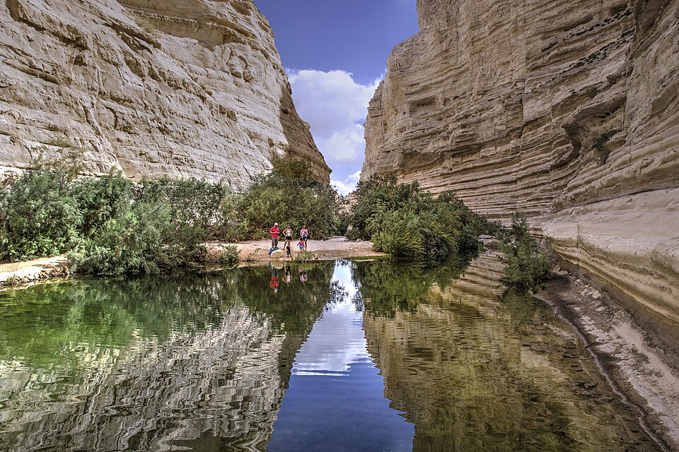
    The crater's only natural water source, and therefore the reason anyone ever crossed here. Beside it stand the ruins of Khan Saharonim, a Nabataean way station on the Incense Route that carried frankincense and myrrh from Arabia to the Mediterranean — the route is now a UNESCO World Heritage Site. Nearby, the Nekarot Curve cuts a dramatic canyon line for those with another day to spend.

    About this place

    The Negev or Naqab is the name for a desert and semidesert area in southern Israel. Today, it forms the bulk of the Southern District of Israel, whose largest city and administrative capital is Beersheba, in the north of the Negev. At its southern end lie the Gulf of Aqaba and the resort city and port of Eilat. It contains several development towns, including Dimona, Arad, and Mitzpe Ramon, as well as a number of small Bedouin towns, including Rahat, Tel Sheva, and Lakiya. There are also several kibbutzim, including Revivim and Sde Boker; the latter became the home of Israel's first prime minister, David Ben-Gurion, after his retirement from politics.

    Read more on Wikipedia ↗

    Photo: Hagai Agmon-Snir حچاي اچمون-سنير חגי אגמון-שניר · CC BY-SA 4.0
Comments