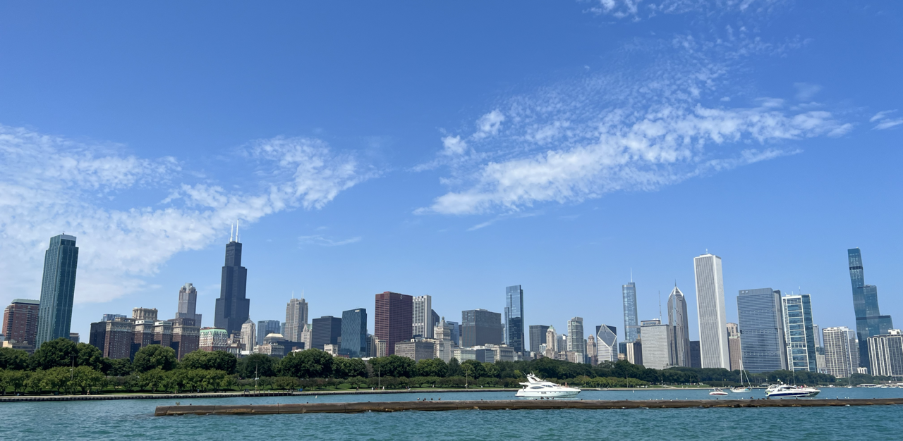
A clockwise loop from Millennium Park down to the river, west to Willis Tower, and back along Michigan Avenue.
Segments
- Millennium Park & Cloud Gate
Michigan Avenue entrance → Grainger Plaza
Paved park paths
Start where the city shows off. Millennium Park opened in 2004 on the deck above a rail yard, and its centerpiece is Anish Kapoor's Cloud Gate — 168 stainless steel plates welded into a seamless mirror, roughly 33 by 66 by 42 feet and around 110 short tons. Everyone calls it the Bean, a nickname Kapoor disliked before he came round to it. Walk underneath into the concave chamber, then cross to Frank Gehry's Pritzker Pavilion. About 60 minutes.
- The Chicago Riverwalk
Millennium Park → Riverwalk at State Street
Paved waterfront promenade
Head north to the river and drop down to the water. The Riverwalk runs along the south bank of the main branch, from Lake Michigan and the Outer Drive Bridge west toward Wolf Point and Lake Street, and it is the best place in the city to understand the skyline — you are below it, looking up, with bridges overhead. Cafés, bars and kayak rentals line the way. Stop for lunch. About 60 minutes.
- The Chicago Architecture Center
Riverwalk → 111 East Wacker Drive
City streets
Climb back up to Wacker Drive for the Chicago Architecture Center, a nonprofit — formerly the Chicago Architecture Foundation — devoted to explaining the city's buildings. Its river-facing gallery is the vantage: a wall of glass over the water with a scale model of the whole city in front of it, so you can match what you saw from the Riverwalk to what you are standing in. Their river cruises leave from just below. About 60 minutes.
-
 Willis Tower Skydeck
Wacker Drive → Skydeck, 103rd floor
City streets
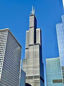
Walk southwest to the tower most Chicagoans still call the Sears: 110 storeys and 1,451 feet (442.3 m), designed by Bruce Graham and engineer Fazlur Rahman Khan of SOM, and the tallest building in the world for nearly 25 years after it opened in 1973. The Skydeck on the 103rd floor is the highest observation deck in the United States and draws more than 1.7 million visitors a year — which is the argument for a timed ticket and an early slot. Step out onto the glass Ledge boxes if your nerve holds. About 90 minutes.
About this place
The Willis Tower, formerly and still commonly referred to as the Sears Tower, is a 110-story, 1,451-foot (442.3 m) skyscraper in the Loop of Chicago, Illinois, United States. Designed by architect Bruce Graham and engineer Fazlur Rahman Khan of Skidmore, Owings & Merrill (SOM), it opened in 1973 as the world's tallest building, a title that it held for nearly 25 years. It is the third-tallest building in the Western Hemisphere, as well as the 26th-tallest in the world. Each year, more than 1.7 million people visit the Skydeck, the highest observation deck in the United States, making it one of Chicago's most popular tourist destinations. Due to its height and location, the tower is visible from a great distance. The building has appeared in numerous films and television shows set in Chicago.
Read more on Wikipedia - The Art Institute of Chicago
Willis Tower → 111 South Michigan Avenue
City streets
Walk back east through the Loop to Grant Park and the bronze lions on Michigan Avenue. The Art Institute is one of the great encyclopedic museums — this is where Seurat's 'A Sunday on La Grande Jatte', Hopper's 'Nighthawks' and Wood's 'American Gothic' actually live. You cannot do it justice in an afternoon, so pick two galleries and accept the loss. About 2 hours.
- Michigan Avenue
Art Institute → Michigan Avenue Bridge
City streets
Finish by walking north up Michigan Avenue with the park on your right and an unbroken wall of Chicago on your left. Cross the river on the Michigan Avenue Bridge, where the Wrigley Building and Tribune Tower face each other — this is where the Magnificent Mile begins, and where the day's skyline finally resolves into one view. Best in the last hour of light. About 45 minutes.
Comments
Sign in to join the conversation.
No comments yet — be the first.