← All routes
Trek Yamanashi Prefecture β€” Fuji Five Lakes, Japan

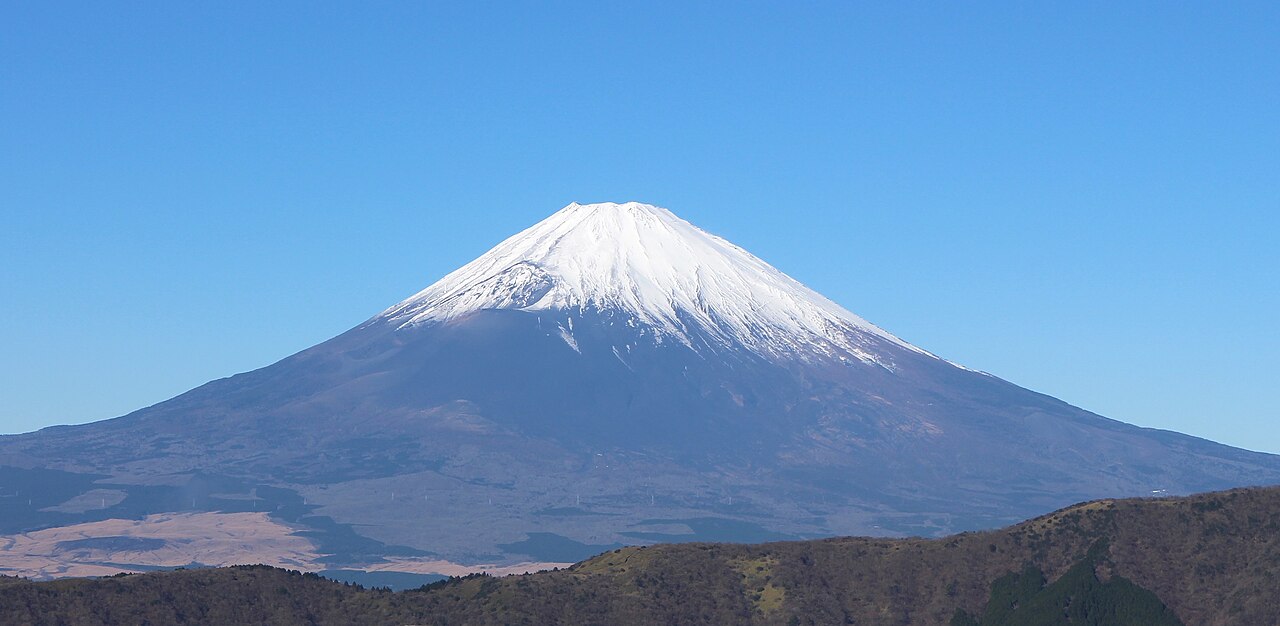
Mount Fuji by the Yoshida Trail

Two days up Japan's sacred volcano on its most popular route, sleeping in a mountain hut near the eighth station to catch the goraiko sunrise from the 3,776 m summit.

Mount Fuji by the Yoshida Trail
Photo: Suicasmo Β· CC BY-SA 4.0
Duration
2 days
Distance
15 km
Ascent
1471 m
Difficulty
Hard
Best season
Official climbing season early July to early September

Climbing Mount Fuji is a rite of passage, and the Yoshida Trail is the way most people do it. Starting high on the volcano’s northern flank at the Fuji Subaru Line 5th Station, it is the busiest and best-served route, lined with mountain huts and reached directly by bus from Tokyo. Split over two days with an overnight hut stay, it lets you climb through the night or rest before a pre-dawn push to watch the sun rise over the sea of clouds β€” the goraiko, or β€˜arrival of light’.

Fuji is a hard climb despite its huts and crowds: the summit air is thin, the weather turns fast, and the endless volcanic gravel is tiring. But the reward is standing on the highest point in Japan at dawn.

Getting there. Direct buses run from Tokyo (Shinjuku) and Kawaguchiko Station to the Fuji Subaru Line 5th Station in the climbing season. Spend an hour at the 5th Station letting your body adjust to the altitude before setting off.

Season & huts. The official climbing season runs from early July to early September, when the huts, buses and summit facilities are open. Book your eighth-station hut well ahead β€” beds sell out, and sleeping on the mountain outside the huts is discouraged.

Good to know:

Day 1

5th Station to the eighth-station huts

Fuji Subaru Line 5th Station (2,305 m) β†’ Eighth Station huts (~3,100 m) 5 km ↑ 800 m
Navigate this day

Leave the busy 5th Station and climb through the last of the forest into open red gravel, gaining height past a chain of huts to the eighth station, where you stop for the night.

Segments

  1. 5th to 7th Station 2.5 km ↑ 400 m πŸ“ Map

    Fuji Subaru Line 5th Station (2,305 m) β†’ Seventh Station (~2,700 m)

    Volcanic forest then open gravel

    A gentle start along the tree line gives way to zig-zags up bare volcanic slope, reaching the first cluster of seventh-station huts clinging to the lava. About 2.5 hours.

  2. 7th to 8th Station 2.5 km ↑ 400 m πŸ“ Map

    Seventh Station β†’ Eighth Station huts (~3,100 m)

    Rocky lava switchbacks

    The trail steepens over rock and switchbacks past a string of huts to the eighth station, where you check in, eat early and sleep before the night climb. About 3 hours.
Day 2

Summit for the goraiko, then the descent

Eighth Station huts (~3,100 m) β†’ Fuji Subaru Line 5th Station 10 km ↑ 676 m
Navigate this day

Set off in the dark to reach the summit gate for the goraiko sunrise, circle the crater to the highest point at Kengamine, then descend the separate Yoshida trail back to the 5th Station.

Segments

  1. Pre-dawn climb to the summit gate 2 km ↑ 615 m πŸ“ Map

    Eighth Station huts β†’ Kusushi Shrine, Yoshida summit (3,715 m)

    Steep rock, final torii gate

    Climb by headlamp through the ninth station and the crowds queuing on the final rock steps, passing under the torii gate to Kusushi Shrine on the crater rim just in time for the goraiko sunrise. About 2 hours.

  2. Crater rim to Kengamine 2 km ↑ 61 m πŸ“ Map

    Kusushi Shrine β†’ Kengamine (3,776 m)

    Crater rim loop (Ohachimeguri)

    Walk the Ohachimeguri circuit around the summit crater to Kengamine, the old weather-station peak and the true 3,776 m high point of Japan, before returning to the descent gate. About 1.5 hours.

  3. Descent to the 5th Station 6 km ↑ 0 m πŸ“ Map

    Yoshida summit β†’ Fuji Subaru Line 5th Station

    Zig-zag volcanic gravel descent trail

    Take the dedicated descent trail down endless gravel switchbacks, watching for the point where the Yoshida and Subashiri routes divide, back to the 5th Station and the bus. About 3 hours.