All routes
Trek Khumbu — Sagarmatha National Park, Nepal

Everest Base Camp Trek: The 8-Day Highlights

An accelerated highlights version of the classic trek through the Khumbu — from the airstrip at Lukla up the Sherpa valleys to the foot of the world's highest mountain at 5,364 m.

Everest Base Camp Trek: The 8-Day Highlights
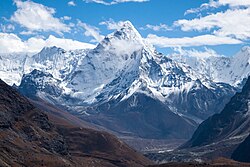
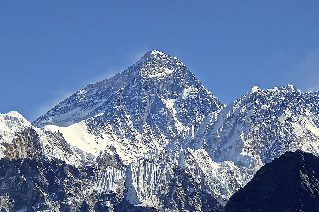
Photo: Rdevany · CC BY-SA 3.0
Duration
8 days
Distance
110 km
Ascent
3200 m
Difficulty
Hard
Best season
Pre-monsoon spring (March–May) and post-monsoon autumn (late September–November)

This is the walk to the base of Everest itself, following the Sherpa trading trails of the Khumbu from the mountain airstrip at Lukla to the glacier at 5,364 m. This 8-day highlights itinerary strings together the essential stages — Lukla, Namche Bazaar, Tengboche, Dingboche, Lobuche and Gorak Shep — for trekkers who are already fit and short on time.

Altitude, not distance, is the real difficulty. The classic route builds in extra acclimatisation days at Namche and Dingboche; on this compressed version you should be confident with altitude, walk slowly, and turn back if symptoms appear.

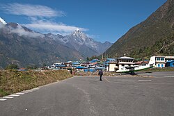
Getting there. Fly to Kathmandu, then take the short, dramatic mountain flight to Lukla (2,860 m), where the trek begins. Most trekkers walk back down the same valleys, or fly out from Lukla; some take a helicopter from Gorak Shep or Pheriche to save the return days.

Permits & tickets. You need the Sagarmatha National Park entry permit and the local Khumbu Pasang Lhamu Rural Municipality permit, both bought en route or in Kathmandu. A licensed guide is now required for trekking in the region.

Good to know:

Tips & Insights for this route Planning this route? Read our practical tips before you go — 7 tips. Read the tips
Day 1

Lukla to Phakding

Lukla (2,860 m) → Phakding (2,610 m) 8 km 200 m
Navigate this day

An easy first afternoon losing height along the river, to sleep low before the big climb to Namche.

Segments

  1. Off the airstrip 3 km 40 m Map

    Lukla airport → Cheplung

    Stone village path

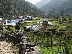
    Leave Lukla's clifftop airstrip and follow the well-trodden trail through Sherpa villages and prayer walls, contouring gently above the Dudh Koshi river. About 1 hour.

  2. Down to the river 5 km 160 m Map

    Cheplung → Phakding (2,610 m)

    River valley path

    Descend steadily to the riverside village of Phakding, crossing the first of many suspension bridges strung with prayer flags. The night is spent low on purpose, to aid acclimatisation. About 2 hours.

Day 2

Phakding to Namche Bazaar

Phakding (2,610 m) → Namche Bazaar (3,440 m) 11 km 830 m
Navigate this day

A long river walk into the national park, then a steep forested climb with the first glimpse of Everest to the trading town of Namche.

Segments

  1. Into Sagarmatha National Park 5 km 220 m Map

    Phakding → Monjo park gate

    River path and suspension bridges

    Follow the Dudh Koshi upstream, crossing and re-crossing on high bridges, to the park entrance at Monjo where permits are checked. About 2.5 hours.

  2. The Namche hill 6 km 610 m Map

    Monjo → Namche Bazaar (3,440 m)

    Steep forest switchbacks

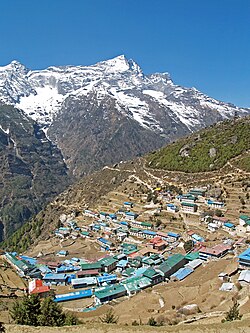
    Cross the high Hillary Suspension Bridge, then climb a long forested staircase — with a first distant view of Everest on a clear day — to Namche Bazaar, the horseshoe-shaped Sherpa capital and trading hub. About 3.5 hours.

Day 3

Namche Bazaar to Tengboche

Namche Bazaar (3,440 m) → Tengboche (3,867 m) 10 km 700 m
Navigate this day

A high contouring trail with sweeping mountain views, a drop to the river, then a steady climb to the monastery at Tengboche.

Segments

  1. The panorama trail 5 km 100 m Map

    Namche Bazaar → Phunki Thanga

    High contour path, then descent

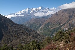
    Contour along an open hillside with grand views of Everest, Lhotse and the fluted peak of Ama Dablam, then descend to the river at Phunki Thanga. About 2.5 hours.

  2. Climb to the monastery 5 km 600 m Map

    Phunki Thanga → Tengboche (3,867 m)

    Steep forest climb

    Climb steadily through rhododendron forest to Tengboche, home to the largest Buddhist monastery in the Khumbu, set on a saddle facing Ama Dablam. About 2.5 hours.

Day 4

Tengboche to Dingboche

Tengboche (3,867 m) → Dingboche (4,410 m) 11 km 550 m
Navigate this day

Descend to the river, then a long climb past Pangboche onto the open, wind-scoured slopes of the Imja valley.

Segments

  1. Through Pangboche 5 km 250 m Map

    Tengboche → Pangboche (3,930 m)

    River crossing and climb

    Drop to the Imja Khola, then climb to Pangboche, the highest year-round village on the route and home to an old monastery. About 2.5 hours.

  2. Into the Imja valley 6 km 480 m Map

    Pangboche → Dingboche (4,410 m)

    Open alpine valley above the treeline

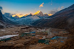
    Leave the last trees behind and climb the broad Imja valley to the stone-walled fields of Dingboche, a good place to feel the thinning air. About 2.5 hours.

Day 5

Dingboche to Lobuche

Dingboche (4,410 m) → Lobuche (4,940 m) 9 km 530 m
Navigate this day

A gradual climb to Thukla, a steep pull to the memorial ridge for lost Everest climbers, then a walk beside the Khumbu Glacier to Lobuche.

Segments

  1. The Thukla climb 5 km 420 m Map

    Dingboche → Thukla Pass memorials (4,830 m)

    Alpine trail and steep moraine

    Cross open pasture to Thukla, then climb a steep moraine slope to the moving row of stone memorials to climbers who died on Everest. About 3 hours.

  2. Beside the glacier 4 km 110 m Map

    Thukla Pass → Lobuche (4,940 m)

    Glacial moraine path

    Follow the lateral moraine of the Khumbu Glacier on a gentler grade to the cluster of lodges at Lobuche, the last stop before Base Camp. About 1.5 hours.

Day 6

Lobuche to Everest Base Camp

Lobuche (4,940 m) → Gorak Shep (5,164 m) 15 km 600 m
Navigate this day

A demanding day on rough glacial terrain to Gorak Shep and out along the moraine to Base Camp at 5,364 m, returning to sleep at Gorak Shep.

Segments

  1. Lobuche to Gorak Shep 5 km 240 m Map

    Lobuche → Gorak Shep (5,164 m)

    Rough glacial moraine

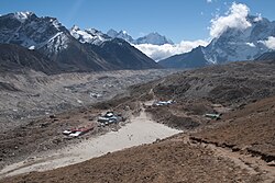
    Pick a way across boulder-strewn moraine beside the Khumbu Glacier to the bleak sandy flat of Gorak Shep, the last settlement on the trek. About 3 hours.

  2. Out to Base Camp 5 km 200 m Map

    Gorak Shep → Everest Base Camp (5,364 m)

    Undulating moraine trail

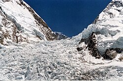
    Follow the moraine to Everest Base Camp at the foot of the tumbling Khumbu Icefall — the staging point for summit expeditions and the goal of the whole trek. About 2.5 hours out.

  3. Return to Gorak Shep 5 km 0 m Map

    Everest Base Camp → Gorak Shep (5,164 m)

    Moraine trail

    Retrace the moraine to Gorak Shep for the night, sleeping at 5,164 m — the highest camp of the trek. About 2 hours.

Day 7

Kala Patthar and the descent to Pheriche

Gorak Shep (5,164 m) → Pheriche (4,240 m) 15 km 400 m
Navigate this day

Climb Kala Patthar in the dark for sunrise on Everest, then begin the return, descending steeply back down the valley to the thicker air of Pheriche.

Segments

  1. Kala Patthar at dawn 2 km 380 m Map

    Gorak Shep → Kala Patthar (5,545 m)

    Steep rocky ridge

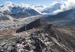
    Set off in the dark for the steep climb to Kala Patthar, the highest point of the trek, for the finest unobstructed view of Everest's summit at sunrise. About 2 hours up.

  2. Down to Pheriche 13 km 20 m Map

    Gorak Shep → Pheriche (4,240 m)

    Glacial moraine and valley trail

    Begin the return: retrace the moraine past Lobuche and down the Thukla slope, then follow the valley to the exposed village of Pheriche, dropping over 900 m to sleep in noticeably richer air. About 5 hours.

Day 8

Pheriche to Namche Bazaar

Pheriche (4,240 m) → Namche Bazaar (3,440 m) 17 km 500 m
Navigate this day

A long downhill day retracing the trail through Tengboche and the forests above the Dudh Koshi to Namche Bazaar, from where trekkers walk out to Lukla the next morning for the flight home.

Segments

  1. Back over the monastery saddle 9 km 350 m Map

    Pheriche → Tengboche (3,867 m)

    Valley descent and short climb

    Descend the valley and climb back to the saddle at Tengboche for a last look at the high peaks over the monastery. About 4 hours.

  2. Down to Namche 8 km 150 m Map

    Tengboche → Namche Bazaar (3,440 m)

    Forest and contour trail

    Drop through rhododendron forest to the river, then contour back along the panorama trail to Namche Bazaar. The final walk out to Lukla and the flight to Kathmandu follow the next day. About 3 hours.

Comments