
Blog
Toubkal in Two Days from Imlil
In short
Toubkal in two days is a hard 30 km and 2,360 m of ascent from Imlil, sleeping at the refuge and summiting at 4,167 m. The walking months are roughly May to October. Winter and early spring need crampons and an ice axe. Since 2019 the route has required a licensed local mountain guide.
Two hard days from Imlil, with a refuge in between
Toubkal is a hard two-day ascent of the highest mountain in North Africa: 30 km and 2,360 m of climbing, summit 4,167 m. The months on the route are May to October. Winter and early spring are a different mountain. From roughly November to April it carries snow and ice, it is avalanche-prone, and it needs crampons, an ice axe, and the skill to use them. The summer route is non-technical. No ropes, no scrambling on the south-cirque line in the snow-free months. Altitude and endless scree are what make the grade hard. You can leave Marrakesh after breakfast and sleep at 3,207 m that night. That proximity is why people under-rate it.
Since 2019 a licensed local mountain guide has been required for the Imlil to Toubkal route. Checkpoints in the Ait Mizane valley check passports and guide credentials. Bring your passport. That is the requirement. Book the refuge ahead in the busy months. A three-day version, with a night in Imlil or Aroumd before the refuge, is kinder on the body than the standard two. Most people still do it in two. Know which of those you have bought.
The village, the shrine, the refuge
Imlil, at about 1,800 m, is the start. A shared taxi from Marrakesh takes roughly 75 to 90 minutes. Guides, mules and gear hire are arranged there. The path up the Ait Mizane valley is a working mule track through Amazigh villages, walnut groves and terraces, not a wilderness trail.
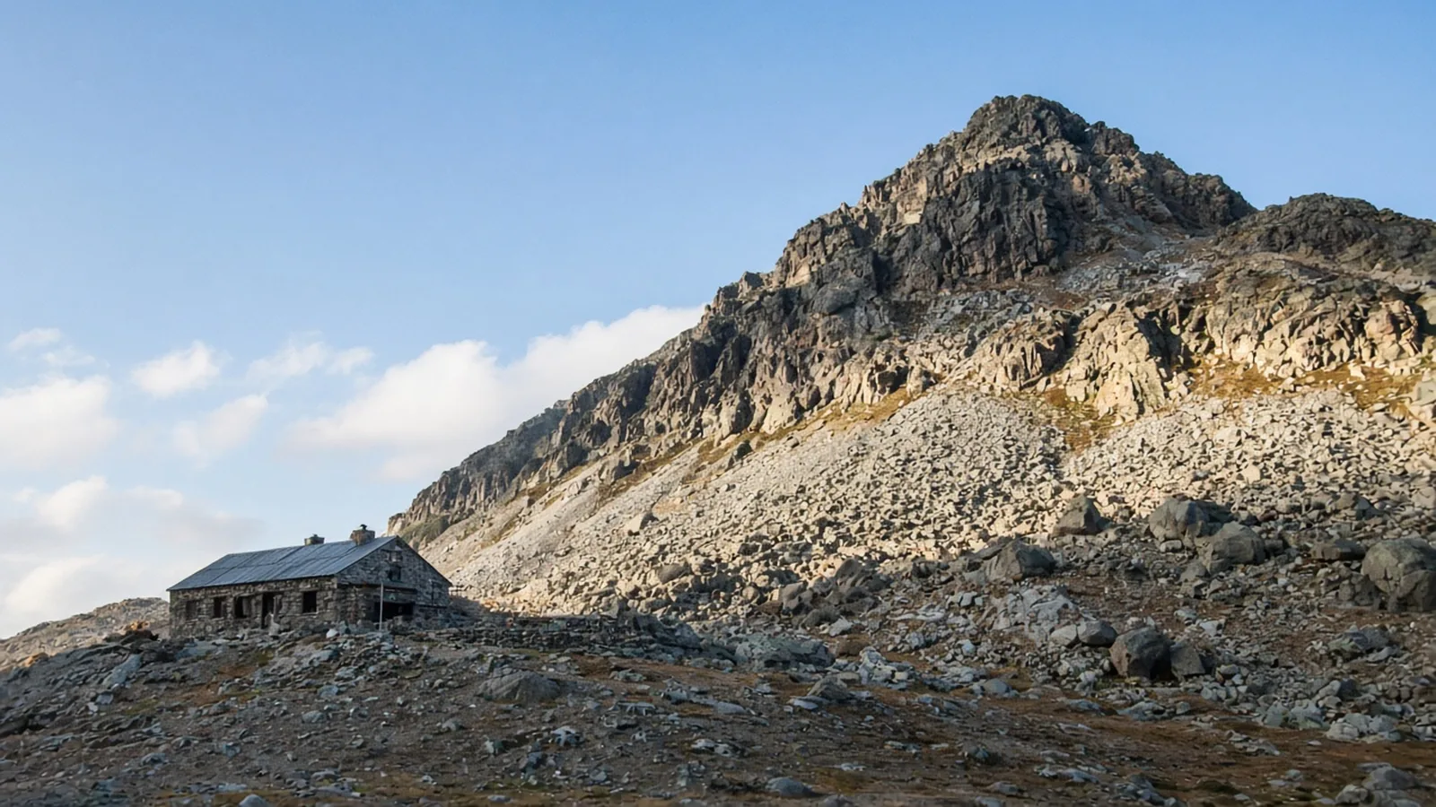
Day one is about 11 km and 1,400 m, five to six hours, to the refuges at 3,207 m. The first hour to Aroumd is easy, through walnut trees to a stone village above a boulder flood plain. Then about two hours and 450 m beside the stream to Sidi Chamharouch, around 2,350 m. The settlement sits by a white and blue painted boulder that marks a Muslim shrine and a place of pilgrimage. Do not cross the bridge to the shrine if you are not Muslim. The tea stop is on the trail side of that boundary. Use it. Then the valley narrows, the greenery stops, and a long series of exposed zigzags climbs the west flank to the Refuge du Toubkal and Refuge Les Mouflons. This is where the altitude starts to matter. Three hours is a fair estimate for that last pull. Drink on the way up, not only at the hut.
Summit day is a long day
Leave in the dark. The south cirque, the Ikhibi Sud, is steep loose scree into a hanging valley, then another pull to the Tizi n’Toubkal col at about 3,940 m. Two steps up, one back, is the honest description. About two hours for most parties. From the col a boulder ridge runs north to the metal pyramid at 4,167 m. In summer there is no scrambling on that ridge. It is still thin, cold and windy, including in August. From the refuge, a party that is coping with the height takes about two and a half to three hours to the top. The view on a clear day runs from the edge of the Sahara to Atlantic haze. Do not bet the day on the view. Bet it on the turnaround if someone is unwell.
The descent is the part people refuse to believe. You drop the scree to the refuge, which is fast and brutal on the knees, pack, and retrace the entire valley through Sidi Chamharouch and Aroumd to Imlil. Day two is about 19 km, with about 960 m of ascent on the way up and something like 2,350 m of descent by the time you are in the village. Allow five to six hours down after the refuge, and nine to ten hours for the whole day. “We will be in Marrakesh for a late lunch” is the sentence that makes this day miserable. Plan the taxi for the evening, or for the next morning.
The height is the grade
Two days and 30 km sound like a fast pack. The 2,360 m of ascent, finishing at 4,167 m, is why the grade is hard and not moderate. Day one alone climbs about 1,400 m from a village to a hut. If you live at sea level and fly into Marrakesh the same week, that is a lot of new altitude in one walking day. The three-day version exists for that reason: a night in Imlil or in Aroumd before you sleep at 3,207 m. It is the same path, with more time for the height to become ordinary. Take it if the two-day version is a boast rather than a schedule you have trained for.
The refuge night is not optional colour. It is the only reason the summit is a pre-dawn walk rather than a 2,300 m day from the village. Both huts sit at the same height. Book one of them in the months when everyone else has the same idea, which is the heart of May to October. Arriving at 3,207 m to find the beds gone is a poor time to discover that the valley behind you is the only way down.
On the summit ridge, cold and wind are normal in summer. A clear view to the Sahara is also normal, and it is not a reason to stay. The metal pyramid is the top. Touch it, turn around, and start the scree while your legs still agree. The valley walk after the refuge is longer than the morning, and it passes the shrine again. The same rule applies on the way down: the tea is on the path, and the bridge to the shrine is not a viewpoint for everyone.
May to October, and not a winter improvisation
May and October are the edges of the listed season. June, July, August and September are the middle. Snow can still matter at the shoulders. If you are there in November, December, or the early spring months before May, you are in the crampon season, and “the path is only scree in summer” does not help you. Hire the winter kit and the skill, or wait.
The summit is cold even when Marrakesh is hot. Take a warm layer for the ridge and for the pre-dawn scree, and sun protection for the valley on the way down, which is a different climate by lunchtime. Eat and drink at the refuge as if the afternoon still exists, because it does.
A licensed guide, a booked bed at 3,207 m, a passport, and a date inside May to October: that is the two-day Toubkal. The other high walks are on trails. None of them start an hour and a half from a major city and finish at 4,167 m the next morning, which is exactly why this one catches people out.
Questions
- Where does the two-day Toubkal start?
- Imlil, at about 1,800 m, roughly 75 to 90 minutes by shared taxi from Marrakesh. Day one climbs the Ait Mizane valley through Aroumd and Sidi Chamharouch to the refuge at 3,207 m.
- Is a guide required?
- Yes. Since 2019 a licensed local mountain guide has been required for the Imlil to Toubkal route. Checkpoints in the Ait Mizane valley check passports and guide credentials. Bring your passport.
- When can I climb without winter gear?
- Roughly May to October, when the route is non-technical. From roughly November to April the mountain carries snow and ice, is avalanche-prone, and needs crampons, an ice axe, and the skills to use them.
- How high is the summit, and where do I sleep?
- The summit is 4,167 m. You sleep at the refuges at 3,207 m, then leave in the dark for the scree climb to the col and the ridge.
- What is the rule at Sidi Chamharouch?
- It is a Muslim shrine marked by a white and blue boulder, and a place of pilgrimage. Non-Muslims should not cross the bridge to the shrine. The tea stop is on the trail side of that line.
Sources
Routes in this post
-
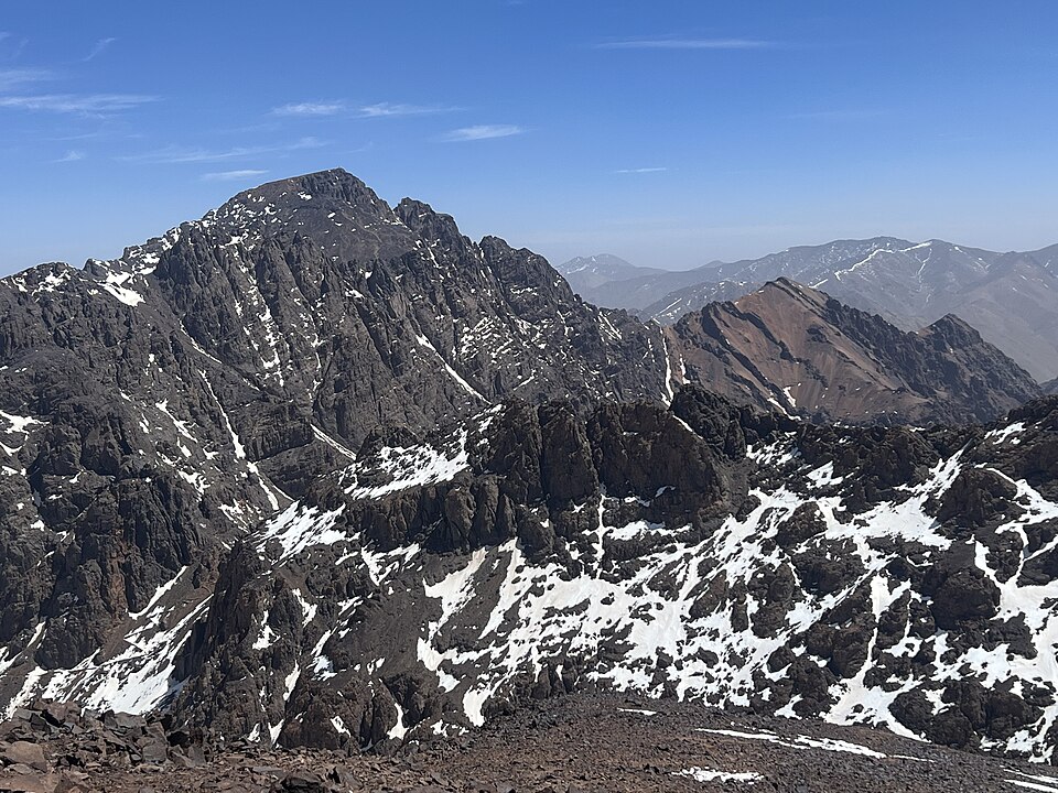 Photo: SimonKing74 · CC0Trek Morocco
Mount Toubkal — North Africa's Highest Summit
Two days from a Berber village to the roof of North Africa at 4,167 m — mule tracks, a blue-painted shrine, a mountain refuge, and a long scree climb to a summit that sees the Sahara.
- Duration
- 2 days
- Distance
- 30 km
- Difficulty
- Hard