
Blog
Table Mountain via Platteklip Gorge
In short
Table Mountain via Platteklip is a hard 5 km climb with 780 m of ascent, best from November to April if you start early enough to beat Cape Town's summer heat. Ride the cable car down when it is running. High wind closes it, and so does maintenance. If it is shut, the gorge is also the way down.
A short hard climb, and the heat is the hazard
Table Mountain via Platteklip Gorge is a hard walk of 5 km and 780 m of ascent, from Tafelberg Road to the summit plateau. The months on the route are November to April: November, December, January, February, March and April. That is Cape Town’s summer and autumn. It is also when the gorge, which faces the sun and has almost no shade, can be dangerously hot. The season being “summer” is not a comfort. It is the reason you start early.
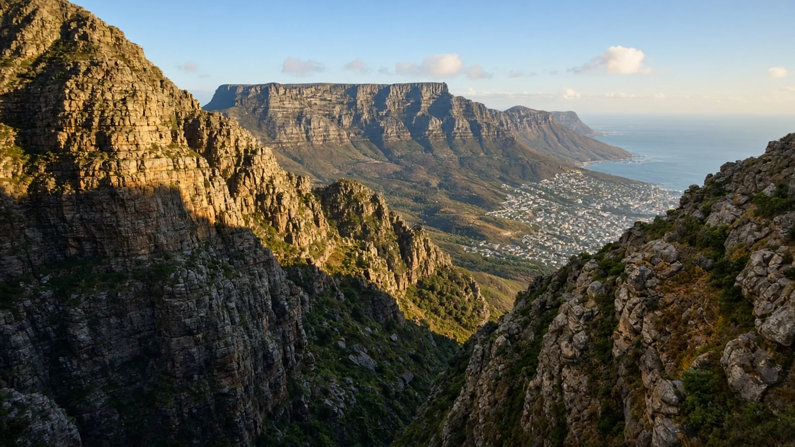
The route is the oldest straightforward line up the mountain, the cleft that splits the flat face. It is not technical. It is relentlessly steep. Of the 780 m, about 600 m is packed into the gorge itself, on rough steps and zigzags, with nothing to stand under. The first recorded ascent of the mountain, by the Portuguese navigator António de Saldanha in 1503, used this line. It is still the walkers’ highway. Popularity has not added shade.
Start early, and know whether the cable car is running
The trailhead is on Tafelberg Road, about 302 m above sea level, a short drive or taxi from the city, below the lower cableway station. Many people climb Platteklip and ride the Table Mountain Aerial Cableway down from the western end of the plateau. That is a good plan on a day the cable car is running. It closes in high wind, and it closes for maintenance. Check before you leave a car, or a plan, that assumes the ride down. If it is shut, the way you came is the way down, and that is another hour of steep stone on tired legs, in whatever the afternoon has become. Do not begin the gorge until you know which descent you actually have.
The summit plateau reaches about 1,086 m at Maclear’s Beacon, a stone cairn built in 1865 and the true high point. From the top of the gorge you walk east across fynbos and sandstone to the cairn, then west to the upper cableway station, with Cape Town, Table Bay and the Atlantic below. Those plateau kilometres are part of the 5 km. They are not a flat victory lap you can ignore when you are counting effort. They are also where a cold wind arrives on a day that felt like a furnace in the gorge. Carry a warm layer even when the city is hot. Weather on the mountain changes faster than the forecast you read at breakfast.
The gorge itself
A contour path of about 0.8 km and a small climb brings you from the roadside to the mouth of the cleft. Twenty to thirty minutes. Then the gorge: about 1.8 km and 600 m, an hour and a half to two hours of continuous steps if you are moving well, longer if you are not, and much longer if you started late and the rock is already too hot to touch comfortably. There is no secret shady variant inside this route. Turn around if you are lightheaded, out of water, or watching the tablecloth cloud pour over the summit. That cloud is a reason to go down, not a photograph to wait for from inside the cleft.
Carry more water than 5 km suggests. The distance is a short distance. The grade is hard because of the vertical and the sun. A noon start in January is the mistake. A dawn start in January or February is the season used properly. November and April are the milder ends of the listed months and still want an early start. May to October are not months on this route. Do not move a Platteklip plan into them because the cable car happens to be spinning on a mild winter morning. The listed season is the season.
After the gorge, you are not finished
Coming out of the cleft onto the plateau is the moment people stop counting. The route does not. From the top of the gorge it is about 1.4 km and a further small climb east to Maclear’s Beacon, the 1865 cairn at about 1,086 m. The path is rock and fynbos, not a promenade, and a wind that was absent in the city is ordinary up here. Then about a kilometre west to the upper station of the cableway. Those two pieces are inside the 5 km and inside the 780 m. Skipping the beacon because the station is the “real” finish leaves the high point unvisited, which is your choice, but it does not make the gorge shorter on the way down if the cable car has stopped.
The cable car is the rotating one. It is a descent, not a summit experience you have to buy to have “done” the mountain. Walking back down the gorge is legitimate. It is also steeper on the knees than it was in the morning, and it puts you in the sun again at the worst hour if you lingered. Decide at the top, with the wind in front of you, whether the car is running. A group that splits, half riding and half walking, needs a meeting point at the bottom that is not “somewhere on Tafelberg Road.”
Heat, cloud, and the turnaround
Cape Town summer heat is the hazard on this route, more than exposure in the climbing sense and more than the distance. The gorge faces the sun. The steps hold it. People who start late discover that “5 km” did not include a way to get out of the sun. If the tablecloth is pouring over the plateau, turn back. That cloud is the mountain’s own weather, and walking up into it to see if it clears is how a half-day becomes a cold descent in cloud. A warm layer in the pack is for that change, and for the wind at the beacon, on a day that began hot at the roadside.
Water is the other half of the same rule. Fill it in town. There is no reason, on a climb this direct, to discover at the mouth of the gorge that you brought a single small bottle because the walk “is only 5 km.” Two people on a January ascent need more than that before they need a philosophy of minimalism. If you are already rationing before the steep steps begin, the right move is to go down to Tafelberg Road and try again at dawn.
The first recorded ascent used this cleft in 1503. You do not need to repeat it at midday to join a tradition. You need an early start in November to April, a checked cable car, and the honesty to turn around when the heat or the cloud says the plateau is a bad idea today. The other walks are on trails. This one is over when you are down, not when you first see the city.
A half-day with a closed exit
Allow about two and a half to three hours up when conditions are kind, plus the plateau walk to the beacon and the station. The cable car, when it turns, is the easy exit. Wind is the ordinary reason it stops. Treat a windy forecast as a day you either walk down or you do not go up. The lower station being busy is not evidence that the upper station will still be loading passengers when you arrive.
If you want a longer mountain day, this is the wrong route to stretch. It is a direct ascent, graded hard, built for an early start and a certain descent. The other walks are on trails. Platteklip is the one you finish before the heat, or you do not start.
Questions
- How hard is Platteklip Gorge?
- Hard, despite the short distance: 5 km and 780 m, with about 600 m of that climb inside the shadeless gorge. It is not technical. The sun and the steepness are the work.
- When should I climb?
- November to April, which is Cape Town's summer and autumn, and start early. The heat in the gorge is the hazard. May to October are not months on this route.
- Can I take the cable car down?
- When it is running. It closes in high wind and for maintenance. Check before you commit to a one-way plan. If it is shut, you walk back down the gorge.
- Where is the top?
- Maclear's Beacon, a cairn built in 1865, at about 1,086 m. It is a short walk east from the top of the gorge. The upper cableway station is west of that.
- What is the tablecloth?
- Cloud pouring over the summit. If it is pouring over the top, turn back. Carry a warm layer even on a hot day, because the weather on the plateau changes quickly.
Sources
Routes in this post
-
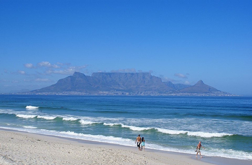 Photo: Danie van der Merwe from Cape Town, South Africa · CC BY 2.0Trek South Africa
Table Mountain via Platteklip Gorge
The classic direct ascent of Table Mountain — a steep, sun-baked climb up the great cleft in the cliffs to the flat summit high above Cape Town, with the option to ride the cable car back down.
- Duration
- 1 day
- Distance
- 5 km
- Difficulty
- Hard