← كل المسارات
جولة في المدينة Louisiana — New Orleans, USA

New Orleans: The French Quarter and the Garden District

A day on foot through the oldest neighborhood in New Orleans, then a streetcar ride to the mansions and above-ground tombs of the Garden District.

New Orleans: The French Quarter and the Garden District
صورة: Chris Litherland · CC BY-SA 3.0
المدة
1 أيام
المسافة
5 km
مستوى الصعوبة
سهل
أفضل موسم
February–April and late October–December

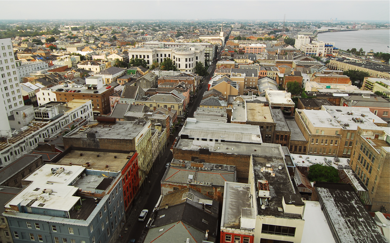
New Orleans was founded in 1718, and the Vieux Carré — the French Quarter — is the piece of it that never went away. What survives is mostly Spanish rather than French, rebuilt after the fires of the late 1700s, which is why the Quarter reads as wrought-iron balconies and courtyards rather than steep French roofs.

This route walks the Quarter in the morning, then puts you on the world’s oldest continuously operating streetcar line and out to the Garden District, where the American side of the city built its mansions after the Louisiana Purchase. The two halves are deliberately different: one is dense, loud and Creole, the other is quiet, green and Anglo-American money.

Getting there. From Louis Armstrong International Airport the E2 Airport Downtown Express bus reaches the Central Business District in about 45 minutes; from there the Quarter is a short walk or streetcar hop.

Permits & tickets. The walk itself is free. Streetcar fare is a couple of dollars each way, or buy a Jazzy Pass for a day of unlimited rides — bring exact change if paying onboard. St. Louis Cathedral is free to enter outside of services.

Good to know:

اليوم 1

The Vieux Carré and the American Quarter

Jackson Square → St. Charles Avenue streetcar 5 km
التنقّل في هذا اليوم

A morning in the French Quarter, a streetcar out St. Charles Avenue, and an afternoon among the Garden District mansions.

مقاطع

  1. Jackson Square & St. Louis Cathedral
    Jackson Square & St. Louis Cathedral 0.4 km 📍 خريطة

    Decatur Street → St. Louis Cathedral

    City streets and paved square

    Start in the square the French laid out as the Place d'Armes and the Spanish called the Plaza de Armas — now a National Historic Landmark with Andrew Jackson on horseback at its center. Behind it stands St. Louis Cathedral, the seat of the Archdiocese of New Orleans and one of the oldest cathedrals in continuous use in the United States. A church has stood here since 1718; the present building was raised under Spanish rule in 1789, made a cathedral in 1793, and largely rebuilt in the 1850s. Allow about 45 minutes.

    عن هذا المكان

    Jackson Square, formerly the Place d'Armes (French) or Plaza de Armas (Spanish), is a historic park in the French Quarter of New Orleans, Louisiana. It was declared a National Historic Landmark in 1960, for its central role in the city's history, and as the site where in 1803 Louisiana was made United States territory pursuant to the Louisiana Purchase. In 2012 the American Planning Association designated Jackson Square as one of the Great Public Spaces in the United States.

    اقرأوا المزيد في ويكيبيديا ↗

    صورة: Andrew rodden · CC BY-SA 4.0

  2. The French Market
    The French Market 0.5 km 📍 خريطة

    Jackson Square → French Market

    City streets

    Walk downriver along Decatur to the market, a run of commercial buildings spanning about six blocks and claiming descent from a Native American trading post that predates the city itself. Today it mixes a farmers' market, a flea market and food stalls. It is touristy and makes no secret of it — come for the produce, the pralines and a café au lait rather than for the souvenir tables. About 45 minutes.

    عن هذا المكان

    The French Market is a market and series of commercial buildings spanning six blocks in the French Quarter of New Orleans, Louisiana. Founded as a Native American trading post predating European colonization, the market is the oldest of its kind in the United States. It began where Café du Monde currently stands and has been rebuilt and renovated a number of times.

    اقرأوا المزيد في ويكيبيديا ↗

    صورة: MusikAnimal · CC BY-SA 4.0

  3. Royal Street's galleries
    Royal Street's galleries 0.7 km 📍 خريطة

    French Market → Royal Street at St. Peter

    City streets, uneven sidewalks

    Cut inland one block to Royal, one of the city's original streets, dating from the early 18th century. This is the Quarter at its best: antique dealers, art galleries, iron balconies dripping with ferns, and — on the pedestrianized blocks in the afternoon — street musicians who are genuinely worth stopping for. Slow down here; it is the most rewarding hour of the walk. About 60 minutes.

    عن هذا المكان

    Royal Street is a street in the French Quarter of New Orleans, Louisiana, U.S. It is one of the original streets of the city, dating from the early 18th century, and is known today for its antique shops, art galleries, and hotels.

    اقرأوا المزيد في ويكيبيديا ↗

    صورة: MusikAnimal · CC BY-SA 4.0

  4. Bourbon Street
    Bourbon Street 0.4 km 📍 خريطة

    Royal Street → Bourbon Street

    City streets

    One block over is the street everyone has heard of, running about twelve blocks from Canal to Esplanade. Be clear-eyed about what it is: a corridor of bars, daiquiri shops, strip clubs and neon, loud from mid-afternoon onward and frankly grubby by daylight. It is worth ten minutes to see it, and worth knowing that the New Orleans people love is on the streets either side of it. If you want live music rather than volume, keep walking to Frenchmen Street after dark instead. About 20 minutes.

    عن هذا المكان

    Bourbon Street is a historic street in the heart of the French Quarter of New Orleans. Extending twelve blocks from Canal Street to Esplanade Avenue, Bourbon Street hosts many bars and strip clubs.

    اقرأوا المزيد في ويكيبيديا ↗

    صورة: ajay_suresh · CC BY 4.0

  5. The Garden District & Lafayette Cemetery
    The Garden District & Lafayette Cemetery 2 km 📍 خريطة

    Washington Avenue → Prytania Street

    Residential streets, cracked pavement, live-oak roots

    Ride the streetcar out to Washington Avenue and step into a different city. After the Louisiana Purchase, American newcomers who were unwelcome among the Creoles built here instead, each mansion set in its own garden — hence the name. Wander First, Second and Third Streets past Greek Revival and Italianate houses under enormous live oaks. At the center is Lafayette Cemetery No. 1, founded in 1833 and the city's first planned cemetery, laid out on a cruciform plan with above-ground family tombs — the high water table is the usual explanation for burying upward. Restoration work has closed it at times, so check before you go. About 90 minutes.

    عن هذا المكان

    The Garden District is a neighborhood of the city of New Orleans, Louisiana, United States. A subdistrict of the Central City/Garden District Area, its boundaries as defined by the New Orleans City Planning Commission are: St. Charles Avenue to the north, 1st Street to the east, Magazine Street to the south, and Toledano Street to the west. The National Historic Landmark district extends a little farther.

    اقرأوا المزيد في ويكيبيديا ↗

    صورة: (t/c/bio/en:WP:CHICAGO/en:WP:LOTM) · CC BY-SA 3.0

  6. The St. Charles streetcar
    The St. Charles streetcar 0.5 km 📍 خريطة

    St. Charles Avenue → Canal Street

    Streetcar and city streets

    Finish the day the right way: board an olive-green streetcar on St. Charles Avenue and ride it back downtown. The line has run since 1835 and is the oldest continuously operating streetcar line in the world — the cars have wooden seats, windows that you open yourself, and no air conditioning. Sit on the left going in, watch the mansions and the oak tunnel slide past, and get off at Canal Street. About 40 minutes.
    عن هذا المكان

    The St. Charles Streetcar Line is a historic streetcar line in New Orleans, Louisiana, US. Running since 1835, it is the oldest continuously operating streetcar line in the world. It is operated by the New Orleans Regional Transit Authority (RTA). Officially the St. Charles Streetcar line is designated as Route 12, and it runs along its namesake, St. Charles Avenue. It is the busiest route in the RTA system as it is heavily used by local commuters and tourists. On most RTA maps and publications, it is denoted in green, which is also the color of the streetcars on this line.

    اقرأوا المزيد في ويكيبيديا ↗

    صورة: Diego Delso · CC BY-SA 3.0

Comments