← كل المسارات
رحلة مشي Southern Highlands — Fjallabak & Þórsmörk, Iceland

The Laugavegur Trail — Landmannalaugar to Þórsmörk

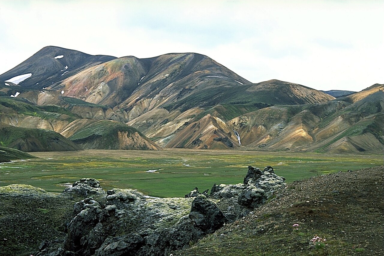
Four days across Iceland's southern highlands, from the rhyolite mountains and hot springs of Landmannalaugar over an obsidian plateau and black-sand deserts to the birch woods of Þórsmörk.

The Laugavegur Trail — Landmannalaugar to Þórsmörk
صورة: Andreas Tille · CC BY-SA 4.0
المدة
4 أيام
المسافة
55 km
الصعود
1200 m
مستوى الصعوبة
متوسط
أفضل موسم
Late June to early September, when the mountain huts are staffed and open

The Laugavegur is Iceland’s most famous long-distance hike and one of the most varied walks anywhere. In roughly 55 km it strings together nearly every landscape the island can offer: the banded rhyolite peaks and steaming ground of Landmannalaugar, a high snow-streaked obsidian plateau, glacier-fed lakes, roaring river fords, black volcanic deserts and, at the end, the green birch valley of Þórsmörk beneath three glaciers.

It is walked north to south, hut to hut, and while the trail is well marked and non-technical, the weather does the grading — sun, sleet and fog can all arrive in one afternoon.

Getting there. Most hikers ride the highland bus from Reykjavík to Landmannalaugar in early summer and catch the bus back out of Þórsmörk at the end. Both run only during the season.

Huts & camping. The route is spaced around the mountain huts at Hrafntinnusker, Álftavatn and Emstrur (Botnar), run by Ferðafélag Íslands. Beds sell out months ahead, so book early or bring a tent for the marked campsites beside each hut.

Good to know:

اليوم 1

Landmannalaugar to Hrafntinnusker

Landmannalaugar (~600 m) → Hrafntinnusker (~1,050 m) 12 km ↑ 470 m
التنقّل في هذا اليوم

The classic opening day, leaving the hot-spring basin of Landmannalaugar and climbing steadily through some of the most colourful ground in Iceland to the trek’s highest hut.

مقاطع

  1. Through the Laugahraun lava field
    Through the Laugahraun lava field 6 km ↑ 250 m 📍 خريطة

    Landmannalaugar hut → Stórihver hot spring

    Lava field and rhyolite slopes

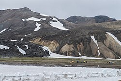
    Cross the Laugahraun obsidian lava field straight out of camp, then climb between the banded rhyolite peaks of Brennisteinsalda past steaming vents and the warm ground of Stórihver. About 3 hours.

    عن هذا المكان

    Landmannalaugar is a location in Iceland's Fjallabak Nature Reserve in the Highland. It is on the edge of the Laugahraun lava field. This lava field was formed by an eruption in approximately 1477. It is largely known for its natural geothermal hot springs and surrounding landscape.

    اقرأوا المزيد في ويكيبيديا ↗

    صورة: Anjali Kiggal · CC BY-SA 4.0

  2. Onto the obsidian plateau 6 km ↑ 220 m 📍 خريطة

    Stórihver → Hrafntinnusker hut

    High plateau with snowfields and obsidian

    Climb onto the cold, snow-streaked plateau scattered with black obsidian (hrafntinna) to the Hrafntinnusker hut, the highest and often coldest camp on the route. About 2.5 hours.
اليوم 2

Hrafntinnusker to Álftavatn

Hrafntinnusker → Álftavatn (~540 m) 12 km ↑ 100 m
التنقّل في هذا اليوم

A day of long views and a big descent, dropping off the obsidian plateau over ridges and snowfields to the green lakeside hut at Álftavatn.

مقاطع

  1. Ridges above Jökultungur 6 km ↑ 80 m 📍 خريطة

    Hrafntinnusker → Jökultungur descent

    Snowfields and gorges

    Traverse a high, snow-patched terrain of gullies and small gorges, with a worthwhile detour toward the peak of Háskerðingur, before the ground falls away toward the lakes. About 2.5 hours.

  2. Descent to the lake 6 km ↑ 20 m 📍 خريطة

    Jökultungur → Álftavatn hut

    Steep descent and first river ford

    Drop steeply down Jökultungur with the twin lakes and green plains opening below, ford the Grashagakvísl stream, and reach the Álftavatn hut on the lake shore. About 2 hours.

اليوم 3

Álftavatn to Emstrur (Botnar)

Álftavatn → Emstrur / Botnar (~500 m) 16 km ↑ 300 m
التنقّل في هذا اليوم

A long crossing of the black sands, linking the lakes country to the canyon rim at Emstrur with a string of river fords along the way.

مقاطع

  1. Fords to Hvanngil 5 km ↑ 120 m 📍 خريطة

    Álftavatn → Hvanngil

    River fords and grassy gorge

    Ford the Bratthálskvísl and Kaldaklofskvísl rivers to the sheltered green gorge of Hvanngil, a welcome patch of grass among the ash. About 2 hours.

  2. Across the black desert
    Across the black desert 11 km ↑ 180 m 📍 خريطة

    Hvanngil → Emstrur (Botnar) hut

    Black volcanic sand and desert plain

    Cross the Bláfjallakvísl and strike out over the black volcanic desert beneath Mýrdalsjökull to the Emstrur huts, where a short evening walk reaches the rim of the deep Markarfljót canyon. About 4 hours.

    عن هذا المكان

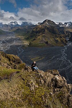
    Markarfljót is a river in the south of Iceland. It is approximately 100 km (62 mi) long and has had in pre-history jökulhlaups which would be potentially catastrophic, if a similar sized one was to happen in the future.

    اقرأوا المزيد في ويكيبيديا ↗

    صورة: The original uploader was Reykholt at German Wikipedia. · CC BY-SA 3.0

اليوم 4

Emstrur to Þórsmörk

Emstrur / Botnar → Þórsmörk (~200 m) 15 km ↑ 250 m
التنقّل في هذا اليوم

The landscape turns green again on the last day, descending past the Markarfljót canyon and the big Þröngá ford into the sheltered woodland of Þórsmörk.

مقاطع

  1. Along the Markarfljót canyon
    Along the Markarfljót canyon 9 km ↑ 150 m 📍 خريطة

    Emstrur (Botnar) → Þröngá river

    Canyon edges and ravines

    Follow the trail past the gorge of the Fremri-Emstruá and along the edge of the Markarfljót canyon, with the first shrubs and greenery returning underfoot. About 4 hours.

    عن هذا المكان

    Markarfljót is a river in the south of Iceland. It is approximately 100 km (62 mi) long and has had in pre-history jökulhlaups which would be potentially catastrophic, if a similar sized one was to happen in the future.

    اقرأوا المزيد في ويكيبيديا ↗

    صورة: The original uploader was Reykholt at German Wikipedia. · CC BY-SA 3.0

  2. The Þröngá ford into the woods
    The Þröngá ford into the woods 6 km ↑ 100 m 📍 خريطة

    Þröngá river → Þórsmörk

    Glacial river crossing and birch forest

    Ford the Þröngá, the largest and coldest river of the trek, then walk up into the birch woods of Þórsmörk, ringed by three glaciers and the end of the trail. About 2.5 hours.

    عن هذا المكان

    Thórsmörk is a mountain ridge in Iceland that was named after the Norse god Thor (Þór). It is situated in the south of Iceland between the glaciers Tindfjallajökull and Eyjafjallajökull. The name "Thórsmörk" properly refers only to the mountain ridge between the rivers Krossá, Þröngá, and Markarfljót, but is sometimes used informally to describe a wider area that includes the region between Thórsmörk and Eyjafjallajökull. Thórsmörk is one of the most popular hiking areas in Iceland.

    اقرأوا المزيد في ويكيبيديا ↗

    صورة: David Karnå · CC BY 3.0

Comments