Central Hiroshima in the morning, Hiroshima Bay at midday, and Itsukushima in the afternoon.
مقاطع
- Peace Memorial Park
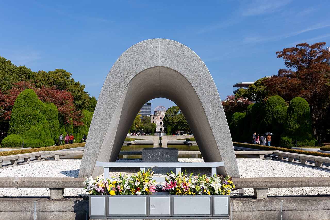
Genbaku Dome-mae tram stop ← Cenotaph and Peace Flame
Paved park paths
A park in the centre of the city, laid out by the architect Kenzō Tange on ground that was a merchant district before the bombing. It holds more than fifty memorials and monuments, among them the arched cenotaph and the Children's Peace Monument. Entry is free and the grounds are open at all hours. Allow about an hour.
- The A-Bomb Dome
Cenotaph ← Hiroshima Peace Memorial (Genbaku Dome)
Riverside path
The Hiroshima Prefectural Industrial Promotion Hall stood close to the point above which the bomb detonated. Its walls and the steel frame of its dome remained standing and have been kept in that state. It was designated a UNESCO World Heritage Site in 1996. It is viewed from the path around it; the ruin itself is not entered.
- Peace Memorial Museum
A-Bomb Dome ← Peace Memorial Museum
Paved park paths
The museum at the southern end of the park documents the bombing and its effects through objects, photographs and survivor testimony. Admission is small. Allow at least 90 minutes; many visitors take longer.
- Ferry to Miyajima
Miyajimaguchi Station pier ← Miyajima ferry terminal
Ferry crossing and pier approach
Itsukushima, popularly called Miyajima, sits in the northwest of Hiroshima Bay and belongs to the city of Hatsukaichi. The crossing from Miyajimaguchi takes about ten minutes. Wild deer move freely around the terminal and the streets beyond it.
- Itsukushima Shrine and the floating torii
Miyajima ferry terminal ← Itsukushima Shrine
Seafront promenade
A Shinto shrine built out over the water on piles, best known for the vermilion torii standing offshore, which appears to float at high tide. The complex is a UNESCO World Heritage Site and several of its buildings are designated National Treasures. A small entry fee applies.
- Mount Misen foothills
Itsukushima Shrine ← Momijidani Park and the ropeway base
Valley paths and shrine lanes
Behind the shrine the island rises to Mount Misen, the sacred mountain at the island's centre and its high point at 535 m, inside the shrine's World Heritage area. This route stays low, following the maple-lined valley of Momijidani Park to the ropeway base — climbing the summit is a longer half-day of its own.
التعليقات
سجّلوا الدخول للانضمام إلى النقاش.
لا توجد تعليقات بعد — كونوا أوّل المعلّقين.