Itinerary New York to Toronto — Road trip, USA & Canada

New York to Toronto by Car: Hudson Valley, Finger Lakes and Niagara in Five Days

About 900 kilometres from Manhattan to Toronto the long way round: sculpture and mountain views in the Hudson Valley, Catskills waterfalls, the gorges of the Finger Lakes, both sides of Niagara Falls and the wine country of Niagara-on-the-Lake.

New York to Toronto by Car: Hudson Valley, Finger Lakes and Niagara in Five Days
Photo: Flickr user: Peter Rivera Stamford, Connecticut https://www.flickr.com/people/riverap1/ · CC BY 2.0
Duration
5 days
Distance
900 km
Difficulty
Easy
Best season
Late May–mid-October

Walking

    Your location stays on this phone. It is never sent, stored or put in a link.

    Getting there and back

    Start
    Manhattan
    Finish
    Toronto

    One-way: plan your trip back

    The direct drive from New York City to Toronto is about 760 kilometres and nine or ten hours, mostly on interstates. This route adds only about 140 kilometres and turns it into five unhurried days. It follows the Hudson north past Bear Mountain and the sculpture fields of Storm King, climbs into the Catskills to the waterfall that the Hudson River School painters made famous, and crosses to the Finger Lakes, where glaciers left long, deep lakes and gorges full of waterfalls. Then it runs west to Niagara, crosses the border on the Rainbow Bridge, and finishes along the Niagara Parkway and the lakeshore into Toronto.

    No single day is long except the second, and even that has a waterfall break in the middle. The drive times below are without traffic; leaving Manhattan and entering Toronto can easily add an hour each, so pad every leg by 15 to 25 percent and avoid weekday rush hours at both ends.

    The route is at its best from late May, when the Watkins Glen gorge trail opens, to mid-October, when it closes and the leaves along the Hudson and the Finger Lakes are at their peak.

    Getting there. Pick up a rental car in New York City or, more cheaply, at one of the airports or in New Jersey. Tell the rental company you are taking the car into Canada and returning it there, and get that written on the rental agreement.

    Permits & tickets. Storm King Art Center sells timed tickets online, and booking ahead is effectively required. Watkins Glen State Park charges a vehicle fee in season. At Niagara, Cave of the Winds and Maid of the Mist on the US side, and Journey Behind the Falls and the Niagara City Cruises boats on the Canadian side, all charge admission. The Rainbow Bridge charges a toll. Prices and seasons change, so check each official site.

    Good to know:

    Tips & Insights for this route Planning this route? Read our practical tips before you go — 9 tips. Read the tips

    Day by day

    DayDistanceAscentDescentWalking time
    Day 1Manhattan to the Hudson Valley
    Distance166 kmAscentNot recordedDescentNot recordedWalking timeNot recorded
    Day 2 Hardest dayCatskills waterfall, then west to Ithaca
    Distance285 kmAscentNot recordedDescentNot recordedWalking timeNot recorded
    Day 3The Finger Lakes gorges
    Distance52 kmAscentNot recordedDescentNot recordedWalking timeNot recorded
    Day 4To Niagara Falls and across the border
    Distance258 kmAscentNot recordedDescentNot recordedWalking timeNot recorded
    Day 5Horseshoe Falls, the Niagara Parkway and into Toronto
    Distance151 kmAscentNot recordedDescentNot recordedWalking timeNot recorded

    Flights on Kayak Car rental on Localrent

    Day 1

    Manhattan to the Hudson Valley

    Manhattan → Kingston, New York 166 km

    Leave by 8:37 PM

    If you have a spare morning in the city before you go, walk the High Line in Manhattan. Then head north up the west bank of the Hudson to Bear Mountain, spend the afternoon at Storm King Art Center, and finish in Kingston, New York’s first state capital.

    Segments

    1. Up the Palisades to Bear Mountain
      Up the Palisades to Bear Mountain 75 km Map

      Manhattan → Bear Mountain State Park

      By car: George Washington Bridge and Palisades Interstate Parkway, about 1 hour 15 minutes

      Cross the George Washington Bridge and take the Palisades Interstate Parkway north along the cliffs above the Hudson to Bear Mountain Circle, where it meets the Bear Mountain Bridge. It is the prettiest way out of the city and has no trucks.

      About this place

      The Palisades Interstate Parkway (PIP) is a 38.25-mile (61.56 km) controlled-access parkway in the U.S. states of New Jersey and New York. The parkway is a major commuter route into New York City from Rockland and Orange counties in New York and Bergen County in New Jersey. The southern terminus of the route is at the George Washington Bridge in Fort Lee, New Jersey, where it connects to Interstate 95 (I-95), US 1-9, and US 46. Its northern terminus is at a traffic circle in Fort Montgomery, New York, where the PIP meets US 9W and US 202 at the Bear Mountain Bridge. At exit 18, the PIP forms a concurrency with US 6 for the remaining duration of its run.

      Read more on Wikipedia Photo: TwinsMetsFan · Public domain
    2. Perkins Memorial Tower
      Perkins Memorial Tower 8 km Map

      Bear Mountain Inn → Perkins Memorial Tower

      By car: Perkins Memorial Drive, then a short walk

      Bear Mountain State Park covers over 5,000 acres of the Hudson Highlands. Drive the winding Perkins Memorial Drive to the summit tower for the view down the Hudson; the drive is open from spring to late November. Back at the bottom, the Bear Mountain Inn and the Trailside Museums and Zoo are beside the lake. Allow about 1.5 hours.

      About this place

      Bear Mountain State Park is a 5,205-acre (21.06 km2) state park located on the west bank of the Hudson River in Rockland and Orange counties, New York. The park offers biking, hiking, boating, picnicking, swimming, cross-country skiing, cross-country running, sledding and ice skating. It also includes several facilities such as the Perkins Memorial Tower, the Trailside Museum and Zoo, the Bear Mountain Inn, a merry-go-round, a pool, and a skating rink. It also hosts the Bear Mountain Circle, where the historic Palisades Interstate Parkway and Bear Mountain Bridge meet. It is managed by the Palisades Interstate Park Commission, which is overseen by the State of New York.

      Read more on Wikipedia Photo: CoffeeSoup · CC BY 4.0
    3. Storm King Art Center
      Storm King Art Center 22 km Map

      Bear Mountain State Park → Storm King Art Center

      By car, about 30 minutes, then walking on lawns and paths

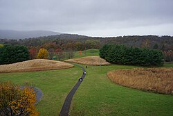
      Storm King is an open-air museum of about 500 acres, founded in 1960, with one of the largest collections of outdoor contemporary sculpture in the United States set in rolling fields against the Hudson Highlands. Look for Mark di Suvero's giant steel pieces, Andy Goldsworthy's snaking stone wall and Maya Lin's grassy Wavefield. It is closed some weekdays and for the winter, so check the schedule and book a timed ticket. Allow three hours.

      About this place

      Storm King Art Center, commonly called Storm King and named for nearby Storm King Mountain, is an open-air museum near New Windsor, New York. It contains perhaps the largest collection of contemporary outdoor sculptures in the United States. Founded in 1960 by Ralph E. Ogden as a museum for Hudson River School paintings, it soon became a major sculpture venue with works from some of the most acclaimed artists of the 20th century. The site covers about 500 acres, and is located about a one-hour drive north of Manhattan.

      Read more on Wikipedia Photo: Ɱ · CC BY-SA 4.0
    4. North to Kingston
      North to Kingston 61 km Map

      Storm King Art Center → Kingston, New York

      By car: New York State Thruway, about 1 hour

      Drive north on the Thruway to Kingston, which became New York's first capital in 1777 and was burned by the British that October. Walk the old Stockade District and the Rondout waterfront on the Hudson before dinner.

      About this place

      Kingston is a city in and the county seat of Ulster County, New York, United States. The population was 24,069 at the 2020 census, while the Kingston metropolitan statistical area had 177,749 residents. It is at the confluence of Rondout Creek and the Hudson River, 91 miles (146 km) north of New York City and 59 miles (95 km) south of Albany. The city's metropolitan area is grouped with the New York metropolitan area around Manhattan by the United States Census Bureau.

      Read more on Wikipedia Photo: Amy Lavine · CC BY-SA 4.0
    Day 2

    Catskills waterfall, then west to Ithaca

    Kingston, New York → Ithaca, New York 285 km

    Leave by 11:12 AM

    Climb into the Catskills to see Kaaterskill Falls, then make the longest drive of the trip west across upstate New York to Ithaca, at the southern end of Cayuga Lake.

    Segments

    1. Into the Catskills
      Into the Catskills 45 km Map

      Kingston, New York → Kaaterskill Falls trailhead

      By car, about 45 minutes

      Drive north and then up through the Kaaterskill Clove, a steep gorge on Route 23A, to the high plateau around Haines Falls. Park at an official lot such as the one on Laurel House Road; parking in the roadside pull-offs on Route 23A is prohibited for much of the year.

      About this place

      The Catskill Mountains, also known as the Catskills, are a physiographic province and subrange of the larger Appalachian Mountains, located in southeastern New York, United States. As a cultural and geographic region, the Catskills are generally defined as those areas close to or within the borders of the Catskill Park, a 700,000-acre (2,800 km2) forest preserve protected from many forms of development under New York state law.

      Read more on Wikipedia Photo: The original uploader was Daniel Case at English Wikipedia. · CC BY-SA 3.0
    2. Kaaterskill Falls
      Kaaterskill Falls 1 km Map

      Laurel House Road parking → Kaaterskill Falls viewing platform

      Gravel path to a viewing platform, about 0.5 km each way

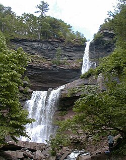
      A short, easy path leads to a platform above the two-tiered falls, which drop about 79 metres in total on Spruce Creek. Thomas Cole painted them from 1825, and they became one of the defining images of the Hudson River School and of American landscape painting. Stay on the marked trail and platforms: people have died climbing off-trail here. Allow an hour.

      About this place

      Kaaterskill Falls is a two-stage waterfall on Spruce Creek in the eastern Catskill Mountains of New York, between the hamlets of Haines Falls and Palenville in Greene County. The two cascades total 260 feet in height, making Kaaterskill Falls one of the highest waterfalls in New York, and one of the Eastern United States' tallest waterfalls.

      Read more on Wikipedia Photo: Mwanner · CC BY-SA 3.0
    3. West across upstate New York
      West across upstate New York 239 km Map

      Kaaterskill Falls → Ithaca, New York

      By car, about 3.5 to 4 hours

      The long leg of the trip, through rolling farmland and small towns to Ithaca, home of Cornell University at the foot of Cayuga Lake. Break it with lunch on the way, and aim to arrive in time for an evening walk.

      About this place

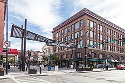
      Ithaca is a city in the U.S. state of New York. It is situated on the southern shore of Cayuga Lake in the Finger Lakes region of Upstate New York. With a population of 32,108 as of the 2020 census, Ithaca is the largest community in the Ithaca metropolitan statistical area, which includes all 103,558 residents of Tompkins County, of which it is the county seat. The city is named after the Greek island of Ithaca, home of the protagonist Odysseus in Homer's Odyssey.

      Read more on Wikipedia Photo: Kenneth C. Zirkel · CC BY-SA 4.0
    4. Ithaca Falls at dusk
      Ithaca Falls at dusk 1.5 km Map

      Downtown Ithaca → Ithaca Falls

      Short walk on city streets and a gravel path

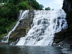
      Inside the city itself, Fall Creek pours over Ithaca Falls, 46 metres high and 53 metres wide, the last of a chain of waterfalls down the gorge below the Cornell campus. It is a short walk from downtown. About 45 minutes.

      About this place

      Ithaca Falls is a waterfall located within the city of Ithaca, New York. It is the last of a series of waterfalls along the hanging valley formed where Fall Creek intersects the glacial trough of Cayuga Lake. The falls are in an amphitheater formed by freezing and thawing of the weak shale which makes up most of the gorge walls. The splash pool, and the creek just below the falls, are a popular spot for fly fishing. It has a height of 150 feet (46 m) and a width 175 feet (53 m)

      Read more on Wikipedia Photo: Stilfehler · CC BY-SA 3.0
    Day 3

    The Finger Lakes gorges

    Ithaca, New York → Watkins Glen, New York 52 km

    Leave by 4:53 AM

    Drive up the west shore of Cayuga Lake to Taughannock Falls, then cross to Seneca Lake to walk the gorge of Watkins Glen, and stay the night at the head of the lake.

    Segments

    1. Taughannock Falls
      Taughannock Falls 16 km Map

      Ithaca, New York → Taughannock Falls State Park

      By car about 20 minutes, then a flat gravel trail, about 1.2 km each way

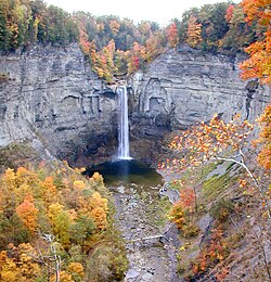
      Taughannock Falls plunges 66 metres in a single drop, taller than Niagara, between rock walls that rise even higher. Walk the flat Gorge Trail to the foot of the falls, then drive up to the free overlook on the rim for the view down into the gorge. Allow about 1.5 hours.

      About this place

      Taughannock Falls State Park is a 750-acre (3.0 km2) state park located in the town of Ulysses in Tompkins County, New York in the United States. The park is northwest of Ithaca near Trumansburg.

      Read more on Wikipedia Photo: RockyRaccoon at English Wikipedia · Public domain
    2. Across to Seneca Lake
      Across to Seneca Lake 36 km Map

      Taughannock Falls State Park → Watkins Glen, New York

      By car, about 45 minutes

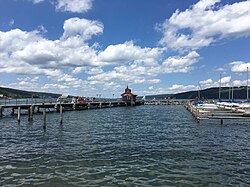
      Cross the hills between the two lakes to Watkins Glen at the southern end of Seneca Lake, the deepest of the Finger Lakes at about 188 metres. Wineries line both shores if you want to stop on the way, with a designated driver.

      About this place

      Seneca Lake is a Finger Lake in central New York state. Spanning four counties—Schuyler, Seneca, Yates, and Ontario—it is the largest of the eleven lake glacial chain, and the deepest glacial lake entirely within the state.

      Read more on Wikipedia Photo: Dough4872 · CC BY-SA 3.0
    3. The Gorge Trail at Watkins Glen
      The Gorge Trail at Watkins Glen 2.5 km Map

      Watkins Glen State Park main entrance → Upper entrance

      Stone paths, tunnels and hundreds of wet stone steps

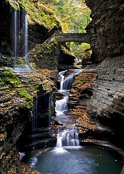
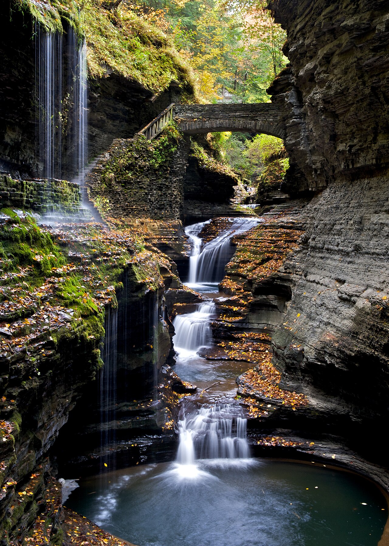
      The most famous walk in the Finger Lakes follows Glen Creek up a gorge about 120 metres deep, past 19 waterfalls, through rock tunnels and, at one point, behind a waterfall. The stonework paths were built by the Civilian Conservation Corps in the 1930s. Walk up and take the seasonal shuttle back, or walk the rim trail down. The Gorge Trail opens in late spring and closes in autumn, and dogs are not allowed on it. Allow two to three hours.

      About this place

      Watkins Glen State Park is in the village of Watkins Glen, south of Seneca Lake in Schuyler County in New York's Finger Lakes region. The park's lower part is near the village, while the upper part is open woodland. It was first opened to the public in 1863 and has been a public park since 1906.

      Read more on Wikipedia Photo: Flickr user: Peter Rivera Stamford, Connecticut https://www.flickr.com/people/riverap1/ · CC BY 2.0
    Day 4

    To Niagara Falls and across the border

    Watkins Glen, New York → Niagara Falls, Ontario 258 km

    Leave by 6:56 PM

    Drive west to Niagara Falls, New York, see the American Falls and the Bridal Veil Falls up close from Goat Island and Cave of the Winds, and cross the Rainbow Bridge into Canada for the night. For a full day built around the falls, see our Niagara Falls day trip.

    Segments

    1. West to the Niagara River 253 km Map

      Watkins Glen, New York → Niagara Falls State Park

      By car, about 3.5 hours

      Leave the lakes behind and head west on interstates past Rochester and Buffalo to the city of Niagara Falls, New York. Park near the state park and go on foot.

    2. Niagara Falls State Park
      Niagara Falls State Park 2 km Map

      Prospect Point → Terrapin Point on Goat Island

      Park paths and footbridges

      Created in 1885 as the Niagara Reservation, with landscapes by Frederick Law Olmsted, this is the oldest state park in the United States. Walk from Prospect Point, beside the edge of the American Falls, across to Goat Island and on to Terrapin Point, where you stand beside the Horseshoe Falls with Canada across the gorge. About an hour.

      About this place

      Niagara Falls State Park is a state park located in Niagara Falls, New York, United States. It is recognized as the oldest state park in the United States, and contains the American Falls, the Bridal Veil Falls, and a portion of the Horseshoe Falls.

      Read more on Wikipedia Photo: Ad Meskens · CC BY-SA 3.0
    3. Cave of the Winds or Maid of the Mist
      Cave of the Winds or Maid of the Mist 0.5 km Map

      Goat Island → Base of the Bridal Veil Falls

      Elevator and wooden decks, or a boat

      Take the elevator down into the gorge at Cave of the Winds and climb the wooden decks to the Hurricane Deck, a few metres from the Bridal Veil Falls, where you will be soaked. Or board the Maid of the Mist at Prospect Point for the boat ride to the foot of the Horseshoe Falls. Both are seasonal; you are given a poncho. About 1.5 hours.

      About this place

      The Cave of the Winds was a natural cave behind Bridal Veil Falls at the Niagara Falls. The cave was some 130 feet (40 m) high, 100 feet (30 m) wide and 30 feet (9 m) in depth. It was discovered in 1834, and originally dubbed Aeolus's Cave, after the Greek god of winds.

      Read more on Wikipedia Photo: Scan by NYPL · Public domain
    4. Over the Rainbow Bridge into Canada
      Over the Rainbow Bridge into Canada 2.5 km Map

      Niagara Falls, New York → Niagara Falls, Ontario

      By car: toll bridge and Canadian border inspection

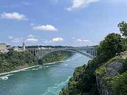
      The Rainbow Bridge, opened in 1941, crosses the gorge just downstream of the American Falls and is closed to trucks. Pay the toll, then stop at the Canadian border booth with passports ready. Waits vary from minutes to an hour or more on summer weekends; the Peace Bridge at Buffalo is the alternative. Check in to your hotel and walk down to see the falls lit up at night.

      About this place

      The Niagara Falls International Rainbow Bridge, commonly known as the Rainbow Bridge, is a steel arch bridge across the Niagara River, connecting the cities of Niagara Falls, New York, United States, and Niagara Falls, Ontario, Canada.

      Read more on Wikipedia Photo: Dough4872 · CC BY-SA 4.0
    Day 5

    Horseshoe Falls, the Niagara Parkway and into Toronto

    Niagara Falls, Ontario → Toronto 151 km

    Leave by 1:22 AM

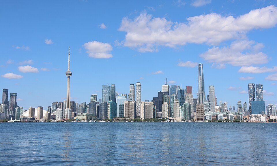
    See the Horseshoe Falls from the Canadian side, drive the Niagara Parkway north to Niagara-on-the-Lake, and follow the Queen Elizabeth Way around Lake Ontario to Toronto. From there, carry on with Toronto in 4 days, starting with the view from the CN Tower.

    Segments

    1. Table Rock and Journey Behind the Falls
      Table Rock and Journey Behind the Falls 5 km Map

      Niagara Falls, Ontario → Table Rock

      Riverside promenade, tunnels and an observation deck

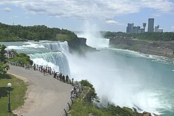
      The Horseshoe Falls carries about 90 percent of the Niagara River's flow, and Table Rock puts you right at its brink. Journey Behind the Falls, open year-round, takes you down by elevator to tunnels in the rock behind the falls and a deck at their foot. The Niagara City Cruises boats leave from the Canadian shore in season. Allow two hours.

      About this place

      Horseshoe Falls is the largest of the three waterfalls that collectively form Niagara Falls on the Niagara River along the Canada–United States border. Approximately 90% of the Niagara River, after around half the water is diverted for hydropower generation, flows over Horseshoe Falls. The remaining 10% flows over American Falls and Bridal Veil Falls. It is located between Terrapin Point on Goat Island in the US state of New York, and Table Rock in the Canadian province of Ontario. These falls are also referred to as the Canadian Falls.

      Read more on Wikipedia Photo: Thomaswm · CC BY-SA 4.0
    2. North on the Niagara Parkway
      North on the Niagara Parkway 12 km Map

      Table Rock → Queenston Heights

      By car: two-lane scenic parkway

      Winston Churchill reportedly called the Niagara Parkway the prettiest Sunday afternoon drive in the world. It follows the river north past the Whirlpool Rapids, the Whirlpool Aero Car and the Butterfly Conservatory to Queenston Heights, where Brock's Monument commemorates the British general killed there in the War of 1812.

      About this place

      The Niagara Parkway, formerly known as Niagara Boulevard and historically as the Niagara Road, is a scenic road in the province of Ontario that travels on the Canadian side of the Niagara River from the town of Fort Erie to Niagara-on-the-Lake. The portion north of Table Rock in the city of Niagara Falls is designated as an Ontario Scenic Highway. Niagara Boulevard originally referred only to the section from Fort Erie to Chippawa.

      Read more on Wikipedia Photo: Paste Let’s have a chat. / Paste at English Wikipedia · CC BY-SA 3.0
    3. Niagara-on-the-Lake
      Niagara-on-the-Lake 12 km Map

      Queenston Heights → Niagara-on-the-Lake

      By car through vineyards, then walking in town

      Continue past vineyards and fruit farms to Niagara-on-the-Lake, where the river meets Lake Ontario. It was briefly the first capital of Upper Canada in the 1790s, and its tree-lined Queen Street, the reconstructed Fort George and the Shaw Festival theatres make it one of the prettiest small towns in Ontario. Have lunch and stop at a winery on the way out. Allow three hours.

      About this place

      Niagara-on-the-Lake (NOTL) is a town in Ontario, Canada. It is located on the Niagara Peninsula at the point where the Niagara River meets Lake Ontario, across the river from New York, United States. Niagara-on-the-Lake is in the Niagara Region of Ontario and is the only town in Canada that has a lord mayor. It had a population of 19,088 as of the 2021 Canadian census.

      Read more on Wikipedia Photo: Paste Let’s have a chat. / Paste at English Wikipedia · CC BY-SA 3.0
    4. Along the lake to Toronto
      Along the lake to Toronto 127 km Map

      Niagara-on-the-Lake → Toronto

      By car: Queen Elizabeth Way and Gardiner Expressway, about 1 hour 45 minutes without traffic

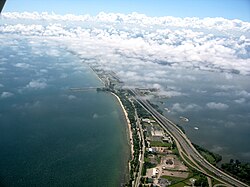
      The Queen Elizabeth Way curves around the western end of Lake Ontario through Hamilton and becomes the Gardiner Expressway as it enters Toronto, with the CN Tower rising ahead. Allow much longer at rush hour. If you are returning the car, drop it off before heading into the city centre, where parking is expensive.

      About this place

      The Queen Elizabeth Way (QEW) is a 400-series highway in the Canadian province of Ontario linking Toronto with Fort Erie in the Niagara Peninsula. The highway begins at the Canada–United States border on the Peace Bridge and travels 139.1 kilometres (86.4 mi) around the western end of Lake Ontario, ending at Highway 427 near the western border of Toronto. The freeway continues as the Gardiner Expressway into downtown Toronto. The QEW is one of Ontario's busiest highways, with an average of close to 250,000 vehicles per day on some sections.

      Read more on Wikipedia Photo: Mathew Campbell · CC BY 2.5

    Partner link: if you book through it we may earn a commission, at no extra cost to you. It does not change what we recommend. How this works

    Tips & Insights

    Best time to go

    • Late September into early October

      The autumn colours along the Hudson, in the Catskills and around the Finger Lakes peak roughly from late September to mid-October, and the waterfalls still run while the summer crowds are gone. Check that the Watkins Glen gorge trail is still open, since it closes for the winter in autumn.

    Getting there

    • Avoid the rush at both ends

      Leave Manhattan early on a weekday morning or late on a weekend morning, and time your arrival in Toronto for the middle of the day. The Queen Elizabeth Way and the Gardiner Expressway into the city are heavily congested at rush hour.

    Permits & fees

    • Passports, rental paperwork and the bridge toll

      Keep passports, the rental agreement showing Canadian travel is authorised, and the car’s registration and insurance papers in the glovebox. Border officers may ask where you are going, how long you will stay and what you are carrying; declare food, alcohol and anything you are bringing as gifts. Have a card or some cash for the Rainbow Bridge toll.

    Tickets & reservations

    • Book Storm King and the Niagara boats ahead

      Storm King’s timed tickets include parking and are the only reliable way in on busy days. At Niagara, book the boat tours and Journey Behind the Falls online for a set time in summer to skip the ticket queues. Check each site for current prices and seasons.

    Beating the lines

    • Niagara early, the gorges on weekdays

      Reach the Niagara boats as they open, or in the last hours of the day, when the queues are shortest. Watkins Glen and Taughannock are far quieter on weekday mornings than on summer weekends.

    With kids

    • Short walks, big waterfalls

      Almost every stop is a short walk to a spectacular view: the Kaaterskill viewing platform, the flat trail to Taughannock Falls, the decks of Cave of the Winds and the boat to the foot of the falls. Watkins Glen has many steps but kids love the tunnels and the path behind a waterfall.

    Food

    • Wine country twice

      Seneca Lake and Niagara-on-the-Lake are both wine regions with tasting rooms along the road. Choose a designated driver or book a tasting you can walk to, and never drive after tastings: the limits in both countries are strict.

    Where to stay

    • Kingston, Ithaca, Watkins Glen, Niagara Falls

      Overnight in Kingston for its old Stockade District, in Ithaca for its restaurants and college-town feel, in Watkins Glen at the head of Seneca Lake, and on the Canadian side of Niagara Falls, where the Fallsview hotels look straight over the Horseshoe Falls. Book summer weekends well ahead.

    Smart savings

    • Pick up the car outside Manhattan

      Car rental and parking in Manhattan are expensive. Take the train to an airport or suburban rental office, and compare the one-way fee for returning in Toronto against returning the car in Buffalo and crossing by bus, which is sometimes far cheaper.

    Comments