
Blog
Kilimanjaro's Machame Route in Six Days
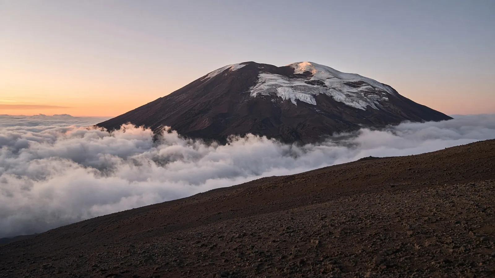
In short
Six days on the Machame Route is 62 km and 4,900 m of ascent to Uhuru Peak at 5,895 m, graded expert because of altitude. Go in the dry seasons, January to March or June to October, and avoid the long rains of April and May. You climb with a licensed operator, guides and porters. Five days is the itinerary to refuse.
Six days is the short honest version, and the grade is expert
The Machame Route is six days, 62 km and 4,900 m of ascent, from the Machame Gate to Uhuru Peak at 5,895 m and then down into the forest. Waymark grades it expert. That word is the grade, not a mood. The walking is not technical. There is no rope work and no glacier travel on this line. The thin air is the difficulty, and summit night is the day that makes the grade true. Five days is the version the page tells you to refuse. Six is the shortest itinerary that still includes the acclimatisation day. Seven is kinder if you can buy the extra night.
You cannot do this independently. Kilimanjaro National Park requires a licensed operator, guides and porters. Park fees are substantial and they sit inside the operator package. This page does not quote them, and it does not name companies. Choose the operator before you choose the flights, and ask how they treat the crew. Porter loads are capped by Tanzanian law and checked at the gates. Arrive in Moshi or Arusha, via Kilimanjaro International Airport, a day or two early so the gear check is not the same morning as the gate.
The dry seasons are January to March and June to October. Those are the months on the route: January, February, March, June, July, August, September and October. April and May are the long rains. Stay out of them. Clearer skies in the dry windows also mean colder summit nights. The two come together.
What the six days actually ask
Day one is Machame Gate at 1,800 m to Machame Camp at 2,835 m. About 11 km and 1,200 m of climbing, five to seven hours, on a muddy forest path through montane rainforest. It is a long steady day, often wet, and it ends at the tree line. This is the easy air. Do not spend it fast.
Day two is shorter and steeper: about 5 km and 850 m, from Machame Camp onto the Shira Plateau at 3,850 m. Five to six hours, out of the forest, through heather, up a rocky ridge. You sleep in the open, with the ice fields of Kibo in front of you. The distance looks like a half-day at home. At this height it is a full one.
Day three is the day the route is built around. From Shira Camp you climb across alpine desert to the Lava Tower at 4,600 m, stop, then descend to Barranco Camp at 3,960 m. About 10 km. You finish only a little higher than you started, and you have spent the middle of the day at 4,600 m. That is the climb-high, sleep-low pattern. Skipping the spirit of this day, by booking a shorter itinerary that rushes the same ground, is how people arrive at the summit already behind.
Day four looks small on paper and is not. About 5 km and 500 m, four to five hours, from Barranco over the Barranco Wall to Karanga Camp at 3,995 m. The wall is a steep scramble of something like 270 m, with hands on rock, including the hold people call the Kissing Rock. It is not technical climbing. Porters go up it with loads. Take it slowly and you are on top inside an hour, with one of the better views on the route. Karanga is the last camp with running water before the summit approach.
Day five is the half-day you must not fill. About 4 km and 700 m, three to four hours, up rock and scree to Barafu Camp at 4,670 m. Barafu means ice. Be there by early afternoon. Eat, drink, and sleep. The summit starts around midnight. A late arrival at Barafu is a worse plan than a slow morning.
Day six is the grade. Leave Barafu around midnight and climb steep scree by headlamp for five to seven hours to Stella Point on the crater rim, at 5,756 m, around dawn. Then about an hour along the rim, past the hanging glaciers, to Uhuru Peak at 5,895 m. Temperatures fall well below freezing, with strong wind. After the summit you descend to Barafu, rest, and keep going down to Mweka Camp at 3,100 m. The stage is about 17 km and something like 12 to 14 hours. Most people are off the top by mid-morning and still walking at dusk.
Add those days up as effort, not as a holiday. The route total is 62 km and 4,900 m. The stage figures on the page are the shape of each day. Summit day is longer than the first five feel in the morning.
Expert means altitude, and six days is how you respect it
Walk pole pole: slowly, slowly. Drink on a schedule, on the order of three to four litres a day, because dehydration imitates altitude sickness and makes it worse. Eat when you do not want to. Tell the guide about a headache, nausea, or a cough the hour it starts, not at the next camp. The Lava Tower day helps. It does not make a five-day itinerary acceptable. The page is plain: six or seven days, not five. The extra time is what improves both the chance of standing on Uhuru and the chance of getting down well.
Summit night is the hardest thing many trekkers ever do, and it is over, one way or another, by mid-morning. Pack for the whole stack of climate in one week: rain low down, real insulation up high, and a layering system that has to work for both. Cold kills batteries before it bothers a well-dressed walker. Keep the phone and the spare battery in an inside pocket. Bladder hoses freeze. Carry summit-night water in insulated bottles, stored upside down so the cap freezes last.
On the last morning the crew gathers for a tipping ceremony. It is a real part of their income, not a surprise you invent at the gate. Ask the operator, before you leave town, for the customary split between guides, cooks and porters, and carry the cash. That is a budget line. It is not a fee this page can quote, because the page does not quote one.
The season is two windows, with a hard gap
January to March is the first dry season. June to October is the second. Book inside those months and expect the summit to be colder when the sky is clear. April and May are the long rains. The route’s month list leaves them out, and so should you. A green mountain in the long rains is not a quieter Machame. It is the season the page says to avoid entirely.
If you want a comparison for the grade, do not use a long walk whose hard part is distance. Expert here is 4,900 m of ascent and a midnight start from 4,670 m. The other routes on trails that take a week at a moderate grade are a different sport. Read the Machame page, pick six or seven days, pick a dry-season month, and treat the operator, the porters and the extra acclimatisation day as the trip, not as extras around it.
Questions
- What does six days on Machame actually involve?
- A forest day to Machame Camp, a shorter day onto the Shira Plateau, a climb to the Lava Tower at 4,600 m with a sleep at Barranco, the Barranco Wall, a half-day to Barafu, and a midnight summit to 5,895 m followed by a long descent.
- Why is the grade expert?
- Because of altitude, not technical climbing. There is no rope work. Summit night from Barafu is cold, dark and long, and the thin air is what makes the grade.
- When should I climb?
- In the dry seasons, January to March and June to October. Avoid the long rains of April and May. Clearer skies also mean colder summit nights.
- Can I trek Kilimanjaro without a guide?
- No. The park requires a licensed operator, guides and porters. Park fees are substantial and included in the package. This page does not name operators or quote a fee.
- Is five days enough?
- No. Take six or seven. The extra time, including the climb-high, sleep-low day via the Lava Tower, is what improves both summit chances and safety.
Sources
Routes in this post
-
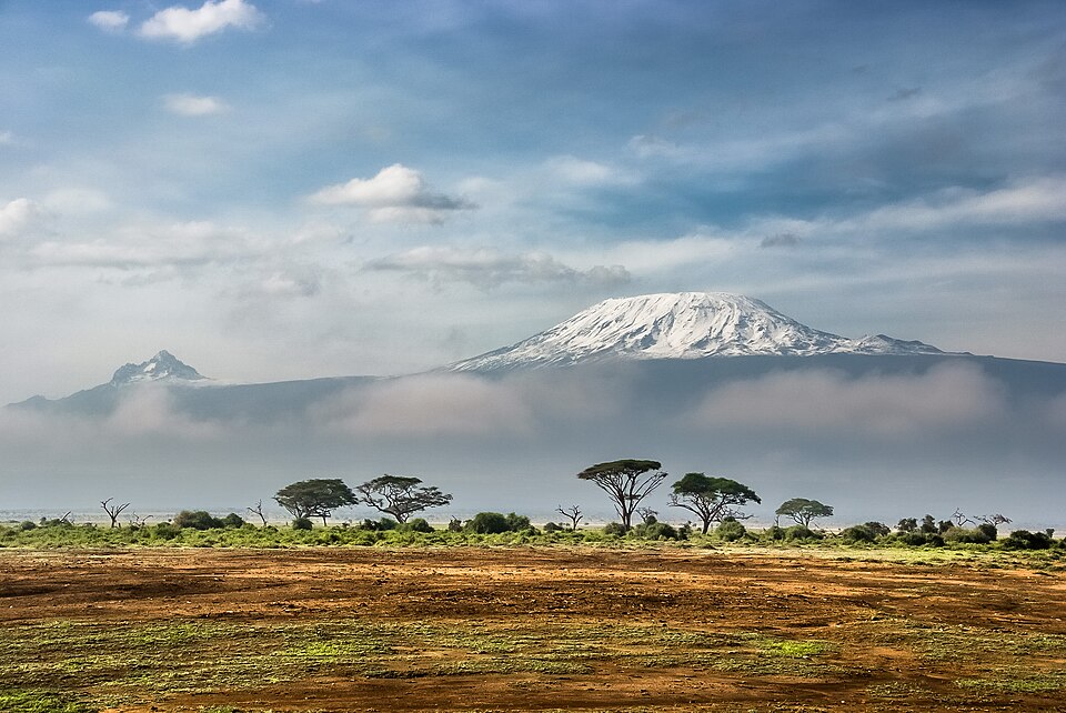 Photo: Sergey Pesterev · CC BY-SA 4.0Trek Tanzania
Kilimanjaro: The Machame Route to Uhuru Peak
Six days from rainforest to glaciers on the 'Whiskey Route', the most scenic way up Kilimanjaro, camping from gate to gate and topping out at Uhuru Peak (5,895 m), the roof of Africa.
- Duration
- 6 days
- Distance
- 62 km
- Difficulty
- Expert