← كل المسارات
رحلة مشي England — Lake District, United Kingdom

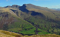
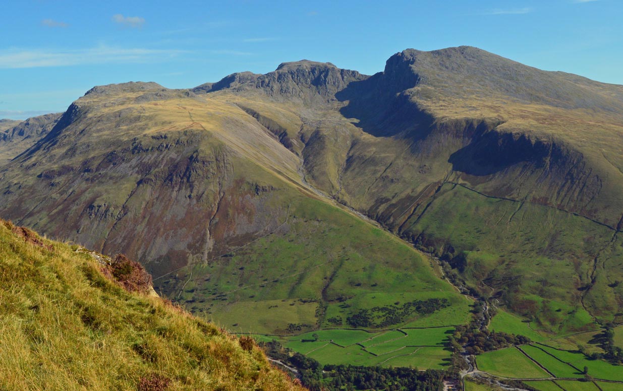
Scafell Pike from Wasdale Head

The shortest way up England's highest mountain (978 m) — about 900 m of climbing from Wasdale through Lingmell Gill and Hollow Stones onto a summit that is a bare field of boulders.

Scafell Pike from Wasdale Head
صورة: Doug Sim · CC BY-SA 4.0
المدة
1 أيام
المسافة
9.6 km
الصعود
900 m
مستوى الصعوبة
صعب
أفضل موسم
May–September; outside summer this is a full winter mountaineering route

Scafell Pike reaches 978 m, the highest and most prominent ground in England. The Wasdale Head route is the shortest way up it, which is not at all the same as the easiest: you start at about 80 m above the sea and climb roughly 900 m in a little under 5 km. It is relentless from the first hour to the last.

The line runs from Wasdale Head up beside Lingmell Gill, onto the steep spur of Brown Tongue, into the hanging bowl of Hollow Stones beneath Pikes Crag and Scafell Crag, and then out onto the summit plateau. Round trip is about 9.6 km and most walkers take somewhere around 5 to 6 hours.

Getting there. Wasdale Head is a scattered hamlet at the head of Wast Water, at the end of a long single-track road with no public transport worth relying on. There is a National Trust car park at Wasdale Head; it fills very early in summer. The Wasdale Head Inn has been a climbers’ base for well over a century.

Be honest with yourself about the top. The summit is a featureless field of boulders — a rough plateau ringed by crags, with a large cairn over the actual high point that doubles as a war memorial. There is no path across it in any meaningful sense, only worn rock. When the cloud comes down, and it does so often and fast, the plateau offers nothing to navigate by, and the crags are close on several sides. This is where people get into trouble on this mountain. Carry a map and compass, know how to take and walk a bearing before you set off, and do not rely on a phone.

Good to know:

اليوم 1

Wasdale Head to the summit and back

Wasdale Head (National Trust car park) → Wasdale Head (National Trust car park) 9.6 km ↑ 900 m
التنقّل في هذا اليوم

A single long day: the gill, the spur, the bowl, the boulder field, and the whole thing again in reverse.

مقاطع

  1. Along Lingmell Gill
    Along Lingmell Gill 1 km ↑ 40 m 📍 خريطة

    Wasdale Head car park → Lingmell Gill footbridge

    Level field paths and a beck-side track

    An easy start across the valley floor from the car park near the campsite, following Lingmell Gill up to the footbridge. The mountain stands over you the whole way and looks improbable. About 20 minutes.

    عن هذا المكان

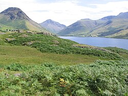
    Wasdale Head is a scattered agricultural hamlet in the Lake District National Park in Cumbria, England. Wasdale Head claims to be home of the highest mountain, deepest lake (Wastwater), smallest church and biggest liar in England. The last of these claims refers to Will Ritson, who paradoxically proclaimed himself as such. In 1870-72 the township/chapelry had a population of 49.

    اقرأوا المزيد في ويكيبيديا ↗

    صورة: Doug Sim · CC BY-SA 4.0

  2. The Brown Tongue grind
    The Brown Tongue grind 1.5 km ↑ 400 m 📍 خريطة

    Lingmell Gill footbridge → Top of Brown Tongue

    Steep, eroded, stone-pitched path

    The path turns uphill and simply does not stop. Brown Tongue is a steep grassy spur, heavily pitched with stone by path-repair teams, climbing under the flank of Lingmell. This is the hardest continuous work of the day. About 1.5 hours.

    عن هذا المكان

    Lingmell is a fell in the English Lake District, standing above the village of Wasdale Head. It is an outlier on the north-west flank of Scafell Pike, England’s highest mountain.

    اقرأوا المزيد في ويكيبيديا ↗

    صورة: Doug Sim · CC BY-SA 4.0

  3. Into Hollow Stones
    Into Hollow Stones 1 km ↑ 180 m 📍 خريطة

    Top of Brown Tongue → Hollow Stones

    Boulder-strewn corrie floor

    The spur opens into Hollow Stones, a stony hanging bowl walled by Pikes Crag on one side and the great dark face of Scafell Crag on the other, with the notch of Mickledore between them. Take the branch right for the Pike rather than the trap of Mickledore. About 40 minutes.

    عن هذا المكان

    Scafell is a mountain in the Lake District region of Cumbria, England. It has a height of 964 metres, making it the second-highest mountain in England after its neighbour, Scafell Pike, from which it is separated by Mickledore col.

    اقرأوا المزيد في ويكيبيديا ↗

    صورة: Dougsim · CC BY-SA 4.0

  4. The boulder field to the summit 1.3 km ↑ 280 m 📍 خريطة

    Hollow Stones → Scafell Pike summit (978 m)

    Bare boulder field, no real path

    Climb to the col below Lingmell and out onto the plateau, where the ground becomes a continuous field of broken boulders with crags on several sides. In cloud there is nothing here to steer by — take a bearing before you commit. The summit cairn covers the high point and serves as a war memorial. About 45 minutes.

  5. Down the way you came
    Down the way you came 4.8 km ↑ 0 m 📍 خريطة

    Scafell Pike summit → Wasdale Head

    Boulders, then the pitched descent of Brown Tongue

    Reverse the route. The first task is finding the right line off the plateau — the standard error is drifting onto the wrong descent. Below that, Brown Tongue is a long, jarring drop back to the valley and Wast Water. About 2.5 hours.

    عن هذا المكان

    Wast Water or Wastwater is a lake located in Wasdale, a valley in the western part of the Lake District National Park, England. The lake is almost three miles long and more than one-third mile (500 m) wide. It is a glacial lake, formed in a glacially "over-deepened" valley. It is the deepest lake in England at 258 feet (79 m). The surface of the lake is about 200 feet (60 m) above sea level, while its bottom is over 50 feet (15 m) below sea level. It is considered relatively clear (oligotrophic). It is owned by the National Trust.

    اقرأوا المزيد في ويكيبيديا ↗
    صورة: The original uploader was Amatire at English Wikipedia. · Public domain

Comments