← كل المسارات
رحلة مشي Cusco Region — Sacred Valley, Peru

The Classic Inca Trail to Machu Picchu

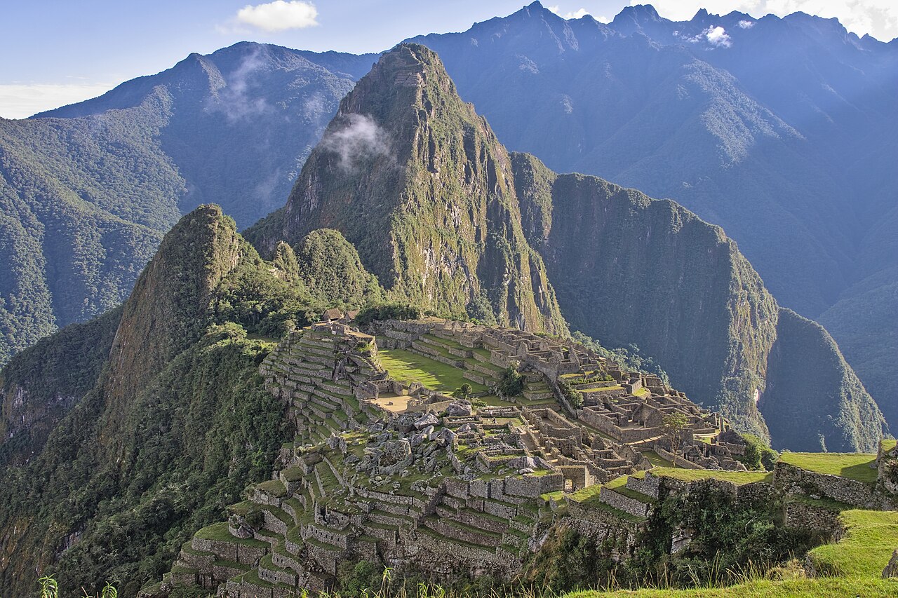
Four days on original Inca stone paths over high passes and past cloud-forest ruins, arriving at Machu Picchu through the Sun Gate at dawn.

The Classic Inca Trail to Machu Picchu
صورة: Draceane · CC BY-SA 4.0
المدة
4 أيام
المسافة
42 km
الصعود
2500 m
مستوى الصعوبة
صعب
أفضل موسم
Dry season May–September (trail closed every February)

The Inca Trail is less a hike than a pilgrimage along a road the Inca built more than five centuries ago. Over four days it climbs from the Urubamba river through cloud forest and puna grassland, crosses two high passes, and passes a string of stone ruins before delivering you to Machu Picchu on foot — the way it was meant to be reached.

Altitude is the real challenge, so build in days to acclimatize in Cusco first.

Getting there. Fly to Cusco via Lima and acclimatize for at least two days. Your operator drives you to the trailhead at Km 82 (Piscacucho) near Ollantaytambo. You return by train from Aguas Calientes.

Permits & tickets. A government permit is required and capped at 500 people per day total (about 200 trekkers). You must book through a licensed operator — independent trekking is prohibited — and permits sell out 4–6 months ahead. Bring the passport that matches your permit.

Good to know:

اليوم 1

Km 82 to Wayllabamba

Piscacucho (Km 82) → Wayllabamba 12 km ↑ 400 m
التنقّل في هذا اليوم

An easy start with early ruins and a first climb to camp, following the river before turning up the Cusichaca valley.

مقاطع

  1. Riverside warm-up 7 km ↑ 100 m 📍 خريطة

    Km 82 checkpoint → Patallacta viewpoint

    River path

    Follow the river on an easy grade past the hilltop fort of Huillca Raccay to a viewpoint over the sweeping agricultural terraces of Patallacta. About 3 hours.

  2. Climb to first camp 5 km ↑ 300 m 📍 خريطة

    Patallacta → Wayllabamba

    Valley climb

    Turn up the Cusichaca valley on a steady climb to Wayllabamba, the last inhabited village on the route and the usual first night's camp.
اليوم 2

Dead Woman's Pass

Wayllabamba → Pacaymayo 11 km ↑ 1200 m
التنقّل في هذا اليوم

A long, steady climb out of the cloud forest to the highest point of the trail, then a steep stone descent to camp.

مقاطع

  1. Ascent to the high pass 6 km ↑ 1200 m 📍 خريطة

    Wayllabamba → Dead Woman's Pass (4,215 m)

    Cloud forest to puna grassland

    Climb out of the cloud forest into open puna grassland to Warmiwañusca, at 4,215 m the highest and most demanding point of the whole trail. Around 4 hours.

  2. Descent to Pacaymayo 5 km ↑ 0 m 📍 خريطة

    Dead Woman's Pass → Pacaymayo camp

    Steep Inca staircase

    Drop steeply down an original Inca staircase into the Pacaymayo valley, where the second night's camp waits below the pass. About 2 hours.

اليوم 3

The archaeological day

Pacaymayo → Wiñay Wayna 16 km ↑ 400 m
التنقّل في هذا اليوم

Cross a second pass and thread a series of stone ruins before a long descent into cloud forest to the final camp.

مقاطع

  1. Runkurakay pass
    Runkurakay pass 4 km ↑ 350 m 📍 خريطة

    Pacaymayo → Runkurakay pass (~3,950 m)

    Stone path

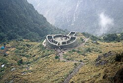
    Climb past the circular ruin of Runkurakay, an Inca way-station, to the second pass of the trek. About 2.5 hours.

    عن هذا المكان

    Runkuraqay or Runku Raqay is an archaeological site on a mountain of the same name in Peru located in the Cusco Region, Urubamba Province, Machupicchu District. It is situated southeast of the archaeological site Machu Picchu and south of the Vilcanota river. The ruins lie on the southern slope of the mountain Runkuraqay near the Runkuraqay pass, northeast of the archaeological site Sayacmarca and southeast of the site Qunchamarka.

    اقرأوا المزيد في ويكيبيديا ↗

    صورة: Tyler Bell · CC BY 2.0

  2. Sayacmarca & Phuyupatamarca
    Sayacmarca & Phuyupatamarca 6 km ↑ 50 m 📍 خريطة

    Runkurakay pass → Phuyupatamarca (~3,650 m)

    Original Inca paving and tunnel

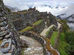
    Pass the cliff-top citadel of Sayacmarca and reach Phuyupatamarca, the 'town above the clouds', with its ritual baths, original paving and a rock-cut tunnel.

    عن هذا المكان

    Sayacmarca is an archaeological site in Peru located in the Cusco Region, Urubamba Province, Machupicchu District. It is situated southwest of the archaeological site Runkuraqay and the Runkuraqay pass and southeast of the sites Phuyupatamarka and Qunchamarka.

    اقرأوا المزيد في ويكيبيديا ↗

    صورة: Mx._Granger · CC0

  3. Descent to Wiñay Wayna
    Descent to Wiñay Wayna 6 km ↑ 0 m 📍 خريطة

    Phuyupatamarca → Wiñay Wayna

    Long staircase into cloud forest

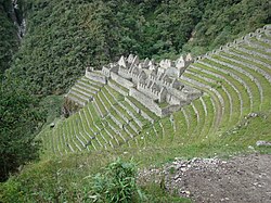
    A long staircase drops into cloud forest to Wiñay Wayna — 'forever young' — a beautiful terraced ruin with cascading fountains and the final camp.

    عن هذا المكان

    Wiñay Wayna is an Inca ruin along the Inca Trail to Machu Picchu. It is built into a steep hillside overlooking the Urubamba River. The site consists of upper and lower house complexes connected by a staircase and fountain structures. Above and below the houses the people built areas of agricultural terraces or andenes, which are still visible.

    اقرأوا المزيد في ويكيبيديا ↗

    صورة: Chris Smith · CC BY 2.0

اليوم 4

Sun Gate to Machu Picchu

Wiñay Wayna → Machu Picchu 6 km ↑ 250 m
التنقّل في هذا اليوم

Set off in the dark to reach Inti Punku for sunrise, then walk down into Machu Picchu itself.

مقاطع

  1. Pre-dawn walk to the Sun Gate 5 km ↑ 250 m 📍 خريطة

    Wiñay Wayna checkpoint → Inti Punku (Sun Gate)

    Inca path, final steep steps

    Set off in the dark and climb the final 'Monkey Steps' to Inti Punku, the Sun Gate, for the classic first sight of Machu Picchu at sunrise. About 2 hours.

  2. Descent into Machu Picchu 1 km ↑ 0 m 📍 خريطة

    Inti Punku → Machu Picchu citadel

    Stone path

    Walk down to the classic postcard viewpoint and into the citadel for a guided tour of the site you have spent four days earning.

Comments