← كل المسارات
جولة في المدينة Haifa — Mount Carmel, Israel

Haifa: The Baháʼí Terraces, the German Colony and Wadi Nisnas

One downhill day across Mount Carmel — nineteen garden terraces, a golden shrine, a Templer boulevard, an Arab market quarter, and a cable car back to the sea.

Haifa: The Baháʼí Terraces, the German Colony and Wadi Nisnas
صورة: Arash Hashemi · CC BY-SA 3.0
المدة
1 أيام
المسافة
5 km
مستوى الصعوبة
سهل
أفضل موسم
March–May and October–November

Haifa is a city best read from top to bottom. It falls in tiers down the northern nose of Mount Carmel to the bay, and the Baháʼí Terraces — nineteen of them, cut in a single green stripe from the ridge to the harbour — make that geography impossible to miss. This route follows the mountain’s own logic: start at the top, let gravity do the work, and finish at the water.

Along the way the city changes character every few hundred metres. The manicured symmetry of the terraces gives way to the Templer stonework of the German Colony, then to the alleys of Wadi Nisnas, where the smell of za’atar and coffee replaces the smell of cut grass. Haifa’s reputation as Israel’s most quietly mixed city is not a slogan you read on a sign; it is something you walk through.

Getting there. The top entrance sits on Yefe Nof Street (Louis Promenade), reachable by bus from Merkaz HaCarmel or by the Carmelit funicular from the lower city. Coming from Tel Aviv, the train to Haifa Hof HaCarmel or Merkaz HaShmona takes about an hour.

Permits & tickets. Entry to the Baháʼí Gardens is free. The full walk down the terraces is only possible on a free guided tour that leaves at set times from the top entrance — typically late morning in Hebrew and around midday in English, first come, first served, and the gardens are usually closed to tours one day a week. Arrive about half an hour early and check the current schedule before you go. Without the tour you can still visit the top observation terrace and the shrine area on your own.

Good to know:

اليوم 1

From the ridge to the sea

Louis Promenade (Yefe Nof Street) → Bat Galim beach 5 km
التنقّل في هذا اليوم

A single top-to-bottom line across Haifa: gardens, shrine, boulevard, market quarter, monastery, cable car.

مقاطع

  1. The top terrace & Louis Promenade 0.6 km 📍 خريطة

    Merkaz HaCarmel → Baháʼí Gardens upper entrance

    Paved promenade

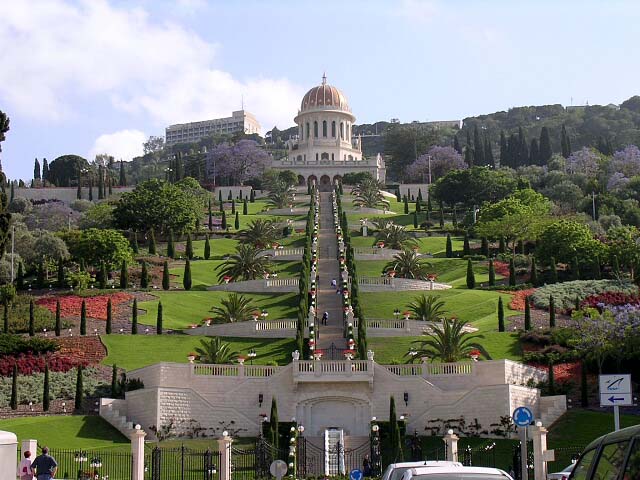
    Start on the Louis Promenade, where the whole route lays itself out below you — the terraces dropping away in a straight green line, the port, the bay curving north to Akko. The gardens were completed in 2001 and climb the mountain in nineteen terraces. This is the viewpoint every photograph of Haifa is taken from, and it is free. Allow about 30 minutes, or longer if you are waiting for the tour.

  2. Down the terraces to the Shrine of the Báb
    Down the terraces to the Shrine of the Báb 1 km 📍 خريطة

    Baháʼí Gardens upper entrance → Shrine of the Báb

    Garden stairs and gravel paths

    The heart of the day, and the part that needs the free guided tour. You descend through terrace after terrace of clipped hedges, red gravel, fountains and cypresses to the central terrace, where the golden-domed Shrine of the Báb holds the remains of the founder of the Bábí Faith. The dome looks north across the bay. It is startlingly quiet for a place in the middle of a working port city. About 60 minutes on the tour.

    عن هذا المكان

    The Shrine of the Báb is a structure on the slopes of Mount Carmel in Haifa, Israel, where the remains of the Báb, founder of the Bábí Faith and forerunner of Baháʼu'lláh in the Baháʼí Faith, are buried; it is considered to be the second holiest place on Earth for Baháʼís, after the Shrine of Baháʼu'lláh in Acre. Its precise location on Mount Carmel was designated by Baháʼu'lláh himself to his eldest son, ʻAbdu'l-Bahá, in 1891. ʻAbdu'l-Bahá planned the structure, which was designed and completed several years later by his grandson, Shoghi Effendi.

    اقرأوا المزيد في ويكيبيديا ↗

    صورة: This picture has been taken, uploaded and the copyright owned by Tom Habibi, but released in the licences below. Shrine · CC BY-SA 3.0

  3. The German Colony
    The German Colony 0.8 km 📍 خريطة

    Baháʼí Gardens lower gate → Ben Gurion Boulevard

    City streets

    Step out of the lower gate and straight onto Ben Gurion Boulevard, which is aligned with the shrine on purpose — turn around and the gardens rise directly up the axis of the street. The colony was founded in 1868 by German Templers, and their low stone houses with pitched red roofs and carved German inscriptions above the doors are still the buildings you are walking between, now filled with restaurants and cafés. A good place to eat. About 45 minutes.

    عن هذا المكان

    The German Colony is an area of Haifa established in 1868 as a Christian German Templer Colony in Ottoman Palestine. It was the first of several colonies established by the group in the Holy Land. Others were founded in Sarona near Jaffa, Galilee and Jerusalem. Some of the original buildings are still surviving today, and the area continues to be visited, lived in, and in use.

    اقرأوا المزيد في ويكيبيديا ↗

    صورة: StateofIsrael · CC BY-SA 2.0

  4. Wadi Nisnas
    Wadi Nisnas 0.9 km 📍 خريطة

    Ben Gurion Boulevard → Wadi Nisnas market

    Narrow streets and stairs

    Cross into the Arab quarter of Haifa, a neighbourhood of about 8,000 people and the least touristed stop on this walk. The market streets are tight, loud and genuinely local — produce, spices, hummus counters that have been arguing over who is best for decades. Sculptures and murals are set into the walls and alleys as part of an open-air 'Museum without Walls'. In December the quarter hosts the Holiday of Holidays festival, marking Hanukkah, Christmas and Ramadan together. About 45 minutes.

    عن هذا المكان

    Wadi Nisnas is a predominantly Arab neighborhood in the city of Haifa, with a population of about 8,000 inhabitants.

    اقرأوا المزيد في ويكيبيديا ↗

    صورة: Deror avi · CC BY-SA 3.0

  5. Up to Stella Maris
    Up to Stella Maris 1.4 km 📍 خريطة

    Wadi Nisnas → Stella Maris Monastery

    City streets and stairs (uphill)

    The one real climb of the day, onto the western shoulder of the Carmel. The Stella Maris Monastery belongs to the Discalced Carmelite friars, the order that took its name from this mountain, and its painted dome and quiet church face the sea rather than the city. Elijah's Cave, associated with the prophet and venerated by Jews, Christians, Muslims and Druze alike, is on the slope below. About 45 minutes including the climb.

    عن هذا المكان

    The Stella Maris Monastery is a Catholic Christian monastery for Discalced Carmelite friars, located on the slopes of Mount Carmel in Haifa, Israel.

    اقرأوا المزيد في ويكيبيديا ↗

    صورة: זאב שטיין · CC BY 2.5

  6. The cable car down to Bat Galim
    The cable car down to Bat Galim 0.4 km 📍 خريطة

    Stella Maris Monastery → Bat Galim beach

    Aerial cable car

    Finish the way the mountain wants you to: in a spherical cabin dangling off the cliff. The Bat Galim cable car has run since 1986, drops about 355 metres of route from opposite the monastery down to the shore, and gives you the bay, the port and the whole descent you just walked in one long window. Step out at the bottom onto the beach. About 15 minutes.
    عن هذا المكان

    The Bat Galim cable car is tourist cable car running up and down the mountain from the top of the Carmel, across from the Stella Maris Carmelite Monastery, to Bat Galim, with views of Haifa Bay and its surroundings. The cable car began operating in 1986. The route is 355 meters long.

    اقرأوا المزيد في ويكيبيديا ↗

    صورة: Gilabrand at English Wikipedia · CC BY-SA 3.0

Comments