← كل المسارات
رحلة مشي Gandaki Province — Annapurna Conservation Area, Nepal

Annapurna Base Camp — the Sanctuary Trek

Seven days from terraced Gurung villages up a hidden gorge into the Annapurna Sanctuary, an amphitheatre of 7,000-metre peaks closing a full circle around base camp at 4,130 m.

Annapurna Base Camp — the Sanctuary Trek
صورة: Nancy Collins · CC BY-SA 3.0
المدة
7 أيام
المسافة
90 km
الصعود
5000 m
مستوى الصعوبة
صعب
أفضل موسم
October–November and March–April (avoid the June–September monsoon and deep winter snow above Deurali)

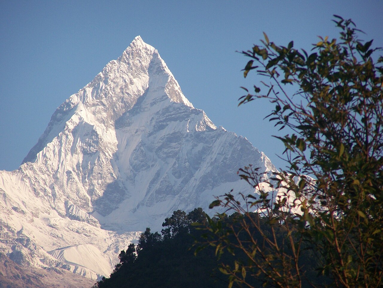
The Annapurna Sanctuary is a high oval basin about 40 km north of Pokhara, ringed almost completely by the peaks of the Annapurna range. There is only one way in: a narrow gorge between Hiunchuli and the sacred fishtail summit of Machapuchare, carved by the Modi Khola. You walk up that gorge for days, hemmed in by walls, and then the valley simply opens — and you are standing inside a ring of mountains with base camp at 4,130 m at its centre.

Unlike a pass trek, the Sanctuary is a dead end, and that is the point. You go in, you sleep inside the ring, and you come back out the same way.

Getting there. Fly or drive to Pokhara, then take a jeep to the roadhead at Nayapul or Siwai. Most trekkers return by jeep from Jhinu Danda or Siwai to Pokhara on the last day.

Permits. You need an ACAP (Annapurna Conservation Area Permit) and a TIMS card, both issued in Pokhara or Kathmandu before you start. Carry passport photos. Teahouses run the whole way, so no tent or stove is needed.

Good to know:

اليوم 1

Nayapul to Ghandruk

Nayapul (1,070 m) → Ghandruk (about 1,940 m) 10 km ↑ 900 m
التنقّل في هذا اليوم

Leave the roadhead and climb steadily beside the Modi Khola through rice terraces and villages to Ghandruk, one of the biggest Gurung settlements in the region.

مقاطع

  1. Up the Modi Khola
    Up the Modi Khola 6 km ↑ 400 m 📍 خريطة

    Nayapul roadhead → Kimche

    River trail and jeep track

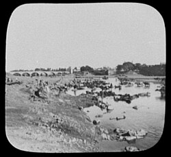
    Follow the milky Modi Khola upstream on an easy grade through Birethanti, past subtropical terraces and suspension bridges. Hot and low — this is the last of the easy walking.

    عن هذا المكان

    Nayapul is a neighbourhood of Hyderabad, Telangana, India. It gets its name from the bridge that was built during the time of the Nizams called as Nayapul because there was already another bridge called Puaranapul.

    اقرأوا المزيد في ويكيبيديا ↗

    صورة: William Henry Jackson · Public domain

  2. Stone stairs to Ghandruk
    Stone stairs to Ghandruk 4 km ↑ 500 m 📍 خريطة

    Kimche → Ghandruk

    Stone staircase

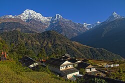
    A long flight of stone steps climbs to Ghandruk, a slate-roofed Gurung village stacked on the hillside. On a clear evening Annapurna South and Machapuchare stand directly above the rooftops.

    عن هذا المكان

    Ghandruk is a picturesque traditional village nestled in the Annapurna Rural Municipality, Kaski District of the Gandaki Province of Nepal. Situated 32 km north-west to Pokhara, this traditional Gurung settlement sits at an elevation of 2,012 meters (6,601 ft) and serves as a key stop on several iconic trekking routes, including the Annapurna Base Camp and Annapurna Circuit treks.

    اقرأوا المزيد في ويكيبيديا ↗

    صورة: Bijaya2043 · CC BY-SA 3.0
اليوم 2

Ghandruk to Chhomrong

Ghandruk (about 1,940 m) → Chhomrong (about 2,170 m) 10 km ↑ 900 m
التنقّل في هذا اليوم

A day of losing height to gain it back, ending at Chhomrong — the last real village and the checkpoint at the mouth of the Sanctuary trail.

مقاطع

  1. Drop to the Kimrong Khola
    Drop to the Kimrong Khola 4 km ↑ 50 m 📍 خريطة

    Ghandruk → Kimrong Khola bridge

    Steep forest descent

    A steep, knee-testing descent through rhododendron forest to a bridge over the Kimrong Khola. Everything you lose here you climb straight back.

    عن هذا المكان

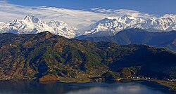
    Annapurna Conservation Area is Nepal's largest protected area covering 7,629 km2 (2,946 sq mi) in the Annapurna range of the Himalayas. It ranges in elevation from 790 m (2,590 ft) to the peak of Annapurna I at 8,091 m (26,545 ft). The conservation area stretches across Manang, Mustang, Kaski, Myagdi, and Lamjung Districts. Annapurna Conservation Area encompasses Annapurna Sanctuary and is known for several trekking routes including the Annapurna Circuit.

    اقرأوا المزيد في ويكيبيديا ↗

    صورة: Jean-Marie Hullot · CC BY-SA 3.0

  2. Climb to Chhomrong
    Climb to Chhomrong 6 km ↑ 850 m 📍 خريطة

    Kimrong Khola → Chhomrong

    Long climb, then a traverse

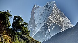
    Climb hard over the Kimrong Danda and traverse to Chhomrong, a village of stepped stone terraces facing the Sanctuary entrance. This is where the fishtail of Machapuchare first fills the skyline.

    عن هذا المكان

    Machapuchare, Machhapuchchhre or Machhapuchhre, is a mountain situated in the Annapurna massif of Gandaki Province, north-central Nepal. Its highest peak has never been officially climbed due to the impossibility of gaining a permit from the government of Nepal.

    اقرأوا المزيد في ويكيبيديا ↗

    صورة: Carsten.nebel · CC BY-SA 4.0

اليوم 3

Chhomrong to Bamboo

Chhomrong (about 2,170 m) → Bamboo (about 2,310 m) 11 km ↑ 700 m
التنقّل في هذا اليوم

Down some 2,500 stone steps to the Chhomrong Khola, up the other side to Sinuwa, then into the deep forest of the gorge itself.

مقاطع

  1. The Chhomrong staircase 5 km ↑ 500 m 📍 خريطة

    Chhomrong → Sinuwa (about 2,360 m)

    Endless stone steps, down then up

    Descend a famously long stone staircase to the river at about 1,900 m, cross the suspension bridge, and grind straight back up to Sinuwa. Trekkers talk about these steps for years afterwards — and you get them again on the way home.

  2. Into the bamboo forest
    Into the bamboo forest 6 km ↑ 200 m 📍 خريطة

    Sinuwa → Bamboo

    Damp forest trail

    Contour and drop through dense bamboo and rhododendron to the cluster of lodges called Bamboo, wedged in the bottom of the gorge. Damp, green and closed-in — the walls are rising on both sides now.

    عن هذا المكان

    Annapurna Conservation Area is Nepal's largest protected area covering 7,629 km2 (2,946 sq mi) in the Annapurna range of the Himalayas. It ranges in elevation from 790 m (2,590 ft) to the peak of Annapurna I at 8,091 m (26,545 ft). The conservation area stretches across Manang, Mustang, Kaski, Myagdi, and Lamjung Districts. Annapurna Conservation Area encompasses Annapurna Sanctuary and is known for several trekking routes including the Annapurna Circuit.

    اقرأوا المزيد في ويكيبيديا ↗

    صورة: Jean-Marie Hullot · CC BY-SA 3.0

اليوم 4

Bamboo to Deurali

Bamboo (about 2,310 m) → Deurali (about 3,200 m) 10 km ↑ 900 m
التنقّل في هذا اليوم

The gorge narrows and steepens. Waterfalls come off both walls, the forest thins, and by Deurali you are above the treeline in cold, thin air.

مقاطع

  1. Dovan and Himalaya 6 km ↑ 600 m 📍 خريطة

    Bamboo → Himalaya (about 2,920 m)

    Forest trail beside the river

    Climb through Dovan (about 2,600 m) and on to the lodges at Himalaya, with the Modi Khola roaring below and waterfalls dropping from the cliffs above.

  2. Above the treeline
    Above the treeline 4 km ↑ 300 m 📍 خريطة

    Himalaya → Deurali

    Rocky trail, avalanche slopes

    Pass the Hinku Cave and climb out of the last trees into open rock and scrub at Deurali. This is where altitude starts to be felt and where the avalanche-prone section ahead begins — check conditions at the lodge.

    عن هذا المكان

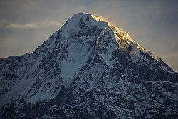
    Hiunchuli is a peak situated in the Annapurna massif of the Gandaki Province in north-central Nepal. The mountain is an extension of the Annapurna South. Between this peak and the Machapuchare is a narrow section of the Modi Khola valley that constitutes the sole access to the Annapurna Sanctuary.

    اقرأوا المزيد في ويكيبيديا ↗

    صورة: Saroj Pandey · CC BY-SA 3.0

اليوم 5

Deurali to Annapurna Base Camp

Deurali (about 3,200 m) → Annapurna Base Camp (4,130 m) 9 km ↑ 950 m
التنقّل في هذا اليوم

A short but high day. The walls pull back, the valley flattens into moraine, and you walk into a complete ring of 7,000-metre peaks.

مقاطع

  1. The gorge gate to MBC
    The gorge gate to MBC 4 km ↑ 500 m 📍 خريطة

    Deurali → Machhapuchhre Base Camp (about 3,700 m)

    Moraine and avalanche paths

    Cross the slide paths early in the day and climb through the narrow gate between Hiunchuli and Machapuchare to Machhapuchhre Base Camp. The sacred fishtail summit above you has never been climbed — it is closed by law.

    عن هذا المكان

    Machapuchare, Machhapuchchhre or Machhapuchhre, is a mountain situated in the Annapurna massif of Gandaki Province, north-central Nepal. Its highest peak has never been officially climbed due to the impossibility of gaining a permit from the government of Nepal.

    اقرأوا المزيد في ويكيبيديا ↗

    صورة: Carsten.nebel · CC BY-SA 4.0

  2. Into the Sanctuary
    Into the Sanctuary 5 km ↑ 450 m 📍 خريطة

    Machhapuchhre Base Camp → Annapurna Base Camp

    Open moraine, often snow

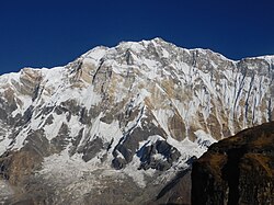
    A slow, breathless walk up open moraine as the amphitheatre closes around you. Base camp sits at 4,130 m under the vast south face of Annapurna I, with the ring of peaks turning gold at sunset and pink again at dawn.

    عن هذا المكان

    Annapurna is a mountain situated in the Annapurna mountain range of Gandaki Province, north-central Nepal. It is the 10th highest mountain in the world at 8,091 metres (26,545 ft) above sea level and is well known for the difficulty and danger involved in its ascent.

    اقرأوا المزيد في ويكيبيديا ↗

    صورة: PrajwalMohan · CC BY-SA 4.0

اليوم 6

Sunrise at base camp, then down to Bamboo

Annapurna Base Camp (4,130 m) → Bamboo (about 2,310 m) 20 km ↑ 150 m
التنقّل في هذا اليوم

Up in the cold for sunrise on Annapurna I, then a long descent back out through the gorge to the forest.

مقاطع

  1. First light on Annapurna 5 km ↑ 0 m 📍 خريطة

    Annapurna Base Camp → Machhapuchhre Base Camp

    Moraine

    Stand out in the freezing dark until the sun catches the south face of Annapurna I and works its way down the ring, then walk back down the moraine as the Sanctuary warms up.

  2. Back down the gorge
    Back down the gorge 15 km ↑ 150 m 📍 خريطة

    Machhapuchhre Base Camp → Bamboo

    Rock, then forest trail

    Retrace the route through Deurali, Himalaya and Dovan. Descending is fast but hard on the knees — poles earn their keep here.

    عن هذا المكان

    Annapurna Conservation Area is Nepal's largest protected area covering 7,629 km2 (2,946 sq mi) in the Annapurna range of the Himalayas. It ranges in elevation from 790 m (2,590 ft) to the peak of Annapurna I at 8,091 m (26,545 ft). The conservation area stretches across Manang, Mustang, Kaski, Myagdi, and Lamjung Districts. Annapurna Conservation Area encompasses Annapurna Sanctuary and is known for several trekking routes including the Annapurna Circuit.

    اقرأوا المزيد في ويكيبيديا ↗

    صورة: Jean-Marie Hullot · CC BY-SA 3.0

اليوم 7

Bamboo to Jhinu Danda and out

Bamboo (about 2,310 m) → Jhinu Danda (about 1,780 m) / Siwai roadhead 20 km ↑ 500 m
التنقّل في هذا اليوم

A final morning of stone steps, a soak in riverside hot springs, and the road home.

مقاطع

  1. The staircase, in reverse 11 km ↑ 500 m 📍 خريطة

    Bamboo → Chhomrong

    Down to the river, up the steps

    Climb back to Sinuwa, drop to the Chhomrong Khola and haul up the long staircase into Chhomrong for the last time. Order the cinnamon roll — you have earned it.

  2. Hot springs and the road
    Hot springs and the road 9 km ↑ 0 m 📍 خريطة

    Chhomrong → Jhinu Danda / Siwai

    Descending village trail

    Descend to Jhinu Danda and walk twenty minutes down to the natural hot springs on the bank of the Modi Khola. From Jhinu or the roadhead at Siwai, a jeep takes you back to Pokhara.

    عن هذا المكان

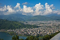
    Pokhara is a metropolitan city located in central Nepal, which serves as the capital of Gandaki Province. Named the country's "capital of tourism" it is the second largest city after Kathmandu, with 600,051 inhabitants living in 120,594 households as of 2021 census.

    اقرأوا المزيد في ويكيبيديا ↗

    صورة: Utsab Raj Giri · CC BY-SA 4.0

Comments