← All routes
Trek Corsica — Haute-Corse, France

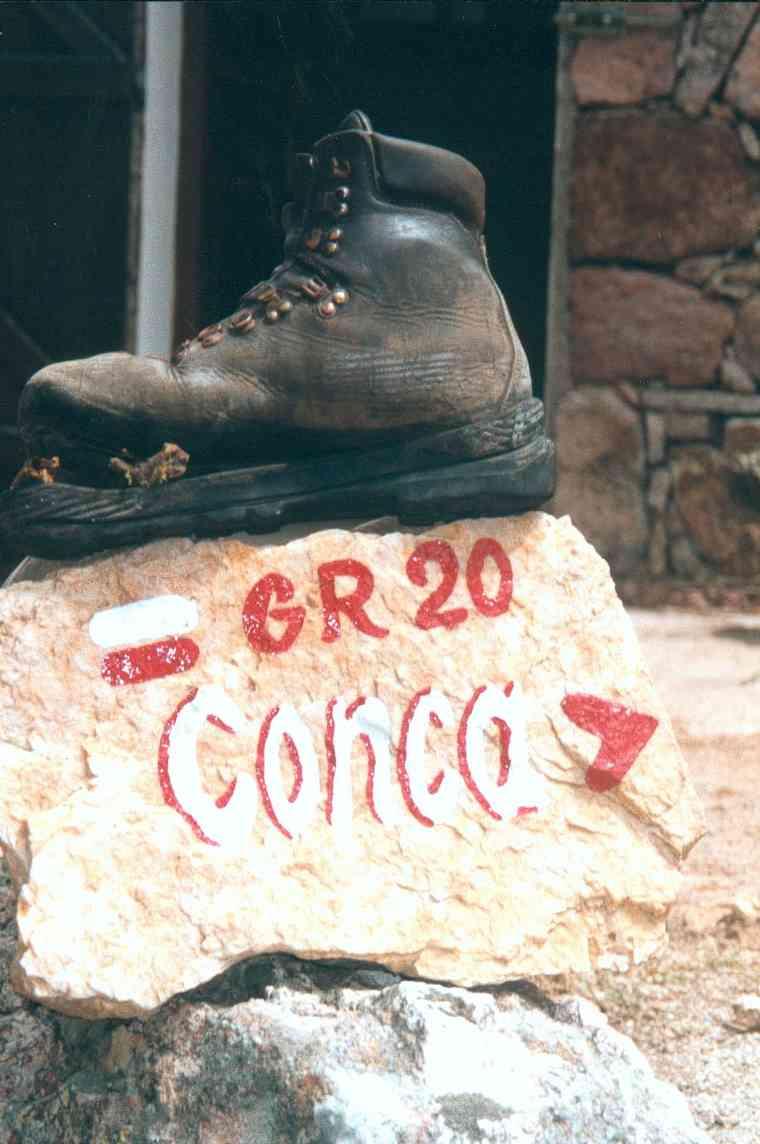
GR20 North — Calenzana to Vizzavona

Six demanding days across the granite spine of northern Corsica, from the maquis above Calenzana over the Monte Cinto massif and past Lac de Nino to the forests of Vizzavona.

GR20 North — Calenzana to Vizzavona
Photo: User:Tcherome · Public domain
Duration
6 days
Distance
98 km
Ascent
6450 m
Difficulty
Expert
Best season
Mid-June to September (snow lingers on the high passes into early summer)

The GR20 is routinely called Europe’s toughest waymarked trail, and its northern half holds the hardest of it. This highlights itinerary compresses the classic refuge-to-refuge stages between Calenzana and Vizzavona into six long days of scrambling over granite ridges, crossing high cols on chained rock, and camping beneath some of Corsica’s most dramatic peaks.

This is high-mountain terrain, not a gentle long-distance path. You need sure footing, a head for exposure, and real hill fitness.

Getting there. Fly to Bastia, Calvi or Ajaccio. Calenzana, the northern trailhead, is a short taxi or bus ride from Calvi. Vizzavona sits on the Ajaccio–Bastia railway, so you can finish and step straight onto a train.

Refuges & camping. The route is served by staffed PNRC refuges and gîtes where you can sleep in a dormitory, pitch a tent, or hire one. Book bunks ahead in July and August; carry food for the long central stages where resupply is thin.

Good to know:

Day 1

Calenzana to Ortu di u Piobbu

Calenzana → Refuge d'Ortu di u Piobbu 12 km ↑ 1470 m
Navigate this day

The trail leaves the village of Calenzana and climbs almost without pause through scented maquis and pine into high pasture, gaining nearly 1,500 m to the first refuge.

Segments

  1. Into the maquis 5 km ↑ 900 m 📍 Map

    Calenzana → Bocca a u Saltu

    Maquis scrub and pine

    Climb steadily out of Calenzana through fragrant maquis scrub and Corsican pine to the pass of Bocca a u Saltu, with the coast falling away behind you. About 3 hours.

  2. Traverse to the first refuge 7 km ↑ 570 m 📍 Map

    Bocca a u Saltu → Refuge d'Ortu di u Piobbu

    High mountain path

    Contour beneath Capu Ladroncellu on a rocky path to Refuge d'Ortu di u Piobbu, set on a shoulder at around 1,570 m with the first night's camp.
Day 2

Ortu di u Piobbu to Carrozzu

Refuge d'Ortu di u Piobbu → Refuge de Carrozzu 7 km ↑ 780 m
Navigate this day

Climb to the col of Bocca Piccaia and follow an airy ridge before a long, rough descent through forest to the refuge at Carrozzu.

Segments

  1. Bocca Piccaia ridge 4 km ↑ 650 m 📍 Map

    Refuge d'Ortu di u Piobbu → Bocca Piccaia

    Granite ridge

    Climb to Bocca Piccaia and traverse a rugged ridge with big views over the Filosorma valley, an early taste of the exposure that defines the northern GR20.

  2. Descent to Carrozzu 3 km ↑ 130 m 📍 Map

    Bocca Piccaia → Refuge de Carrozzu

    Steep rocky descent

    Drop steeply on loose rock and through laricio pine to Refuge de Carrozzu, tucked in the forest above the Spasimata stream. About 2.5 hours down.

Day 3

Carrozzu to Haut Asco

Refuge de Carrozzu → Haut Asco (Ascu Stagnu) 6 km ↑ 790 m
Navigate this day

One of the signature days of the north: a suspension footbridge, polished granite slabs, and a high col before dropping to the old ski station of Haut Asco.

Segments

  1. Spasimata footbridge and slabs 3 km ↑ 400 m 📍 Map

    Refuge de Carrozzu → Lac de la Muvrella

    Granite slabs, chains and cable

    Cross the Passerelle de Spasimata, a swaying suspension bridge, then climb the famous smooth granite slabs — fitted with chains — past the small Lac de la Muvrella.

  2. Bocca di a Muvrella to Haut Asco 3 km ↑ 390 m 📍 Map

    Bocca di a Muvrella → Haut Asco (Ascu Stagnu)

    High col and rocky descent

    Cross the col of Bocca di a Muvrella with a first view of Monte Cinto, then descend rocky ground to Haut Asco, a small station and refuge in the valley.

Day 4

The Monte Cinto crossing

Haut Asco (Ascu Stagnu) → Refuge de Ciottulu di i Mori 19 km ↑ 1300 m
Navigate this day

The crux of the northern GR20. The modern route climbs to the Pointe des Éboulis below Monte Cinto — the high point of the whole trail — replacing the notorious Cirque de la Solitude that collapsed in a 2015 rockfall, then descends past Tighjettu to camp below Paglia Orba.

Segments

  1. Up to the Pointe des Éboulis
    Up to the Pointe des Éboulis 6 km ↑ 900 m 📍 Map

    Haut Asco → Pointe des Éboulis (~2,607 m)

    Steep scree and rock scramble

    A long, exposed climb over scree and rock to the Pointe des Éboulis, at about 2,607 m the highest point of the GR20, on the shoulder of Monte Cinto (2,706 m), the highest peak in Corsica.

    About this place

    Monte Cinto is the highest mountain on the island of Corsica, a region of France.

    Read more on Wikipedia ↗

    Photo: Ceky · CC BY-SA 3.0

  2. Descent to Tighjettu 5 km ↑ 100 m 📍 Map

    Pointe des Éboulis → Refuge de Tighjettu

    Steep chained descent

    Drop steeply on chained rock and scree to Refuge de Tighjettu and the nearby Auberge U Vallone, a welcome halt after the high crossing.

  3. Climb to Ciottulu di i Mori
    Climb to Ciottulu di i Mori 8 km ↑ 300 m 📍 Map

    Refuge de Tighjettu → Refuge de Ciottulu di i Mori

    Valley path

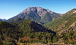
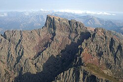
    Follow the Viru valley upstream to Refuge de Ciottulu di i Mori at around 1,990 m, perched beneath the great fang of Paglia Orba, one of the highest refuges on the trail.

    About this place

    The Paglia Orba is a mountain peak in the Monte Cinto Massif in Corsica. It rises to an altitude of 2,525 metres (8,284 ft), between the valleys of the Golo and the Cavicchia. Relatively isolated, this peak, notable for its characteristic tooth-shaped silhouette, dominates the Fango Valley and the west coast of the island.

    Read more on Wikipedia ↗

    Photo: Original uploader was Ceky at fr.wikipedia · CC BY-SA 3.0

Day 5

Ciottulu di i Mori to Manganu

Refuge de Ciottulu di i Mori → Refuge de Manganu 24 km ↑ 710 m
Navigate this day

Descend to the Castel di Vergio saddle, then cross open plateau to Lac de Nino, the beautiful high lake ringed by pozzines, before continuing to Refuge de Manganu.

Segments

  1. Down to Castel di Vergio 8 km ↑ 100 m 📍 Map

    Refuge de Ciottulu di i Mori → Castel di Vergio

    Forest descent

    A long descent through the Valdu Niellu pine forest to the pass and small resort of Castel di Vergio, the lowest point of this stretch and a resupply stop.

  2. Lac de Nino and the pozzines
    Lac de Nino and the pozzines 8 km ↑ 350 m 📍 Map

    Castel di Vergio → Lac de Nino

    Open mountain plateau

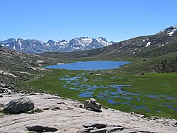
    Climb to Lac de Nino at about 1,760 m, the source of the Tavignano river, whose shores are laced with pozzines — grassy hollows and streams grazed by half-wild horses and pigs.

    About this place

    Lac de Nino is a lake in Haute-Corse, France. At an elevation of 1743 m, its surface area is 0.065 km².

    Read more on Wikipedia ↗

    Photo: Francis THOMAS · CC BY-SA 3.0

  3. Camputile to Manganu 8 km ↑ 260 m 📍 Map

    Lac de Nino → Refuge de Manganu

    Plateau and stream crossings

    Cross the wide plateau du Camputile, fording streams, to Refuge de Manganu at around 1,600 m below the Rotondo massif.

Day 6

Manganu to Vizzavona

Refuge de Manganu → Vizzavona 30 km ↑ 1400 m
Navigate this day

The compressed finish links the high balcony above Lac de Capitellu and Lac de Melu with the ridges of Petra Piana and Onda, before a long forest descent past the Cascades des Anglais to Vizzavona and its train station.

Segments

  1. Brèche de Capitellu and the lakes 8 km ↑ 700 m 📍 Map

    Refuge de Manganu → Bocca alle Porte

    Steep chained climb to a col

    Climb steeply to Bocca alle Porte (the Brèche de Capitellu) at around 2,225 m, with one of the finest views on the trail down to the glacial lakes of Capitellu and Melu.

  2. Petra Piana to Onda 10 km ↑ 400 m 📍 Map

    Bocca alle Porte → Refuge de l'Onda

    High ridge and traverse

    Traverse the high ground past Refuge de Petra Piana and along the ridge, then descend to the pastoral bergerie and refuge of l'Onda.

  3. Descent to Vizzavona
    Descent to Vizzavona 12 km ↑ 300 m 📍 Map

    Refuge de l'Onda → Vizzavona

    Beech forest and river path

    A long descent through beech and laricio forest past the Cascades des Anglais, a chain of pools and waterfalls, to the village of Vizzavona and its railway station — the end of the north.

    About this place

    Vizzavona is a village of the commune of Vivario in the Haute-Corse department of France on the island of Corsica at an altitude of 900 meters. The village is dominated by Monte d'Oro (2389m).

    Read more on Wikipedia ↗

    Photo: Pierre Bona · CC BY-SA 3.0