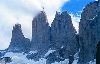
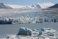
מהמקטע המזרחי, טפסו בעמק אסנסיו אל האגם הקרחוני שמתחת לטורס דל פאינה עצמם, ואז חזרו באותה דרך אל המחנה.
מקטעים
-
 במעלה עמק אסנסיו
רפוחיו סנטרל ← רפוחיו צ'ילנו
רכס סוער ועמק נהר
טפסו את 'מעבר הרוח' החשוף מעל נהר אסנסיו, ואז עקפו אל תוך העמק המוגן עד רפוחיו צ'ילנו. כ־2.5 שעות.
על המקום הזה
The Cordillera Paine is a group of mountains in Torres del Paine National Park in Chilean Patagonia. It is 280 km (170 mi) north of Punta Arenas, and about 1,960 km (1,220 mi) south of the Chilean capital Santiago. The cordillera is part of the Commune of Torres del Paine in Última Esperanza Province of Magallanes and Antártica Chilena Region. No accurate surveys have been published, and published elevations have been claimed to be seriously inflated, so most of the elevations given on this page are approximate. Paine means "blue" in the native Tehuelche (Aonikenk) language and is pronounced PIE-nay.
קראו עוד בוויקיפדיה צילום: Karen Chan 16 · CC BY 2.0 - שדה הסלעים האחרון אל המירדור
רפוחיו צ'ילנו ← מירדור לאס טורס (כ־900 מ')
יער ואז מורנה סלעית תלולה
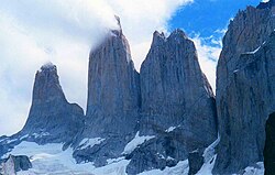
עלו דרך יער אשור דרומי, ואז טפסו את השעה התלולה האחרונה על פני תוהו של סלעי מורנה אל האגם שמתחת לשלושת המגדלים — הנוף האיקוני של הפארק. כשעתיים במעלה.
על המקום הזה
The Cordillera Paine is a group of mountains in Torres del Paine National Park in Chilean Patagonia. It is 280 km (170 mi) north of Punta Arenas, and about 1,960 km (1,220 mi) south of the Chilean capital Santiago. The cordillera is part of the Commune of Torres del Paine in Última Esperanza Province of Magallanes and Antártica Chilena Region. No accurate surveys have been published, and published elevations have been claimed to be seriously inflated, so most of the elevations given on this page are approximate. Paine means "blue" in the native Tehuelche (Aonikenk) language and is pronounced PIE-nay.
קראו עוד בוויקיפדיה צילום: Karen Chan 16 · CC BY 2.0
תגובות
התחברו כדי להצטרף לשיחה.
אין עדיין תגובות — היו הראשונים.