← كل المسارات
جولة في المدينة Seville — Casco Antiguo, Spain

Seville Historic Walk: Cathedral, Alcázar and Triana

An easy day across the old town of Andalusia's capital — the largest Gothic cathedral in the world, a Mudéjar royal palace, a whitewashed former Jewish quarter, and the river crossing to Triana.

Seville Historic Walk: Cathedral, Alcázar and Triana
صورة: Ingo Mehling · CC BY-SA 4.0
المدة
1 أيام
المسافة
5 km
مستوى الصعوبة
سهل
أفضل موسم
March–May and October–November

Seville wears its layers openly. A minaret became a bell tower, a Muslim citadel became a Christian royal palace, a medieval Jewish quarter became a maze of whitewashed lanes, and a 1929 world’s fair left behind a plaza so theatrical it keeps getting cast as an alien planet. All of it sits within one walkable old town on the east bank of the Guadalquivir.

This route links the essentials in the order they make sense on foot, then crosses the river at the end to Triana, the barrio that historically stood apart from the city and still behaves that way. Take it slowly — the point of Seville is the shade, the orange trees and the pauses.

Getting there. From Seville airport the EA bus runs to the centre in about 35 minutes. From elsewhere in Spain, the AVE high-speed train reaches Santa Justa station from Madrid in around 2.5 hours; it is a short taxi or bus ride from there to the cathedral, where the walk begins.

Permits & tickets. The cathedral and Giralda share one ticket (about €12). The Real Alcázar needs an advance timed ticket (about €15) and sells out days ahead in high season — book before you travel. Santa Cruz, the Plaza de España, María Luisa Park and Triana are free.

Good to know:

اليوم 1

The old town and across to Triana

Seville Cathedral → Triana 5 km
التنقّل في هذا اليوم

A continuous line from the cathedral through the Alcázar and Santa Cruz to María Luisa Park, then over the river to Triana.

مقاطع

  1. Seville Cathedral & La Giralda
    Seville Cathedral & La Giralda 0.3 km 📍 خريطة

    Avenida de la Constitución → Seville Cathedral

    City streets

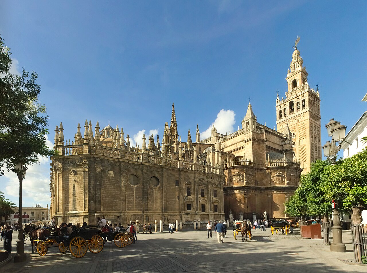
    Begin at the Cathedral of Saint Mary of the See — one of the largest churches in the world and the largest Gothic cathedral, listed by UNESCO in 1987 together with the Alcázar and the Archive of the Indies. Its bell tower, the Giralda, was built as the minaret of the Almohad-era Great Mosque, with a Renaissance belfry added later; ramps rather than stairs carry you up. Allow about 90 minutes.

    عن هذا المكان

    The Cathedral of Saint Mary of the See, better known as Seville Cathedral, is a Catholic cathedral in Seville, Andalusia, Spain. It was registered in 1987 by UNESCO as a World Heritage Site, along with the adjoining Alcázar palace complex and the General Archive of the Indies. It is one of the largest churches in the world and the largest Gothic cathedral.

    اقرأوا المزيد في ويكيبيديا ↗

    صورة: Ingo Mehling · CC BY-SA 4.0

  2. Real Alcázar
    Real Alcázar 0.3 km 📍 خريطة

    Seville Cathedral → Real Alcázar

    City streets, palace courtyards and garden paths

    Cross the square to the royal palace, still one of the official residences of the Spanish royal family. The site began as a 10th-century Islamic citadel under the Umayyads and grew under the Abbadids and Almohads; after the Castilian conquest of 1248 it was rebuilt, most famously as the richly decorated Mudéjar palace of Pedro I in the 1360s. Leave time for the gardens. About two hours.

    عن هذا المكان

    The Alcázar of Seville, officially called Royal Alcázar of Seville, is a historic royal palace in Seville, Spain and one of the official residences of the Spanish royal family. It was formerly the site of the Islamic-era citadel of the city, begun in the 10th century under the Umayyads and then developed into a larger palace complex by the Abbadid dynasty and the Almohads. After the Castilian conquest of the city in 1248, the site was progressively rebuilt and replaced by new palaces and gardens. Among the most important of these is a richly decorated Mudéjar-style palace built by Pedro I during the 1360s.

    اقرأوا المزيد في ويكيبيديا ↗

    صورة: Ajay Suresh from New York, NY, USA. Edited by MenkinAlRire · CC BY 2.0

  3. Barrio Santa Cruz
    Barrio Santa Cruz 1 km 📍 خريطة

    Real Alcázar → Jardines de Murillo

    Narrow lanes and small squares

    Walk out into the old Jewish quarter of the medieval city, now a lattice of whitewashed lanes, tiled patios and orange trees, bordered by the Alcázar walls and the Jardines de Murillo. Some alleys are barely shoulder-width — which is exactly how they stay cool. Get lost on purpose. About 60 minutes.

    عن هذا المكان

    Santa Cruz, is the primary tourist neighborhood of Seville, Spain, and the former Jewish quarter of the medieval city. Santa Cruz is bordered by the Jardines de Murillo, the Real Alcázar, Calle Mateos Gago, and Calle Santa María La Blanca/San José. The neighbourhood is the location of many of Seville's oldest churches and is home to the Cathedral of Seville, including the converted minaret of the old Moorish mosque Giralda.

    اقرأوا المزيد في ويكيبيديا ↗

    صورة: peribanyez · CC BY-SA 2.0

  4. Plaza de España & María Luisa Park
    Plaza de España & María Luisa Park 1.4 km 📍 خريطة

    Jardines de Murillo → Plaza de España

    Park paths and paved avenues

    Head south into the Parque de María Luisa, the city's principal green space, stretching along the Guadalquivir. At its edge stands the Plaza de España, built in 1928 for the Ibero-American Exposition of 1929 — a vast tiled semicircle of Baroque, Renaissance and Neo-Mudéjar revival that is the landmark example of Regionalist architecture. About 90 minutes for both.

    عن هذا المكان

    The Plaza de España is a plaza in Maria Luisa Park in Seville, Spain. It was built in 1928 for the Ibero-American Exposition of 1929. It is a landmark example of Regionalism Architecture, mixing elements of the Baroque Revival, Renaissance Revival and Moorish Revival (Neo-Mudéjar) styles of Spanish architecture.

    اقرأوا المزيد في ويكيبيديا ↗

    صورة: Carlos Delgado · CC BY-SA 4.0

  5. Across the river to Triana
    Across the river to Triana 2 km 📍 خريطة

    Plaza de España → Calle Betis, Triana

    Riverside promenade and city streets

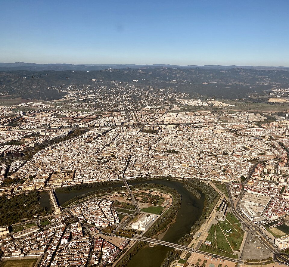
    Follow the riverbank north and cross the Isabel II bridge to Triana, the neighbourhood on the west bank that was historically an arrabal — a suburb outside the city proper — and still keeps its own identity in ceramics and flamenco. End on Calle Betis at dusk, looking back over the water at the old town you spent the day crossing.
    عن هذا المكان

    Triana is a neighbourhood and administrative district on the west bank of the Guadalquivir River in the city of Seville, Spain. Like other neighbourhoods that were historically separated from the main city, it was known as an arrabal. Triana is located on a peninsula between two branches of the Guadalquivir, narrowly linked to the mainland in the north. Two other districts are also usually included in this area, Los Remedios to the south and La Cartuja to the north.

    اقرأوا المزيد في ويكيبيديا ↗

    صورة: Ajay Suresh from New York, NY, USA · CC BY 2.0

Comments