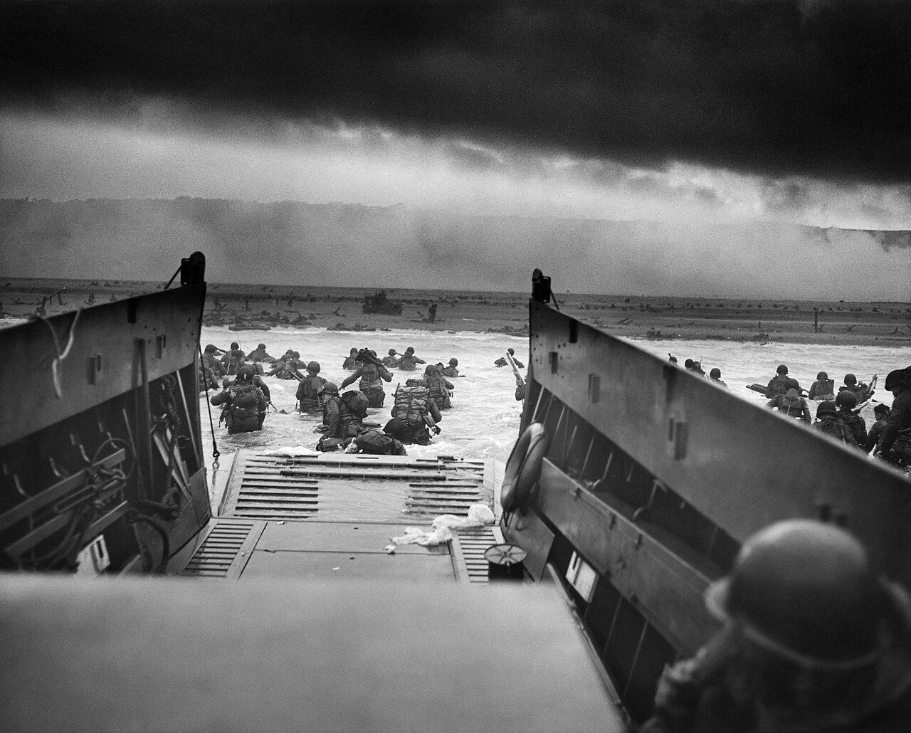
A single day along the western landing sectors, beginning on the sand at Omaha and ending at Utah, on the Cotentin peninsula.
مقاطع
-
 Omaha Beach
Vierville-sur-Mer ← Saint-Laurent-sur-Mer
Sand and seafront road
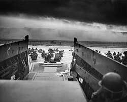
The Omaha sector runs about 8 km, from west of Sainte-Honorine-des-Pertes to east of Vierville-sur-Mer. American forces landed here on 6 June 1944 and took about 2,400 casualties, the heaviest of the five beaches. The reasons are visible from the sand: a tidal flat some 300 m wide, a shingle bank, and bluffs of 30–50 m behind, held by fifteen resistance nests with interlocking fields of fire. The preliminary bombardment had left the defences largely intact. About 34,000 troops were ashore by the end of the day. Allow about 45 minutes.
عن هذا المكان
Omaha Beach was one of five Allied beach landing sectors of the amphibious assault component of Operation Overlord during the Second World War.
اقرأوا المزيد في ويكيبيدياصورة: Chief Photographer's Mate (CPHoM) Robert F. Sargent · Public domain
-
 Normandy American Cemetery, Colleville-sur-Mer
Saint-Laurent-sur-Mer ← Colleville-sur-Mer
Paved paths and lawn
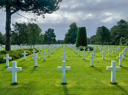
The cemetery stands on the bluff above Omaha Beach, on about 172 acres granted to the United States by France. It holds 9,389 graves — 9,238 marked with Latin crosses and 151 with Stars of David — including 304 unknown. The Walls of the Missing carry 1,557 names; nineteen bear a bronze rosette, meaning the body has since been found and identified. There is a chapel and a visitor centre. The American Battle Monuments Commission maintains the site, which receives about a million visitors a year. Allow about 90 minutes.
عن هذا المكان
The Normandy American Cemetery and Memorial is a World War II cemetery and memorial in Colleville-sur-Mer, Normandy, France, that honors American troops who died in the Normandy landings and the Battle of Normandy that followed. It is located adjacent to the site of the former temporary battlefield cemetery of Saint Laurent, covers 172.5 acres (69.8 ha) and contains 9,389 gravesites.
اقرأوا المزيد في ويكيبيدياصورة: Hayden Soloviev · CC BY 4.0
-
 Pointe du Hoc
Colleville-sur-Mer ← Pointe du Hoc
Cratered ground and concrete bunkers
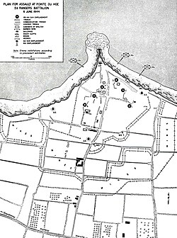
A promontory with a 35 m cliff between the Omaha and Utah sectors. On 6 June the 2nd Ranger Battalion, under Lieutenant Colonel James Earl Rudder, scaled the cliff under fire to take a battery of six 155 mm guns. The guns had been moved before the assault; patrols found five of them inland and destroyed them. Of the 225 men who landed, 77 were killed and 152 wounded over two days. The ground is still covered in bomb craters and the bunkers remain where they stood. The site passed to American control in 1979 and is maintained by the American Battle Monuments Commission. Allow about an hour.
عن هذا المكان
La Pointe du Hoc is a promontory with a 35-metre (110 ft) cliff overlooking the English Channel on the northwestern coast of Normandy in the Calvados department, France.
اقرأوا المزيد في ويكيبيدياصورة: Wikimedia Commons · Public domain
-
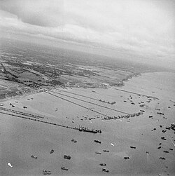 Arromanches and the Mulberry harbour
Pointe du Hoc ← Arromanches-les-Bains
Town streets and beach
The Allies could not count on capturing a deep-water port, so they brought one. Concrete caissons were towed from England and assembled into breakwaters and piers linked to shore by floating roadways. The harbour here opened on 14 June 1944 and ran for about 100 days, landing some 2.5 million men, 500,000 vehicles and 4 million tons of materiel. Caissons still sit on the sand and out in the bay, and are easiest to see at low tide. A museum in the town covers the harbour and Operation Overlord. Allow about 75 minutes.
عن هذا المكان
The Mulberry harbours were two temporary portable harbours developed by the British Admiralty and War Office during the Second World War to facilitate the rapid offloading of cargo onto beaches during the Allied invasion of Normandy in June 1944. They were designed in 1942, then built in under a year in great secrecy; within hours of the Allies creating beachheads after D-Day, sections of the two prefabricated harbours were towed across the English Channel from southern England and placed in position off Omaha Beach and Gold Beach, along with old ships to be sunk as breakwaters.
اقرأوا المزيد في ويكيبيدياصورة: Harrison (Sgt), No 5 Army Film & Photographic Unit · Public domain
-
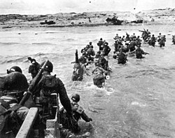 Utah Beach
Arromanches-les-Bains ← Utah Beach (Sainte-Marie-du-Mont)
Sand, dunes and museum
The westernmost of the five sectors, on the Cotentin peninsula. The 4th Infantry Division landed about 21,000 troops here and took 197 casualties — far fewer than at Omaha, in part because the preliminary bombardment was effective. The landing craft came ashore roughly 2,000 yards south of the intended zone; Brigadier General Theodore Roosevelt Jr. judged the new position better defended against and ordered the assault to proceed from there. The airborne divisions supporting the landing lost about 2,500 men. A museum sits behind the dunes. Allow about an hour.
عن هذا المكان
Utah, commonly known as Utah Beach, was the code name for one of the five sectors of the Allied invasion of German-occupied France in the Normandy landings on June 6, 1944 (D-Day), during World War II. The westernmost of the five code-named landing beaches in Normandy, Utah is on the Cotentin Peninsula, west of the mouths of the Douve and Vire rivers. Amphibious landings at Utah were undertaken by United States Army troops, with sea transport, mine sweeping, and a naval bombardment force provided by the United States Navy and Coast Guard as well as elements from the British, Dutch and other Allied navies.
اقرأوا المزيد في ويكيبيدياصورة: Conseil Régional de Basse-Normandie / National Archives USA · Public domain
التعليقات
سجّلوا الدخول للانضمام إلى النقاش.
لا توجد تعليقات بعد — كونوا أوّل المعلّقين.