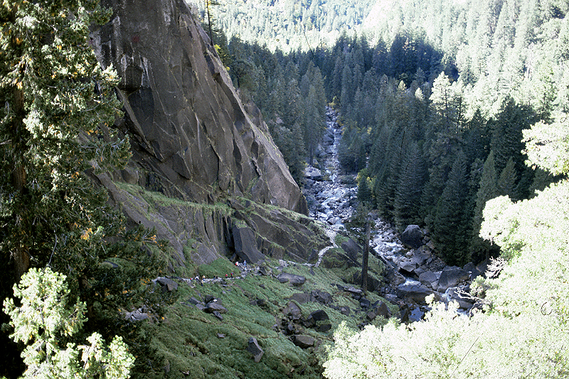
A single strenuous loop: climb the Mist Trail past Vernal and Nevada Falls, then descend the gentler John Muir Trail back to Happy Isles.
Segments
-
 Happy Isles to the Vernal Fall Footbridge
Happy Isles trailhead → Vernal Fall Footbridge
Paved river trail
A steady paved climb along the roaring Merced River brings you in about 0.8 miles to the footbridge, with the first framed view of Vernal Fall upstream. Water and toilets here — the last before the steep work begins. About 30 minutes.
About this place
Vernal Fall is a 317-foot (96.6 m) waterfall on the Merced River just downstream of Nevada Fall in Yosemite National Park, California. Like its upstream neighbor, Vernal Fall is clearly visible at a distance, from Glacier Point, as well as close up, along the Mist Trail. The waterfall flows all year long, although by the end of summer it is substantially reduced in volume and can split into multiple strands, rather than a single curtain of water.
Read more on Wikipedia Photo: Diliff · CC BY-SA 3.0 - The Mist Trail to the top of Vernal Fall
Vernal Fall Footbridge → Top of Vernal Fall
Granite staircase in the spray
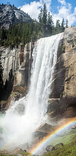
The trail's signature stretch: over 600 stone steps cut into the cliff climb directly beside 97 m (317 ft) Vernal Fall, soaking you in spray and, on sunny spring mornings, framing full circular rainbows. Emerald Pool waits at the top. About 45 minutes.
About this place
Vernal Fall is a 317-foot (96.6 m) waterfall on the Merced River just downstream of Nevada Fall in Yosemite National Park, California. Like its upstream neighbor, Vernal Fall is clearly visible at a distance, from Glacier Point, as well as close up, along the Mist Trail. The waterfall flows all year long, although by the end of summer it is substantially reduced in volume and can split into multiple strands, rather than a single curtain of water.
Read more on Wikipedia Photo: Diliff · CC BY-SA 3.0 -
 Vernal Fall to the top of Nevada Fall
Top of Vernal Fall → Top of Nevada Fall
Granite steps and switchbacks
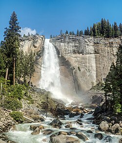
Climb on above Emerald Pool through more steep switchbacks to the brink of Nevada Fall, at 181 m (594 ft) almost twice the height of Vernal Fall, with the granite dome of Liberty Cap looming behind it. This is the turnaround for most hikers. Around 90 minutes.
About this place
Nevada Fall is a 594-foot-high (181 m) waterfall on the Merced River in Yosemite National Park, California. It is located below the granite dome, Liberty Cap, at the west end of Little Yosemite Valley. The waterfall is widely recognized by its "bent" shape, in which the water free-falls for roughly the first third of its length to a steep slick-rock slope. This mid-fall impact of the water on the cliff face creates a turbulent, whitewater appearance in the fall and produces a great deal of mist which covers a wide radius, which led to its current name.
Read more on Wikipedia Photo: Diliff · CC BY-SA 3.0 -
 Optional: toward the Half Dome subdome
Top of Nevada Fall → Half Dome subdome (turnaround)
Forest trail then granite steps
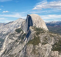
For strong hikers with a Half Dome permit and an early start, the trail continues through Little Yosemite Valley and up switchbacks toward the granite subdome below Half Dome's famous cables. This adds several hours and is optional — most day hikers turn back at Nevada Fall.
About this place
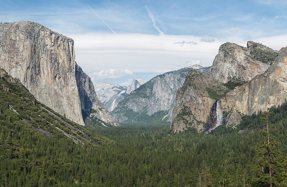
Half Dome is a quartz monzonite batholith at the eastern end of Yosemite Valley in Yosemite National Park, California. It is a well-known rock formation in the park, named for its distinct shape. One side is a sheer face while the other three sides are smooth and round, making it appear like a dome cut in half. It stands at over 8,800 feet above sea level and is composed of quartz monzonite, an igneous rock that solidified several thousand feet within the Earth. At its core are the remains of a magma chamber that cooled slowly and crystallized beneath the Earth's surface. The solidified magma chamber was then exposed and cut in half by erosion, therefore leading to the geographic name Half Dome.
Read more on Wikipedia Photo: Thomas Wolf, www.foto-tw.de · CC BY-SA 3.0 -
 Descent on the John Muir Trail
Top of Nevada Fall → Happy Isles
John Muir Trail switchbacks
Loop back down the longer, gentler John Muir Trail, which trades the wet steps for steady switchbacks and the classic postcard view of both waterfalls from Clark Point. Easier on the knees than descending the Mist Trail. About 2 hours.
About this place
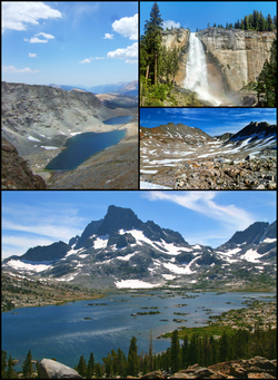
The John Muir Trail (JMT) is a long-distance trail in the Sierra Nevada mountain range of California, passing through Yosemite, Kings Canyon and Sequoia National Parks. It is named after John Muir, a naturalist.
Read more on Wikipedia Photo: Member (talk · contribs) · CC BY-SA 3.0
Comments
Sign in to join the conversation.
No comments yet — be the first.